The Battle of Mount Austen, the Galloping Horse, and the Sea Horse, part of which is sometimes called the Battle of the Gifu, took place from 15 December 1942 to 23 January 1943 and was primarily an engagement between United States and Imperial Japanese forces in the hills near the Matanikau River area on Guadalcanal during the Guadalcanal campaign. The U.S. forces were under the overall command of Major General Alexander Patch and the Japanese forces were under the overall command of Lieutenant General Harukichi Hyakutake.

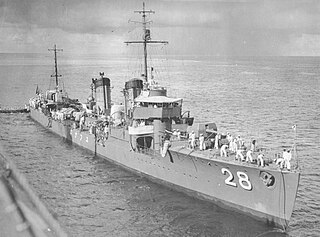
The Japanese destroyer Yūnagi was one of nine Kamikaze-class destroyers built for the Imperial Japanese Navy (IJN) during the 1920s. During the Pacific War, she participated in the occupation of the Gilbert Islands and the Battle of Wake Island in December 1941 and then the occupations of New Guinea and the Solomon Islands in early 1942.
Vura is a suburb in Honiara, Solomon Islands located East of the main center.
King George is a suburb in Honiara, Solomon Islands located East of the main center and west of Henderson
Bloody Ridge is a suburb of Honiara, Solomon Islands and the location of a World War II battle.
Mbokona is a suburb of Honiara, Solomon Islands and is located South of the main center.
Bahai Centre is a suburb of Honiara, Solomon Islands and is located west of Kukum.
Fishing Village/Kukum is a suburb of Honiara, Solomon Islands, and is located east of the main center and west of Panatina.
Panatina is a suburb of Honiara, Solomon Islands and is located West of the main center.
Naha is a suburb of Honiara, Solomon Islands and is located South of Kukum.

Ranadi is a suburb of Honiara, Solomon Islands and is located West of Panatina.
Baranaba is a suburb of Honiara, Solomon Islands and is located South of Ranadi.
Nggeukama is a suburb of Honiara, Solomon Islands and is located West of Lungga Point.
Lungga Point is a suburb of Honiara, Solomon Islands and is located East of the main center and North-West of Honiara International Airport.

Lungga is a suburb of Honiara, Solomon Islands and is located east of the main center on Lungga Point.
Lungga Plantation is a suburb of Honiara, Solomon Islands and is located East of Lungga Point.
NZ Camp is a suburb of Honiara, Solomon Islands and is located South-East of Honiara International Airport.
Henderson West is a suburb of Honiara, Solomon Islands and is located West Honiara International Airport.
Henderson Central is a suburb of Honiara, Solomon Islands and is located near the Honiara International Airport.
Henderson East is a suburb of Honiara, Solomon Islands and is located East of Honiara International Airport.


