
Ōmachi is a city located in Nagano Prefecture, Japan. As of 1 March 2019, the city had an estimated population of 27,559 in 11861 households, and a population density of 49 persons per km². The total area of the city is 565.15 square kilometres (218.21 sq mi).
The Hakkōda Mountains is a volcanic complex that lies to the south of Aomori City in Aomori Prefecture, Japan. The range consists of more than a dozen stratovolcanoes and lava domes arranged into two volcanic groups. The Northern Hakkōda Volcanic Group emerges from the rim of an 8-km wide caldera that dates back to the Pleistocene. The Southern Hakkōda Volcanic Group predates the caldera.

Mount Asahi is a mountain located in the town of Higashikawa, Hokkaido and the tallest mountain in the Japanese island of Hokkaido. It is part of the Daisetsuzan Volcanic Group of the Ishikari Mountains, it is located in the northern part of the Daisetsuzan National Park.

Mount Yari is one of the 100 Famous Japanese Mountains. The 3,180-metre-high (10,433 ft) peak lies in the southern part of the Hida Mountains of Japan, on the border of Ōmachi and Matsumoto in Nagano Prefecture and Takayama in Gifu Prefecture. The priest Banryū (1786–1840) founded a temple there.

Mount Kita is a mountain of the Akaishi Mountains−"Southern Alps", in Yamanashi Prefecture, Japan.

Mount Aino, or Ainodake, is a peak of the Akaishi Mountains−Southern Alps, in Minami Alps National Park, Japan.

Mount Hotaka, also known as Mount Hotakadake, is one of the 100 Famous Japanese Mountains as coined by the media, reaching a height of 3,190 m (10,466 ft). Mount Hotaka is situated in Japan's Hida Mountains and all its major peaks except Mount Maehotaka, lie on the border between the cities of Matsumoto, Nagano Prefecture, and Takayama, Gifu Prefecture. This mountain is located in Chūbu-Sangaku National Park.

Mount Shari is a quaternary stratovolcano and one of Japan's 100 famous mountains. Its summit is 1,547 metres (5,075 ft). The summit consists of Mount Shari, Southern Mount Shari and the western ridge. It is located on the Hokkaidō's Shiretoko Peninsula on the border of Shari and Kiyosato in Shari District, Abashiri and Shibetsu in Shibetsu District, Nemuro.

Mount Tanigawa is a 1,977m mountain on the border of Gunma Prefecture and Niigata Prefecture in Japan.
Mount Pankenūshi or Mount Memuro Western Peak is located in the Hidaka Mountains, Hokkaidō, Japan. This mountain is the western summit of Mount Memuro.

The Ibuki Mountains are a mountain range straddling the border between Gifu and Shiga prefectures in Japan. After lowering and nearly disappearing in Shiga Prefecture, the range continues as the Suzuka Mountains. During the winter, the winds from the Ibuki Mountains are a cause of much of the snowfall on the Nōbi Plain covering Gifu and Aichi prefectures.

Mount Nōtori, or Nōtoridake, is one of the major peaks in the Akaishi Mountains, along with Mount Kita and Mount Aino. The 3,026 m (9,928 ft) peak lies to the south of the other mountains, spanning the town of Hayakawa in Yamanashi Prefecture and Aoi-ku in the city of Shizuoka, Shizuoka Prefecture, Japan.

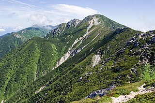
Mount Tsurugi is located in the eastern area of Toyama Prefecture, Japan. It is one of the tallest peaks in the Hida Mountains at 2,999 m (9,839 ft). It is one of the 100 Famous Japanese Mountains, and is called "the most dangerous mountain" climbable.

Mount Meakan is an active stratovolcano located in Akan National Park in Hokkaidō, Japan. It is the tallest mountain in the Akan Volcanic Complex. The volcano consists of nine overlapping cones that grew out of the Akan caldera, on the shores of Lake Akan. Mount Meakan has a triple crater at its summit. According to its name and local legend, Mount Meakan is the female counterpart to Mount Oakan on the other side of Lake Akan.

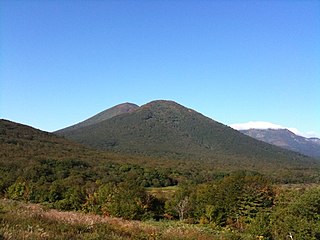
Mount Shiretoko is a volcano located on the Shiretoko Peninsula in Hokkaidō, Japan. The mountain consists of non-alkali mafic rocks, andesite. Mount Shiretoko is in Shari town, in Shari District of Abashiri Subprefecture.

Mount Azumaya is one of the 100 Famous Japanese Mountains. The 2,354-metre-high (7,723 ft) peak lies on the border of Nagano Prefecture and Gunma Prefecture. There exist alternative spellings of the mountain's name, like: 吾妻山 and 吾嬬山 which is read as "Agatsuma-yama". In the village Tsumagoi, the mountain is spelled 吾妻山.

Mount Warusawa, also Mount Higashi, is a mountain located in Shizuoka Prefecture, Japan. It has a height of 3,141 metres (10,305 ft). It is located in the southern part of the Akaishi Mountains, which are known as the "Southern Alps". It is located in the Minami Alps National Park .
Mount Yūbari is a mountain of the Yūbari Mountains. It is located On the border of Minamifurano, Yūbari, Hokkaidō, Japan.
Mount Utsugi is a mountain located on the boundary of Okuwa, Iijima and Miyada, Nagano Prefecture, in the Chūbu region of Japan. It is 2,864 m (9,396 ft) tall and part of the Kiso Mountains. It is also included on the list of "100 Famous Japanese Mountains."
The Iide Mountains or Iide Mountain district is a mountain range that spans the Fukushima, Niigata and Yamagata prefectures in Japan. Its highest peak is Mount Dainichi at 2,128m, and the main peak of the range is Mount Iide at 2,105m above sea level. The range contains a number of peaks higher than 2000m and is a part of the Bandai-Asahi National Park.


