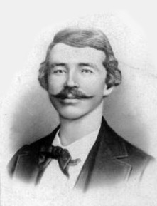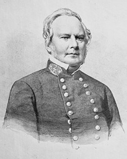
The Lawrence massacre was an attack during the American Civil War (1861–65) by the Quantrill's Raiders, a Confederate guerilla group led by William Quantrill, on the Unionist town of Lawrence, Kansas.
The 11th Kansas Volunteer Cavalry Regiment was a cavalry regiment that served in the Union Army during the American Civil War.
Kansas has always been home to many forts and military posts.
On March 7, 1862, Confederate guerrillas under William C. Quantrill raided the small Kansas town of Aubry, southwest of Kansas City, Missouri, and just west of the Kansas-Missouri border. Three residents were killed in the raid and much property was carted away by the guerrillas.
Barnesville's Post located near Barnesville, in Bourbon County, Kansas, was the site of military camps for stretches of time during the American Civil War. The first mention of a camp there came from a report written on September 4, 1861, by Sen. James Lane. This was during the time Lane had evacuated Fort Scott and moved his forces to areas north of that post. A post was established at Barnesville. Lane wrote to Capt. W. E. Prince, then commanding Fort Leavenworth, "I am holding Barnesville. .. with an irregular force of about 250 men, stationed in log buildings, and am now strengthening their position with earth entrenchments."
In early May 1863 a temporary camp, Camp Hooker, was established at the site of what later became Baxter Springs, Kansas. This area was located in what was known as the Cherokee Strip (Kansas). In late May while the camp commander, Col. James M. Williams, was in Fort Scott, the troops moved the camp three blocks to the east to what is now Washington School Hill. The new camp, Camp Ben Butler (named after Maj. Gen. Benjamin Butler, was in a highly defendable position. It occupied a plateau that covered more than two square blocks. Only a small area to the south allowed easy access to camp. In fact, much of the surrounding area was practically impenetrable by men or horses.
During the Civil War, Coldwater Grove existed 13½ miles east of Paola, Kansas. It straddled the Kansas-Missouri border, being partly in both states. About June 1863 a Union military post was established on the Kansas side of the community and the post was put under the command of Lt. Col. Charles S. Clark. Clark also commanded four nearby posts.
Council Grove's Post is a trading post on the Santa Fe Trail that operated in Council Grove, Kansas. It was established around 1861 and decommissioned around 1864, with ties to the Civil War.
In spring and probably into summer 1864 Fort Henning was constructed. It, along with Fort Blair and Fort Insley, was built to help protect the city and post of Fort Scott. Fort Henning, located at the intersection of Second and National Streets, was almost in the center of town. Fort Henning was an octagonal structure and measured fourteen feet across. It was the smallest of the three blockhouse forts.
In spring and summer 1864 Fort Blair, Fort Henning and Fort Insley were constructed to help protect the town and post of Fort Scott from Confederate forces. Fort Insley was named for Capt. Martain H. Insley. It was located just northeast of town, about 1½ blocks northeast of the main part of the post of Fort Scott. It overlooked Buck Run Creek.
In 1864 Gen. Samuel R. Curtis established a military camp at the Fort Riley-Fort Larned Road crossing of the Smokey Hill River in what is now Ellsworth County, Kans.
Fort Lincoln was established about August 24, 1861, by United States Senator James Lane. Earlier in August, Lane had reestablished Fort Scott as a military post. Soon Confederate troops under Maj. Gen. Sterling Price threatened to overrun the newly reopened post.
Fort Simple was an American fort built in Topeka, Kansas, as a result of Maj. Gen. Sterling Price's Missouri Raid in the late summer and fall of 1864. Topeka had become the permanent capital of the State of Kansas in 1861, but no fortifications had been built to protect the city from guerrilla bands, which roamed eastern Kansas. Even the raid and massacre in August 1863 in Lawrence, Kansas, did not result in a fort being built to protect the capital, although plans had been made to build one by July 1864.
Fort Lane, on the crest of Mount Oread, then southwest of Lawrence, Kansas, was built by the residents of Lawrence in 1856 to serve as a lookout post to observe groups of men desiring to attack Lawrence. Lawrence was a free-state community built by northerners. From 1854 to 1861, when Kansas became a state, at times the area around Lawrence was a battleground for settlers who had come from both the northern and southern states. From this location, one could see for many miles in all directions.
The Lawrence blockhouses where a series of blockhouses built in the spring of 1864 in Lawrence, Kansas, to provide defensive structures in case of attack by Confederate guerrillas. On August 21, 1863, Lawrence had been attacked by 400 guerrillas and Confederate Army recruits under the command of William C. Quantrill. Lawrence was caught virtually defenseless and much of the town was destroyed and about 180 men and boys were killed, most of them defenseless. A militia became active by spring 1864 to prevent another attack.
Mound City's post was established by 1860 in Mound City, Kansas. In August 1861 U.S. Senator James H. Lane reported to the commander of Fort Leavenworth that the post was to be fortified. In fact, Mound City's post became one of the important posts guarding against Confederate guerrilla attacks along the Kansas-Missouri border. Through the War usually 200 to 300 troops at a time were stationed at the post.
Paola's post, sometimes called Post Paola, in Miami County, Kansas, was located on the west side of Bull Creek, just west of Paola, Kansas. It was probably established in December 1861, as that was the first time it was mentioned. This post became one of the more important posts along the Kansas-Missouri border during the Civil War. It became a district headquarters in 1863. Later, in September 1864, it was designated a subdistrict headquarters, when the district headquarters was moved to Lawrence, Kansas. The military road from Fort Leavenworth to Fort Gibson ran through Paola, thus ensuring the post always had some importance.
Rockville's post, in southern Miami County, Kansas, was established at the small town of Rockville, Kansas, founded in 1859 by those loyal to the southern cause in Kansas. The other side, the free-staters, soon gained control of the town and it was loyal to the Union when the Civil War broke out in 1861. Rockville was located on the top of a hill surrounded by rolling plains. During the American Civil War, the area was almost bare of trees, allowing troops holding the town to see anyone coming from some distance away. Rockville's post was one of the many posts established in the War to help guard the Kansas-Missouri border area.
Salina's Stockade was built in Salina, Kansas, to provide the residents with protection from the American Indians in the area, many of whom were hostile toward white settlement. While Salina had been raided in 1862 by Native Americans and then Confederate guerrillas, it was not until May 1864 when residents decided they needed to build a stockade for protection. On May 17, 1864, a makeshift stockade, consisting of wagons placed in a circle around the town's flagpole, was erected. The local militia then drilled and guarded Salina. On the northeast corner of 7th Street and Iron Avenue stood a small building. Around this a permanent stockade was erected in May and June 1864.
In 1842 a large log fort was built at Trading Post by the United States Army, upon the order of Gen. Winfield Scott. This fort was on the Fort Leavenworth-Fort Gibson Military Road. The completed fort was fairly elaborate. It included space to house a company of dragoons and their horses. Also, it contained a hospital and store houses. Gaps along the outside walls of buildings were filled in with stockade walls. The buildings were built around a large interior open area.


