Mount Pleasant, Swansea

Last updated

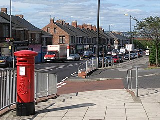
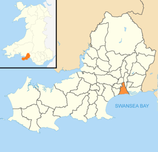
Mount Pleasant is a suburban neighbourhood of Swansea, Wales. The area is centred on the main road, called Mount Pleasant, immediately to the north of Swansea city centre, which connects the city centre to the Townhill and Mayhill districts to the north. It falls within the Castle ward. [1] The demographic of the area changed in recent years with the expansion of the former Swansea Metropolitan University campus on the main Mount Pleasant road and the arrival of a substantial student population.[ citation needed ]

Mount Pleasant has terraced housing to the north with larger semi-detached houses overlooking its southern slopes. The Mount Pleasant Estate, a substantial development of four parallel roads of back-to-back terraced housing completed in 1900. [2]

Constitution Hill, one of the steepest in Swansea, leads up towards Mount Pleasant from the city centre. It is a steep, sloping cobbled street which featured in the film Twin Town in a scene with a daring car stunt.[ citation needed ] In the early 20th century, the Swansea Constitution Hill Incline Railway operated up and down the hill.[ citation needed ] Constitution Hill forms part of the boundary between the Castle and Uplands wards.[ citation needed ]

Mansell Street, De La Beche Street, Grove Place, and Alexandra Road cross the southern fringes of the area as a continuous thoroughfare. Located on this thoroughfare are Swansea Magistrates' Court, [3] Swansea Central police station, Glynn Vivian Art Gallery, the old Swansea Central Library and the building housing the arts wing of the university. Alexandra Road is a designated conservation area, and consists of a number of buildings which were constructed between the late nineteenth and early twentieth centuries. The road has a number of shops.

History

Most of the former Swansea Grammar School site on Mount Pleasant was destroyed by incendiary bombs during the Swansea blitz of World War II. This main surviving structure, then part of Swansea Metropolitan University, was renamed the Dylan Thomas Building in 1988 to honour its former pupil. Swansea Grammar.jpg
Most of the former Swansea Grammar School site on Mount Pleasant was destroyed by incendiary bombs during the Swansea blitz of World War II. This main surviving structure, then part of Swansea Metropolitan University, was renamed the Dylan Thomas Building in 1988 to honour its former pupil.

The road that runs from the end of the High Street up to Mount Pleasant, North Hill Road, was named Gibbet Hill until renamed in 1902. Evidence from the Vatican archives indicates that Gibbet Hill, at the top of the road to which it gave its name, was the historic place of the “lord’s gallows” where in the Middle Ages executions (gibbetings) took place and corpses were left hanging where they could be seen from the town centre. [4]

A workhouse opened in Mount Pleasant in 1862, between what was known as Gibbet Hill (now North Hill Road) and a lower slope known as Poppit Hill. In 1895 it held 584 inmates in extended buildings. It was later called Tawe Lodge, and eventually became Mount Pleasant Hospital in 1929, when it was taken over by Swansea County Borough Council. The hospital closed in 1995 and was converted into social housing. [5] Hospital records are now held by the West Glamorgan Archive Service, [6] as are records of the original Swansea Poor Law Union from 1842 to 1960. [7]

In 1853 Swansea Grammar School for Boys moved from the city centre to a new building on Mount Pleasant designed by the architect Thomas Taylor. The building was extended in 1869 to a design by Benjamin Bucknall. From 1895 the site was shared with the newly created Swansea Intermediate and Technical School for Boys (later the co-educational Swansea Technical College). [8] After much of the site was destroyed by incendiary bombs during World War II the Grammar School relocated to the Sketty area as Bishop Gore Grammar School in 1952. The Technical College remained on a redeveloped site and in 1976 was incorporated into the West Glamorgan Institute of Higher Education, redesignated in 2008 as Swansea Metropolitan University which in 2013 became a constituent member of the University of Wales Trinity Saint David. The university closed its Mount Pleasant campus in 2018 relocating most of its faculties to the SA1 Waterfront area. [9] The Arts faculty, Swansea College of Arts, remains in Mount Pleasant on its Alexander Road site where a new building was opened in 2015 in a redevelopment of the former Dynevor Grammar School site.

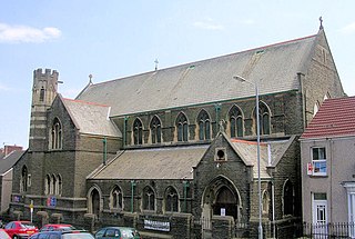
Terrace Road, which runs off Mount Pleasant to the west, has two notable buildings: a Primary School which opened in 1888 and has approximately 300 pupils [10] and St Jude's Church which opened in 1915 and served a congregation which dates from 1889. St Jude closed in 2015 and its parish was merged with St Nicholas on the Hill in Townhill. [11]

Mount Pleasant Baptist Church on Kingsway, one of the city's busiest roads, was built in 1825, when the street was named Gower Street. Christmas Evans preached at its opening service in the following year. It was built to accommodate English speakers in the congregation of the former Back Lane chapel when it divided after the death of its minister Joseph Harris (Gomer). It is one of the few notable buildings in the centre of the town to survive bombing during the Swansea Blitz in the Second World War. [12]

Related Research Articles

<span class="mw-page-title-main">Swansea</span> City and county in Wales

Swansea is a coastal city and the second-largest city of Wales. It forms a principal area, officially known as the City and County of Swansea.

<span class="mw-page-title-main">Mossley Hill</span> Human settlement in England

Mossley Hill is a suburb of Liverpool and a Liverpool City Council ward. Located approximately 3.5 miles south east of Liverpool City Centre, it is bordered by Aigburth, Allerton, Childwall, Garston and Wavertree. At the 2001 Census, the population was 12,650, increasing to 13,816 at the 2011 Census.

Townhill is the name of a hill, a residential district and a community and electoral ward in Swansea, Wales, UK.

<span class="mw-page-title-main">Cockett</span> Human settlement in Wales

Cockett is a district and community in Swansea, Wales falling within Cockett ward. It is located about 1.5 miles (2.4 km) north-west of Swansea city centre. It includes the eastern half of Gowerton.

Mayhill is a district of Swansea, Wales, situated on historic Townhill, a 175m high landform north west of the city centre, the urban geography of which is divided between the Townhill district to the west and Mayhill to the east. Mayhill is part of the Townhill electoral ward.

<span class="mw-page-title-main">Clydach, Swansea</span> Village in Swansea, Wales

Clydach is both a village and a community in Swansea, Wales, within the Clydach ward and the Llangyfelach parish. It is located 6 miles (9.7 km) northeast of Swansea city centre. In 2011, the population was 7,503. Welsh is the first language of 24 per cent of the population and both Welsh and English language schools are available. The village lies close to the M4 motorway which can be accessed via the bypass or old road via Ynystawe. The community includes part of the village of Glais.

Swansea city centre in Swansea, Wales, contains the main shopping, leisure and nightlife district in Swansea. The city centre covers much of the Castle ward including the area around Oxford Street, Castle Square, and the Quadrant Shopping Centre; Alexandra Road, High Street, Wind Street and the Castle; Parc Tawe; and the Maritime Quarter extending down to the seafront.

<span class="mw-page-title-main">Bishop Gore School</span> Secondary school in Swansea, Wales

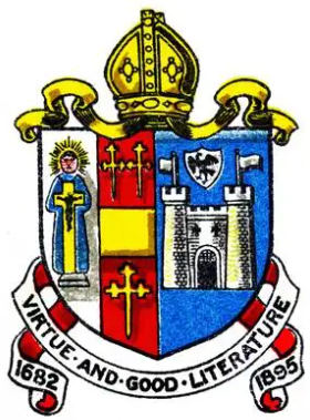
The Bishop Gore School is a secondary school in Swansea in Wales, founded on 14 September 1682 by Hugh Gore (1613–1691), Bishop of Waterford and Lismore. It is situated in Sketty, close to Singleton Park and Swansea University. In December 2013 the school was ranked in the second highest of five bands by the Welsh Government, based on performance in exams, value added performance, disadvantaged pupils' performance, and attendance.

<span class="mw-page-title-main">Swansea Metropolitan University</span> Former college in Swansea, Wales

Swansea Metropolitan University is a former university based in Swansea, Wales, UK. The university merged with, and became a constituent campus of, the University of Wales Trinity Saint David on 1 August 2013.

Ernest Morgan was a Welsh architect and painter.

<span class="mw-page-title-main">Swansea Blitz</span> WWII aerial bombardment of British city

The Swansea Blitz was the heavy and sustained bombing of Swansea by the German Luftwaffe from 19 to 21 February 1941. A total of 230 people were killed and 397 were injured. Swansea was selected by the Germans as a legitimate strategic target due to its importance as a port and docks and the oil refinery just beyond, and its destruction was key to Nazi German war efforts as part of their strategic bombing campaign aimed at crippling coal export and demoralizing civilians and emergency services.

<span class="mw-page-title-main">University of Wales Trinity Saint David</span> Public university based in Wales and London

The University of Wales Trinity Saint David is a multi-campus university with three main campuses in South West Wales, in Carmarthen, Lampeter and Swansea, a fourth campus in London, England, and learning centres in Cardiff, Wales, and Birmingham, England.

<span class="mw-page-title-main">Castle, Swansea</span> Human settlement in Wales

Castle is an electoral ward and community in the City and County of Swansea, Wales, UK. Castle covers most of the heart of the City of Swansea, with Swansea Castle at its centre.

<span class="mw-page-title-main">Swansea Constitution Hill Incline Tramway</span>

The Swansea Constitution Hill Incline Tramway operated a cable funicular tramway service on Constitution Hill in Swansea between 1898 and 1901.

Glanmôr School was a secondary school in Swansea in south Wales, founded as Glanmor Central School for boys and girls in 1922 and closed by merger with Bishop Gore Comprehensive School for Boys in 1972. "Glanmôr", or "Glan y Môr", means "seaside" in English. It was situated on Glanmor Hill in Uplands in wooden ex-army buildings. As a central school it had a status between secondary and elementary until 1930, when it was defined as a secondary school. The buildings were requisitioned for the US army during the Second World War, and the boys' school closed in 1941. The girls' school continued as a grammar school until 1972. When the presence of high alumina cement in support structures of other Swansea schools caused their closure in 1974, its buildings were re-used by Olchfa Comprehensive School for two years. The site was cleared in August 1989 and replaced with housing, with the new streets named after some of the school's houses.

<span class="mw-page-title-main">Elm Grove, Brighton</span>

Elm Grove is a mainly residential area of Brighton, part of the English coastal city of Brighton and Hove. The densely populated district lies on a steep hill northeast of the city centre and developed in the second half of the 19th century after the laying out of a major west–east road, also called Elm Grove. Terraced houses, small shops and architecturally impressive public buildings characterise the streetscape: within the area are a major hospital, two churches and a former board school, as well as Brighton's oldest council houses and an interwar council estate.

<span class="mw-page-title-main">E. M. Bruce Vaughan</span> Welsh architect (1856–1919)

Edwin Montgomery Bruce Vaughan, known as E. M. Bruce Vaughan, was an ecclesiastical architect from Cardiff, Wales.

<span class="mw-page-title-main">St Jude's Church, Swansea</span> Church in United Kingdom

St Jude's Parish Church is a former Anglican church in Mount Pleasant, Swansea, Wales, in the United Kingdom. The final service was held on 8 February 2015, just a few months short of its centenary,.

<span class="mw-page-title-main">Mount Pleasant Hospital</span> Hospital in Wales

Mount Pleasant Hospital was a health facility in Mount Pleasant, Swansea, Wales.

References

  1. "Ward Profiles". City & County of Swansea. Retrieved 29 April 2016.
  2. Nigel Robins (1992) Homes for Heroes: Early Twentieth-Century Council Housing in the County Borough of Swansea. Swansea: Swansea City Council p. 67
  3. "Swansea Magistrates' Court". Everything Legal. Retrieved 29 April 2016.
  4. Bernard Morris (2010) ‘From Swansea Castle to Gibbet Hill’ Swansea History Journal No. 18, pp. 6-11
  5. "The Workhouse: The Story of an Institution". The Workhouse in Swansea. Retrieved 29 April 2016.
  6. "Mount Pleasant Hospital, Swansea". The National Archives. Retrieved 29 April 2016.
  7. "Swansea Union Board of Guardians Records". Archives Wales. Archived from the original on 2 June 2016. Retrieved 29 April 2016.
  8. Davies, J. A. (2000) Dylan Thomas: Swansea, Gower and Laugharne. Cardiff: University of Wales Press, p. 60
  9. "History and Timeline". University of Wales Trinity Saint David. Retrieved 29 April 2016.
  10. "Terrace Road School, Swansea". Archives Wales. Archived from the original on 23 May 2012. Retrieved 29 April 2016.
  11. "St Jude - The Benefice of Swansea St Nicholas on the Hill and St Jude". Archived from the original on 2016-06-17.
  12. "Hidden Histories: the secrets of Mount Pleasant Baptist Church". South Wales Evening Post. 21 March 2015. Retrieved 29 April 2016.

51°37′25″N3°57′0″W / 51.62361°N 3.95000°W / 51.62361; -3.95000