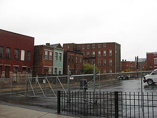
Mount Vernon is a neighborhood of Baltimore, Maryland, located immediately north of the city's downtown. It is named for George Washington's Mount Vernon estate in Virginia, as the site of the city's Washington Monument.

The University of Florida Campus Historic District is a historic district on the campus of the University of Florida in Gainesville, Florida. The district, bounded by West University Avenue, Southwest 13th Street, Stadium Road and Gale Lemerand Drive, encompasses approximately 650 acres (2.6 km2) and contains 11 listed buildings plus contributing properties. On April 20, 1989, it was added to the National Register of Historic Places. On June 24, 2008, additional information was approved which resulted in the addition of 6 contributing properties

Hillcrest Historic District is a historic neighborhood in Little Rock, Arkansas that was listed on the National Register of Historic Places on December 18, 1990. It is often referred to as Hillcrest by the people who live there, although the district's boundaries actually encompass several neighborhood additions that were once part of the incorporated town of Pulaski Heights. The town of Pulaski Heights was annexed to the city of Little Rock in 1916. The Hillcrest Residents Association uses the tagline "Heart of Little Rock" because the area is located almost directly in the center of the city and was the first street car suburb in Little Rock and among the first of neighborhoods in Arkansas.

Police Station Five was a historic police station in the West End neighborhood of Cincinnati, Ohio. Constructed in the 1890s to serve both regular police and the city's patrol service, it was named a historic site in the late twentieth century, but historic designation was unable to save it from destruction.

The Henry Powell House is a historic house in the Mount Auburn neighborhood of Cincinnati, Ohio, United States. Constructed in the mid-19th century, it experienced a radical transformation near the end of the century under the direction of a leading regional architect. This French-style residence has been named a historic site.

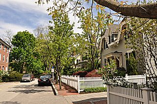
The Ash Street Historic District Cambridge, Massachusetts is a residential historic district on Ash Street and Ash Street Place between Brattle and Mount Auburn Streets in Cambridge, Massachusetts, off Brattle Street just west of Harvard Square. The district consists of ten well-preserved houses, most of which were built between 1850 and 1890. The district was listed on the National Register of Historic Places in 1982.

The Enfield Shaker Museum is an outdoor history museum and historic district in Enfield, New Hampshire, in the United States. It is dedicated to preserving and sharing the history of the Shakers, a Protestant religious denomination, who lived on the site from 1793 to 1923. The museum features exhibitions, artifacts, eight Shaker buildings and restored Shaker gardens. It is located in a valley between Mount Assurance and Mascoma Lake in Enfield.

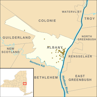
There are 77 properties listed on the National Register of Historic Places in Albany, New York, United States. Six are additionally designated as National Historic Landmarks (NHLs), the most of any city in the state after New York City. Another 14 are historic districts, for which 20 of the listings are also contributing properties. Two properties, both buildings, that had been listed in the past but have since been demolished have been delisted; one building that is also no longer extant remains listed.

The White River Entrance to Mount Rainier National Park is a complex of buildings built between 1929 and 1931 to accommodate visitors arriving on the Yakima Park Highway, in the northeastern portion of the park. Like most of the structures in Mount Rainier, the buildings are designed in the National Park Service Rustic style, using natural stone and log materials. The historic district includes the 1933 Men's Mess Hall and Dormitory, believed to be the only surviving camp structure built by the Civilian Conservation Corps in the park.

Emlen Elementary School, formerly Eleanor Cope Emlen School of Practice, is an historic elementary school located in the Mount Airy neighborhood of Philadelphia, Pennsylvania. It is part of the School District of Philadelphia.

The Henry H. Houston Elementary School is an historic elementary school which is located in the Mount Airy neighborhood of Philadelphia, Pennsylvania. It is part of the School District of Philadelphia.

Charles W. Henry School is a historic school located at 601 Carpenter Lane in the Mount Airy neighborhood of Philadelphia, Pennsylvania. It is part of the School District of Philadelphia. The building was designed by Henry deCourcy Richards and built by Cramp & Co. in 1906–1908. It is a two-story, 20 bay, red brick building in the Colonial Revival-style. Additions were built in 1949–1950 and 1968. It features arched entryways and limestone trim. It was the scene of a bombing during its construction in 1906.

Joseph W. Catharine School is a historic elementary school located in the Mount Moriah neighborhood of Philadelphia, Pennsylvania. It is part of the School District of Philadelphia. The building was designed by Irwin T. Catharine and built in 1937–1938. It is a three-story, six-bay, yellow brick in the Moderne-style. It features a main entrance with decorative stone surround, stone sills, and stone coping atop the building.

The Beech Hill Summer Home District encompasses a collection of six early 20th century summer houses in Harrisville, New Hampshire, built on a ridge overlooking Dublin Pond with views of nearby Mount Monadnock. The properties, a number of which were built for members of the Thayer family, lie on Mason Road, just north of the town line with Dublin. The most significant property of the six is the 140-acre (57 ha) Skyfield estate, whose large Georgian Revival mansion was designed by Lois Lilley Howe and built in 1916. The district is also notable as containing archaeological remnants of 18th century farmsteads, for which reason its properties are also listed in the Harrisville Rural District. The district was listed on the National Register of Historic Places in 1988.

The Chocorua Lake Basin Historic District is a large historic district surrounding Chocorua Lake in the town of Tamworth in New Hampshire, United States. It includes more than 6,000 acres (2,400 ha), with the lake roughly at its center, extending from Washington Hill Road in the east to Fowles Mill Road and Philbrick Neighborhood Road in the west, and from the town line with Albany in the north to Heavenly Hill Road in the south. The district's significance derives from a large cluster of late 19th and early 20th century summer resort houses built around and near the lake, and the role the area's landowners have played in the conservation of the lake and viewsheds associated with it and nearby Mount Chocorua. The district was listed on the National Register of Historic Places in 2005.

The Victory Park Historic District of Manchester, New Hampshire, encompasses Victory Park, a city park laid out in 1838, and four buildings that face it across adjacent streets. Originally called Concord Square, Victory Park was laid out by the proprietors of the Amoskeag Manufacturing Company who founded Manchester, and was first used as a common area, used by abutters for gardening and grazing. The park was sold by the proprietors to the city for $1 in 1848, conditioned on making alterations that would transform it into a park. The city did not immediately act on the required conditions, but it had by the 1870s become more parklike, with a fountain and thickly-planted trees. The park was renamed after the First World War; its most prominent feature is the Winged Victory Monument to the city's soldiers in that war, designed by Lucien Hippolyte Gosselin and erected in 1929. The park underwent a major rehabilitation in 1988.

Mount Vernon Triangle is a neighborhood and community improvement district in the northwest quadrant of Washington, D.C. The neighborhood is located adjacent to Mount Vernon Square. Originally a working-class neighborhood established in the 19th century, present-day Mount Vernon Triangle experienced a decline in the mid-20th century as it transitioned from residential to commercial and industrial use.

Mount Airy is an unincorporated community located within West Amwell Township in Hunterdon County, in the U.S. state of New Jersey.

The Mount Vernon Commercial Historic District is a nationally recognized historic district located in Mount Vernon, Iowa, United States. It was listed on the National Register of Historic Places in 1993. At the time of its nomination it consisted of 18 resources, which included 16 contributing buildings and two non-contributing buildings. This linear historic district is a block and a half in the middle of the central business district. It follows the ridgeline of the paha that defines the town. The buildings were constructed between 1860 and the 1930s, with most of them in place by the turn of the 20th century. Eight of them were built in the 1890s. The district is also unified in appearance with two-story pressed brick facades, ornate metal cornices, heavy pedimented window hoods, and roughly dressed limestone trim dominate. The decorative elements recall Mount Vernon's railroad-related prosperity, as they were brought in by train.

The Cornell College-Mount Vernon Historic District is a nationally recognized historic district located in Mount Vernon, Iowa, United States. It was listed on the National Register of Historic Places in 1980. The district embraces the campus of Cornell College and the residential area that surrounds it. It is composed of 120 buildings and structures, of which 70 are residential. There are also a couple of churches on the east side of the district, and an old hotel was converted into apartments.


