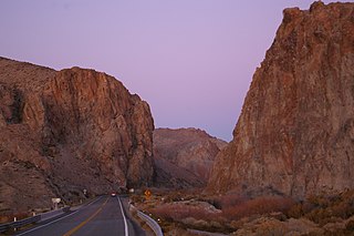
Mount Wilson (Lyon County, Nevada)

Last updated

Mount Wilson is a summit in the U.S. state of Nevada. [1] The elevation is 6,745 feet (2,056 m). [1]
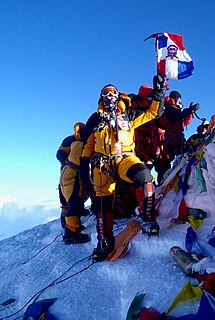
Summit A point on a surface that is higher in elevation than all points immediately adjacent to it, in topography

A summit is a point on a surface that is higher in elevation than all points immediately adjacent to it. The topographic terms acme, apex, peak, and zenith are synonymous.

U.S. state constituent political entity of the United States

In the United States, a state is a constituent political entity, of which there are currently 50. Bound together in a political union, each state holds governmental jurisdiction over a separate and defined geographic territory and shares its sovereignty with the federal government. Due to this shared sovereignty, Americans are citizens both of the federal republic and of the state in which they reside. State citizenship and residency are flexible, and no government approval is required to move between states, except for persons restricted by certain types of court orders. Four states use the term commonwealth rather than state in their full official names.
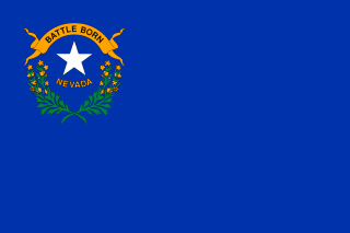
Nevada State of the United States of America

Nevada is a state in the Western United States. It is bordered by Oregon to the northwest, Idaho to the northeast, California to the west, Arizona to the southeast and Utah to the east. Nevada is the 7th most extensive, the 32nd most populous, but the 9th least densely populated of the U.S. states. Nearly three-quarters of Nevada's people live in Clark County, which contains the Las Vegas–Paradise metropolitan area where three of the state's four largest incorporated cities are located. Nevada's capital, however, is Carson City.

Mount Wilson was named after David Wilson. [2]

Related Research Articles

Clark Range (California)

The Clark Range is a subrange of California's Sierra Nevada in Yosemite National Park.

Hoover Wilderness

The Hoover Wilderness is a wilderness area in the Inyo and Humboldt-Toiyabe National Forests. It lies to the east of the crest of the central Sierra Nevada in California, to the north and east of Yosemite National Park - a long strip stretching nearly to Sonora Pass on the north and Tioga Pass on the south.

There are several lakes named Mud Lake within the U.S. state of Nevada.

Clarktown, Ohio human settlement in Ohio, United States of America

Clarktown is an unincorporated community and census-designated place in southeastern Jefferson Township, Scioto County, Ohio, United States. As of the 2010 census it had a population of 958.

Salinian Block A terrane west of the main trace of the San Andreas Fault system in California

The Salinian Block or Salinian terrane is a geologic terrane which lies west of the main trace of the San Andreas Fault system in California. It is bounded on the south by the Big Pine Fault in Ventura County and on the west by the Nacimiento Fault. It was named for the Salinas Valley in Monterey County, California.

Mount Bullion, Alpine County, California Former settlement in California, United States

Mount Bullion is a former settlement in Alpine County, California. It was located at the confluence of the Carson River and Monitor Creek, at an elevation of 5712 feet.

Balch Camp, California Unincorporated community in California, United States

Balch Camp is an unincorporated community in Fresno County, California. It is located near the confluence of the North Fork of the Kings River and Dinkey Creek 38 miles (61 km) east-northeast of Fresno, at an elevation of 1273 feet.

Antelope Valley (California-Nevada) valley in Nevada, United States of America

The Antelope Valley is a high valley in the eastern Sierra Nevada stretching from Mono County, California to Douglas County, Nevada.

Wilson Canyon

Wilson Canyon is a gorge cut by the Walker River through a series of volcanic cliffs. The canyon is located 13 miles (21 km) west of Yerington, along Nevada State Route 208. It is managed by the U.S. Bureau of Land Management.

Vanilla is an unincorporated community in Franklin County, in the U.S. state of Pennsylvania.

Wills Creek is an unincorporated community in Coshocton County, in the U.S. state of Ohio.

Triplett Run is a stream in the U.S. state of West Virginia.

Pittsville is an unincorporated community in Johnson County, in the U.S. state of Missouri.

Centerville is an unincorporated community in Douglas County, in the U.S. state of Nevada.

Holbrook Junction is an unincorporated community in Douglas County, in the U.S. state of Nevada.

Oreana Peak is a summit in the U.S. state of Nevada. The elevation is 9,245 feet (2,818 m).

Red Canyon is a valley in the U.S. state of Nevada.

Simpson is an unincorporated community in Lyon County, in the U.S. state of Nevada.

Sweetwater is an extinct town in Lyon County, in the U.S. state of Nevada.

Mount Hicks is a summit in the U.S. state of Nevada. The elevation is 9,373 feet (2,857 m).

References