 Headstone at Mountain View Cemetery in 2014 | |
| Details | |
|---|---|
| Location | 1411 W Belmont Ave, Fresno, California |
| Country | United States |
| Find a Grave | Mountain View Cemetery |
Mountain View Cemetery is a cemetery in Fresno, California, opened in the 1880s. [1]
| Headstone at Mountain View Cemetery in 2014 | |
| Details | |
|---|---|
| Location | 1411 W Belmont Ave, Fresno, California |
| Country | United States |
| Find a Grave | Mountain View Cemetery |
Mountain View Cemetery is a cemetery in Fresno, California, opened in the 1880s. [1]
In the early 1880s, Moses J. Church donated 80 acres of land along Belmont Avenue for the establishment of cemeteries. [2] [3] He named the combined plot Mountain View Cemetery but subdivided it and allocated it to a number of groups, such as Catholic, Seventh-Day Adventist, Episcopal, Christian, Masonic, Odd Fellows and many others. [3] No fences were installed between the areas. John S. Eastwood performed the initial survey the property in 1888 as Fresno's City Engineer at the time. [4] The 10-acres of donated land earmarked for the Armenian community became Ararat Cemetery. [5]
Upkeep for the cemetery was assigned to the local Odd Fellows lodge. [6] In 1910, citizens became concerned with plant overgrowth and lack of a map showing ownership of individual plots at the cemetery. They formed the "Mountain View Cemetery Improvement Association" and took over some management duties. [6]


Clovis is a city in Fresno County, California, United States. Clovis was established in 1890 as a freight stop for the San Joaquin Valley Railroad by a group of Fresno businessmen and Michigan railroad speculator Marcus Pollasky. The railroad bought the land from two farmers and named the station after one of them, Clovis Cole. Pollasky then developed a town on the site, also named Clovis.
John Samuel Eastwood was an American engineer who built the world's first reinforced concrete multiple-arch dam on bedrock foundation at Hume Lake, California, in 1908, and was one of California's pioneers of hydroelectric power production. Eastwood's papers are held at the Water Resources Collections and Archives, University of California, Riverside.
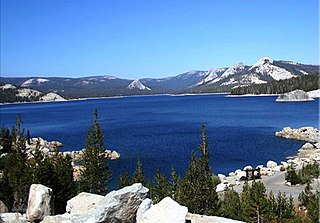
Courtright Reservoir is a reservoir in Fresno County, California. The reservoir is at an elevation of 8,170 feet in the Sierra National Forest, in the Sierra Nevada Mountain Range, bordering the John Muir Wilderness and the Dinkey Lakes Wilderness.

The Big Fresno Fair, founded in 1884, is an annual fair held at the Fresno County Fairgrounds. The Big Fresno Fair is managed by the 21st District Agricultural Association, an entity of the California Department of Food and Agriculture Division of Fairs & Expositions. It is the largest annual event in the San Joaquin Valley, attracting around 600,000 people each October during its twelve-day run featuring exhibits, a livestock show, live horse racing, musical entertainment, educational programs and more. The Fair provides a link between urban and rural California, serving as a tool to educate visitors on the region's rich agricultural industry. The mission of The Big Fresno Fair is to "Educate, Celebrate and Have Fun."
Bertrand Wesley "Bud" Gearhart was an American lawyer and politician. Gearhart, a Republican, served as the United States representative for California's 9th congressional district from 1935 to 1949.

Cecil Fielding White was an American farmer and politician. As a Democrat, White served as the U.S. representative for California's 9th congressional district for one term, from 1949 to 1951. White was a cotton broker and owned his own ranch before getting into politics at the age of 47, and defeating seven-term incumbent Republican Bertrand W. Gearhart.
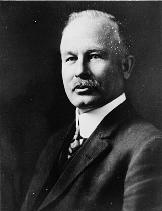
William Angus Sutherland was a California politician, attorney and banker. Sutherland was elected to the California State Assembly in 1910, and re-elected in 1912.
El Prado is a former settlement in Fresno County, California. It was located at the junction of the San Joaquin and Eastern and the Southern Pacific Railroads 6 miles (9.7 km) north-northwest of Clovis, at an elevation of 377 feet. The primary function of the settlement was as a switch yard and was initially known as "Nopac Siding", which was changed to El Prado shortly after its construction. It still appeared on maps as of 1922.
Miramonte is an unincorporated community in Fresno County, California. It is located on Mill Creek 5 miles (8 km) southeast of Dunlap, at an elevation of 3094 feet.
Piedra is an unincorporated community in Fresno County, California. It is located on the south bank of the Kings River 23 miles (37 km) east of Fresno, at an elevation of 538 feet.

Fort Miller is a former fort on the south bank of the San Joaquin River in what is now Fresno County, California, United States. It lay at an elevation of 561 feet. The site is now under Millerton Lake, formed by the Friant Dam in 1944. It is registered as California Historical Landmark #584.
The San Joaquin Light and Power Corporation was a utility company that provided electricity to seven counties in the San Joaquin Valley of California. The company is one of several utilities acquired by the Pacific Gas and Electric Company during the 1920s and 1930s to form the modern PG&E system.
Wishon Dam is a dam in Fresno County, California in the Sierra National Forest, in the Sierra Nevada Mountain Range. It impounds the North Fork Kings River to form Wishon Reservoir.
The Ararat Massis Armenian Cemetery, commonly known as the Ararat Cemetery, is an Armenian cemetery in Fresno, California. Established in 1885, the cemetery is the burial place of many prominent figures of Armenian-American history, including Soghomon Tehlirian, Victor Maghakian, and William Saroyan. The Ararat Massis Cemetery was the only Armenian cemetery built outside Armenia and the Middle East for more than a century.
Mount Pisgah is a peak in Carbon County, Pennsylvania situated north-northwest from and looming over the right bank business district in downtown Jim Thorpe.
The following is a timeline of the history of the city of Fresno, California, USA.
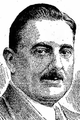
Wallace Dalrymple Henderson was a California politician, serving in the California State Assembly, Fresno City Council, and as acting mayor of Fresno immediately following the death of Mayor Arthur L. Selland.
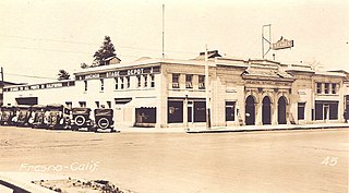
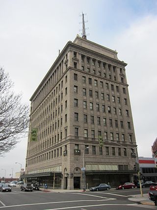
The Rusitigian Building, at Fulton and Mono Streets in Fresno, California, was built in 1920 in Classical Revival style architecture. Originally built as a bus depot, it was renovated and reopened 2019 for retail and restaurant tenants. It is listed as a historic place by Fresno's Local Register of Historic Resources.

Martin Theodore Kearney (1842–1906), also known as M.T. Kearney or M. Theo Kearney, was a nineteenth century English immigrant to the United States and a pioneer land developer. In a biography of Kearney, Rehart and Patterson referred to him as "one of the most powerful and prosperous agricultural leaders in the state of California."

The Meux Home is a historic mansion located in Fresno, California. It was the residence of Thomas Richard Meux, a physician who served Fresno in the initial stages of the city's growth.
Coordinates: 36°44′59″N119°49′36″W / 36.74972°N 119.82667°W