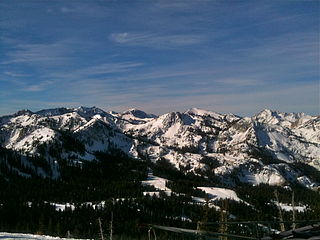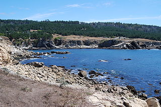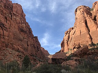
Alpine is a city on the northeastern edge of Utah County, Utah. The population was 10,251 at the time of the 2020 census. Alpine has been one of the many quickly-growing cities of Utah since the 1970s, especially in the 1990s. This city is thirty-two miles southeast of Salt Lake City. It is located on the slopes of the Wasatch Range north of Highland and American Fork. The west side of the city runs above the Wasatch Fault.

Park City is a city in Utah, United States. The vast majority is in Summit County, and it extends into Wasatch County. It is considered to be part of the Wasatch Back. The city is 32 miles (51 km) southeast of downtown Salt Lake City and 20 miles (32 km) from Salt Lake City's east edge of Sugar House along Interstate 80. The population was 8,396 at the 2020 census. On average, the tourist population greatly exceeds the number of permanent residents.

The Wasatch Range or Wasatch Mountains is a mountain range in the western United States that runs about 160 miles (260 km) from the Utah-Idaho border south to central Utah. It is the western edge of the greater Rocky Mountains, and the eastern edge of the Great Basin region. The northern extension of the Wasatch Range, the Bear River Mountains, extends just into Idaho, constituting all of the Wasatch Range in that state.

Snowbird is an unincorporated community in Little Cottonwood Canyon in the Wasatch Range of the Rocky Mountains near Salt Lake City, Utah, United States. It is most famous for Snowbird Ski and Summer Resort, an alpine skiing and snowboarding area, which opened in December 1971.

Little Cottonwood Canyon lies within the Wasatch-Cache National Forest along the eastern side of the Salt Lake Valley, roughly 15 miles from Salt Lake City, Utah. The canyon is part of Granite, a CDP and "Community Council" designated by Salt Lake County. The canyon is a glacial trough, carved by an alpine glacier during the last ice age, 15,000 to 25,000 years ago. A number of rare and endemic plant species are found in the canyon's Albion Basin. Mountain goats inhabit the surrounding mountains.

Antelope Island, with an area of 42 square miles (109 km2), is the largest of ten islands located within the Great Salt Lake in the US state of Utah. The island lies in the southeastern portion of the lake, near Salt Lake City and Davis County, and becomes a peninsula when the lake is at extremely low levels. It is protected as Antelope Island State Park.

Soldier Hollow is a cross-country ski venue located at the mouth of a hollow of the same name about 53 miles (85 km) southeast of Salt Lake City in Wasatch Mountain State Park in northwestern Wasatch County, Utah, United States. The venue was created for the 2002 Winter Olympics, and during the games it hosted the biathlon, cross-country skiing, and the cross country skiing portion of the Nordic combined events. Since hosting the Olympics, it has been developed as a cross-country skiing, tubing, and snowshoeing venue, while featuring mountain biking and golfing in the summer. On May 1, 2016, the venue operation contract transferred from the Soldier Hollow Legacy Foundation to the Utah Olympic Legacy Foundation, which owns and operates several Olympic and Paralympic legacy venues elsewhere in the state.

Red Butte Garden and Arboretum consists of a botanical garden, arboretum, and amphitheatre operated by the University of Utah, in the foothills of the Wasatch Range in Salt Lake City, Utah, United States. It is open year-round to the public. Red Butte Garden contains over 100 acres (0.40 km2) of botanical gardens and several miles of hiking trails through native vegetation. Red Butte Creek runs within the northern part of the garden.

Goosenecks State Park is a state park in the U.S. state of Utah, overlooking a deep meander of the San Juan River. The park is located near the southern border of the state a short distance from Mexican Hat, Utah. Millions of years ago, the Monument Upwarp forced the river to carve incised meanders over 1,000 feet (300 m) deep as the surrounding landscape slowly rose in elevation. Eroded by water, wind, frost, and gravity, this is a classic location for observing incised meanders.

Dead Horse Point State Park is a state park of Utah in the United States, featuring a dramatic overlook of the Colorado River and Canyonlands National Park. The park covers 5,362 acres (2,170 ha) of high desert at an altitude of 5,900 feet (1,800 m).

Brighton Ski Resort is a ski area located in Big Cottonwood Canyon in Brighton, Utah, United States, about 30 miles (48 km) from downtown Salt Lake City. It is owned and operated by Boyne Resorts.

Big Cottonwood Canyon is a canyon in the Wasatch Range 12 miles (19 km) southeast of Salt Lake City in the U.S. state of Utah. The 15-mile (24 km)-long canyon provides hiking, biking, picnicking, rock-climbing, camping, and fishing in the summer. Its two ski resorts, Brighton and Solitude, are popular among skiers and snowboarders. The canyon is accessed by The Big Cottonwood Canyon Scenic Byway (SR-190), which runs its length to Guardsman Pass at the top of the canyon, allowing travel to Park City in the summer months.

Snow Canyon State Park is a state park in Utah, located in the Red Cliffs Desert Reserve. The park features a canyon carved from the red and white Navajo sandstone of the Red Mountains, as well as the extinct Santa Clara Volcano, lava tubes, lava flows, and sand dunes. Snow Canyon is located near the cities of Ivins and St. George in Washington County.

Salt Point State Park is a state park in Sonoma County, California, United States. The park covers 6,000 acres (2,428 ha) on the coast of Northern California, with 20 miles (32 km) of hiking trails and over 6 miles (9.7 km) of a rough rocky coast line including Salt Point which protrudes into the Pacific Ocean. The park also features the first underwater preserves in California. The constant impact of the waves forms the rocks into many different shapes. These rocks continue underwater providing a wide variety of habitats for marine organisms. The activities at Salt Point include hiking, camping, fishing, scuba diving and many others. The weather is cool with fog and cold winds, even during the summer.

The Bonneville Shoreline Trail is a mixed use (biking/hiking) recreation trail in Utah that roughly follows the shoreline of the ancient Lake Bonneville, a prehistoric pluvial lake which existed in northern Utah before naturally draining about 14,000 years ago. Some sections of the trail are complete while other parts are still being developed. The Bonneville Shoreline Trail hopes to one day stretch from the Idaho border and run southward all the way to Nephi, Utah.

Provo Canyon is located in unincorporated Utah County and Wasatch County, Utah. Provo Canyon runs between Mount Timpanogos on the north and Mount Cascade on the south. The canyon extends from Orem on the west end to Heber City on the east. Provo Canyon is situated to the east of Utah Valley and grants access to the valleys and Uinta Basin regions that lie beyond the Wasatch front.

Millcreek Canyon is a canyon in the Wasatch Mountains and part of Millcreek City on the east side of the Salt Lake Valley, Utah. It is a popular recreation area both in the summer and in the winter. It was named by Brigham Young on August 22, 1847, before all of the mills that were built in and below the densely forested canyon. It is home to two restaurants and six Boy Scout Day Camps.
Skiing in Utah is a thriving industry which contributes greatly to the state’s economy. Skiing started off in the state as a recreational activity enjoyed by only a few, but since the 1930s, it has increasingly developed into a substantial industry, which creates thousands of jobs and brings in millions of dollars in revenue.

Padre Canyon is adjacent to Snow Canyon State Park and Red Mountain in Ivins, Utah, and features a three sided canyon and scenic sentinels carved from the red Navajo Sandstone. Padre Canyon is part of the Red Cliffs Desert Reserve, a 62,000 acre protected area that contains three distinct ecosystems: the Mojave Desert, the Colorado Plateau and the Great Basin. Geological features of the canyon include Padre Rock, the Padre Arch, pillared rock formations and sand dunes.
Cherry Peak is a ski area in northern Utah that opened in 2014 and first used for skiing in the 2015–2016 season. It is located in Cherry Canyon, east of Richmond, Utah in the Bear River Mountains. While smaller and less developed than a number of Utah ski resorts, Cherry Peak is close and convenient to residents of nearby Logan, Utah State University, and Cache Valley. It also hosts students from more distant universities.


