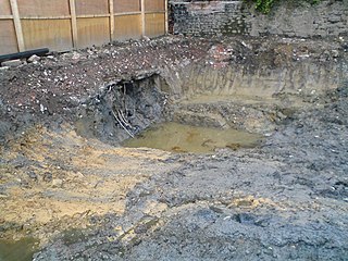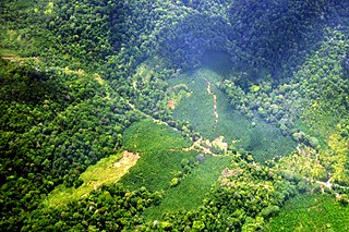
Soil erosion is the denudation or wearing away of the upper layer of soil. It is a form of soil degradation. This natural process is caused by the dynamic activity of erosive agents, that is, water, ice (glaciers), snow, air (wind), plants, and animals. In accordance with these agents, erosion is sometimes divided into water erosion, glacial erosion, snow erosion, wind (aeolian) erosion, zoogenic erosion and anthropogenic erosion such as tillage erosion. Soil erosion may be a slow process that continues relatively unnoticed, or it may occur at an alarming rate causing a serious loss of topsoil. The loss of soil from farmland may be reflected in reduced crop production potential, lower surface water quality and damaged drainage networks. Soil erosion could also cause sinkholes.

The world economy or global economy is the economy of all humans in the world, referring to the global economic system, which includes all economic activities conducted both within and between nations, including production, consumption, economic management, work in general, financial transactions and trade of goods and services. In some contexts, the two terms are distinct: the "international" or "global economy" is measured separately and distinguished from national economies, while the "world economy" is simply an aggregate of the separate countries' measurements. Beyond the minimum standard concerning value in production, use and exchange, the definitions, representations, models and valuations of the world economy vary widely. It is inseparable from the geography and ecology of planet Earth.

Topsoil is the upper layer of soil. It has the highest concentration of organic matter and microorganisms and is where most of the Earth's biological soil activity occurs.

Soil classification deals with the systematic categorization of soils based on distinguishing characteristics as well as criteria that dictate choices in use.
Data assimilation is a mathematical discipline that seeks to optimally combine theory with observations. There may be a number of different goals sought – for example, to determine the optimal state estimate of a system, to determine initial conditions for a numerical forecast model, to interpolate sparse observation data using knowledge of the system being observed, to set numerical parameters based on training a model from observed data. Depending on the goal, different solution methods may be used. Data assimilation is distinguished from other forms of machine learning, image analysis, and statistical methods in that it utilizes a dynamical model of the system being analyzed.
Digital soil mapping (DSM) in soil science, also referred to as predictive soil mapping or pedometric mapping, is the computer-assisted production of digital maps of soil types and soil properties. Soil mapping, in general, involves the creation and population of spatial soil information by the use of field and laboratory observational methods coupled with spatial and non-spatial soil inference systems.

A soil map is a geographical representation showing diversity of soil types or soil properties in the area of interest. It is typically the result of a soil survey inventory, i.e. soil survey. Soil maps are most commonly used for land evaluation, spatial planning, agricultural extension, environmental protection and similar projects. Traditional soil maps typically show only general distribution of soils, accompanied by the soil survey report. Many new soil maps are derived using digital soil mapping techniques. Such maps are typically richer in context and show higher spatial detail, yet are not necessarily more accurate than traditional soil maps. Soil maps produced using (geo)statistical technique can also include an estimate of the model uncertainty.

Spatial analysis is any of the formal techniques which studies entities using their topological, geometric, or geographic properties. Spatial analysis includes a variety of techniques using different analytic approaches, especially spatial statistics. It may be applied in fields as diverse as astronomy, with its studies of the placement of galaxies in the cosmos, or to chip fabrication engineering, with its use of "place and route" algorithms to build complex wiring structures. In a more restricted sense, spatial analysis is geospatial analysis, the technique applied to structures at the human scale, most notably in the analysis of geographic data. It may also be applied to genomics, as in transcriptomics data.

Soil contamination, soil pollution, or land pollution as a part of land degradation is caused by the presence of xenobiotic (human-made) chemicals or other alteration in the natural soil environment. It is typically caused by industrial activity, agricultural chemicals or improper disposal of waste. The most common chemicals involved are petroleum hydrocarbons, polynuclear aromatic hydrocarbons, solvents, pesticides, lead, and other heavy metals. Contamination is correlated with the degree of industrialization and intensity of chemical substance. The concern over soil contamination stems primarily from health risks, from direct contact with the contaminated soil, vapour from the contaminants, or from secondary contamination of water supplies within and underlying the soil. Mapping of contaminated soil sites and the resulting clean ups are time-consuming and expensive tasks, and require expertise in geology, hydrology, chemistry, computer modelling, and GIS in Environmental Contamination, as well as an appreciation of the history of industrial chemistry.

Soil quality refers to the condition of soil based on its capacity to perform ecosystem services that meet the needs of human and non-human life.
The European Soil Database is the only harmonized soil database in Europe from which many other data information and services are derived. For instance, the European Soil Database v2 Raster Library contains raster (grid) data files with cell sizes of 1 km x 1 km for a large number of soil related parameters. Each grid is aligned with the INSPIRE reference grid. These rasters are in the public domain and allow expert users to use the data for instance to run soil-, water- and air related models. The European Soil Database may be downloaded from the European Soil Data Center.

Soil carbon is the solid carbon stored in global soils. This includes both soil organic matter and inorganic carbon as carbonate minerals. It is vital to the soil capacity in our ecosystem. Soil carbon is a carbon sink in regard to the global carbon cycle, playing a role in biogeochemistry, climate change mitigation, and constructing global climate models. Microorganisms play an important role in breaking down carbon in the soil. Changes in their activity due to rising temperatures could possibly influence and even contribute to climate change. Human activities have caused a massive loss of soil organic carbon. For example, anthropogenic fires destroy the top layer of the soil, exposing soil to excessive oxidation.
Soil biodiversity refers to the relationship of soil to biodiversity and to aspects of the soil that can be managed in relative to biodiversity. Soil biodiversity relates to some catchment management considerations.
The Universal Soil Loss Equation (USLE) is a widely used mathematical model that describes soil erosion processes.
Soil management is the application of operations, practices, and treatments to protect soil and enhance its performance. It includes soil conservation, soil amendment, and optimal soil health. In agriculture, some amount of soil management is needed both in nonorganic and organic types to prevent agricultural land from becoming poorly productive over decades. Organic farming in particular emphasizes optimal soil management, because it uses soil health as the exclusive or nearly exclusive source of its fertilization and pest control.
Soil governance refers to the policies, strategies, and the processes of decision-making employed by nation states and local governments regarding the use of soil. Globally, governance of the soil has been limited to an agricultural perspective due to increased food insecurity from the most populated regions on earth. The Global Soil Partnership, GSP, was initiated by the Food and Agriculture Organization (FAO) and its members with the hope to improve governance of the limited soil resources of the planet in order to guarantee healthy and productive soils for a food-secure world, as well as support other essential ecosystem services.
Erodability is the inherent yielding or nonresistance of soils and rocks to erosion. A high erodibility implies that the same amount of work exerted by the erosion processes leads to a larger removal of material. Because the mechanics behind erosion depend upon the competence and coherence of the material, erodibility is treated in different ways depending on the type of surface that eroded.

Land consumption as part of human resource consumption is the conversion of land with healthy soil and intact habitats into areas for industrial agriculture, traffic and especially urban human settlements. More formally, the EEA has identified three land consuming activities:
- The expansion of built-up area which can be directly measured;
- the absolute extent of land that is subject to exploitation by agriculture, forestry or other economic activities; and
- the over-intensive exploitation of land that is used for agriculture and forestry.
Waldemar Koczkodaj, is a Polish-Canadian computer scientist specialized in expert systems, assessments by pairwise comparisons method, inconsistency theory, bioinformatics, rating scale improvement, and behavioral addiction. He is known for the introduction of the inconsistency indicator for pairwise comparisons. He proposed axiomatization for the inconsistency indicator in 2014 (published with Ryszard Szwarc and enhanced it in 2018.


