Municipal Demarcation Board

Last updated
Municipal boundaries of South Africa, as demarcated by the Municipal Demarcation Board Map of South Africa with municipal borders (2016).svg
Municipal boundaries of South Africa, as demarcated by the Municipal Demarcation Board

The Municipal Demarcation Board is an independent authority responsible for delimiting the boundaries of South African districts and municipalities and the boundaries of the electoral wards within those municipalities.

South Africa Republic in the southernmost part of Africa

South Africa, officially the Republic of South Africa (RSA), is the southernmost country in Africa. It is bounded to the south by 2,798 kilometres (1,739 mi) of coastline of Southern Africa stretching along the South Atlantic and Indian Oceans; to the north by the neighbouring countries of Namibia, Botswana, and Zimbabwe; and to the east and northeast by Mozambique and Eswatini (Swaziland); and it surrounds the enclaved country of Lesotho. South Africa is the largest country in Southern Africa and the 25th-largest country in the world by land area and, with over 57 million people, is the world's 24th-most populous nation. It is the southernmost country on the mainland of the Old World or the Eastern Hemisphere. About 80 percent of South Africans are of Sub-Saharan African ancestry, divided among a variety of ethnic groups speaking different African languages, nine of which have official status. The remaining population consists of Africa's largest communities of European (White), Asian (Indian), and multiracial (Coloured) ancestry.

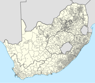
The nine provinces of South Africa are divided into 52 districts, which are either metropolitan or district municipalities. They are the second level of administrative division, below the provinces and above the local municipalities.

Municipalities of South Africa local government structures in South Africa

Local government in South Africa consists of municipalities of various types. The largest metropolitan areas are governed by metropolitan municipalities, while the rest of the country is divided into district municipalities, each of which consists of several local municipalities. After the municipal election of 18 May 2011 there were eight metropolitan municipalities, 44 district municipalities and 226 local municipalities. Since the boundary reform at the time of the municipal election of 3 August 2016 there are eight metropolitan municipalities, 44 district municipalities and 205 local municipalities.

Contents

General

The Board was envisaged in section 155.(2)(b) of the Constitution, and created by the Local Government: Municipal Demarcation Act, 1998. It consists of nine board members, appointed by the President for a five-year term. Except for the Chairperson, the members of the Board serve on a part-time basis. There is also a small support staff for administration and research.

The Constitution of South Africa is the supreme law of the Republic of South Africa. It provides the legal foundation for the existence of the republic,it sets out the rights and duties of its citizens, and defines the structure of the government. The current constitution, the country's fifth, was drawn up by the Parliament elected in 1994 in the South African general election, 1994. It was promulgated by President Nelson Mandela on 18 December 1996 and came into effect on 4 February 1997, replacing the Interim Constitution of 1993.

President of South Africa South Africas head of state and head of government

The President of the Republic of South Africa is the head of state and head of government under the Constitution of South Africa. From 1961 to 1994, the head of state was called the State President.

See also

In other countries demarcation can be called redistricting or redistribution.

Redistricting is the process of drawing electoral district boundaries in the United States. A congressional act passed in 1967 requires that representatives be elected from single-member districts, except when a state has a single representative, in which case one state-wide at-large election be held.

Redistribution is the process, used in many Commonwealth countries, by which electoral districts are added, removed, or otherwise changed. Redistribution is a form of boundary delimitation that changes electoral district boundaries, usually in response to periodic census results. Redistribution is required by law or constitution at least every decade in most representative democracy systems that use first-past-the-post or similar electoral systems to prevent geographic malapportionment. The act of manipulation of electoral districts to favour a candidate or party is called gerrymandering.

Related Research Articles

Eastgate Shopping Centre is a super-regional shopping centre based in Bedfordview, near Bedford Gardens and Johannesburg City Centre in Gauteng province.

West Rand District Municipality District municipality in Gauteng, South Africa

West Rand District Municipality is one of the districts of Gauteng province of South Africa, that covers the West Rand area, with the exception of Roodepoort. The seat of the district municipality is Randfontein. The most spoken language among its population of 820,995 is Tswana. The district code is CBDC8.

Dr Kenneth Kaunda District Municipality District municipality in North West, South Africa

Dr Kenneth Kaunda District Municipality is one of the 4 districts of North West province of South Africa. The seat of Kaunda District is Klerksdorp. A plurality of its 742 821 people speak Setswana. The majority of its people live in the City of Matlosana Municipality. The district code is DC40. The district was formerly known as the Southern District Municipality. It is named after Kenneth Kaunda, the first President of Zambia. The Chief Director of Cultural Affairs is Taz Liwane.

Mopani District Municipality District municipality in Limpopo, South Africa

Mopani is one of the 5 districts of Limpopo province of South Africa. The seat of Mopani is Giyani. According to the 2016 Community Survey it has a population of 1,159,185, of whom the majority speak Tsonga or Northern Sotho. The district code is DC33. After the 12th amendment of the Constitution of South Africa part of the area of the Bohlabela district was incorporated into Mopani.

Ward (South Africa) subdivision of municipality in South Africa

In South Africa, wards are geopolitical subdivisions of municipalities used for electoral purposes. Each metropolitan and local municipality is delimited by the Municipal Demarcation Board into half as many wards as there are seats on the municipal council. Each ward then elects one councillor directly, and the remaining councillors are elected from party lists so that the overall party balance is proportional to the proportion of votes received by each party.

Bushbuckridge Local Municipality Local municipality in Mpumalanga, South Africa

Bushbuckridge Local Municipality is a third-level administrative division in the Ehlanzeni District of Mpumalanga in South Africa. Tobacco, cotton and vegetables are farmed in the municipality's countryside. The municipality includes part of Kruger National Park. Bushbuckridge is the biggest local municipality in Mpumalanga, in terms of land mass and by population.

Twelfth Amendment of the Constitution of South Africa

The Twelfth Amendment of the Constitution of South Africa altered the boundaries of seven of South Africa's nine provinces. It also redefined all of the provinces' geographical areas in terms of the areas of district and metropolitan municipalities, and repealed the provisions introduced by the Third Amendment that allowed municipal areas to cross provincial boundaries. A number of the boundary changes were highly controversial and led to popular protest and court challenges.

Vuwani Place in Limpopo, South Africa

Vuwani is a town in Vhembe District Municipality in the Limpopo province of South Africa.