Related Research Articles

Wahlenbergfjorden, sometimes known in English as Waalenburg Bay, is a fjord on the southwest coast of the Arctic island of Nordaustlandet, in Norway's Svalbard archipelago. At 46 kilometres (29 mi) in length, and 15 km (9.3 mi) wide, it is the fifth longest fjord in the archipelago, and the longest on the island. The fjord separates Gustav V Land in the north from Gustav Adolf Land in the south, at geographical co-ordinates 79°40′N20°00′E. Its mouth faces Spitsbergen across Hinlopen Strait, the strait separating the two islands.
Duvefjorden is a fjord at the northern side of Nordaustlandet, Svalbard. The fjord has a length of about 35 kilometres (22 mi) and a width of 12 to 13 km. Former names of the fjord include Baye du Pigeon, Dove Bay, Tauben Bai and Duiven-baai.
Rijpfjorden is a fjord at the northern side of Nordaustlandet, Svalbard. The fjord has a length of about 40 kilometres (25 mi) and a width of about 12 kilometres (7.5 mi). Former names of the fjord include Rypefjorden, Red Currant Bay and Ripsbai. The fjord is named after Dutch explorer Jan Rijp, who never came anywhere near it.
Adlersparrefjorden is a fjord of Nordaustlandet, Svalbard, an eastern branch of Duvefjorden at the northern coast. It has a length of about 10 kilometers, and has three branches. A land tongue of 0.5 kilometers separates the fjord from Finn Malmgren Fjord at the eastern side of Glenhalvøya. Adlersparrefjorden is named after naval officer Axel Adlersparre.

Finn Malmgren Fjord is a fjord in Orvin Land at Nordaustlandet, Svalbard, between Glenhalvøya and Bergstrømodden. A land tongue of 0.5 kilometers separates the fjord from Adlersparrefjorden. Finn Malmgrenfjorden is named after Arctic explorer Finn Malmgren.

Glenhalvøya is a peninsula in Orvin Land at Nordaustlandet, Svalbard, between Finn Malmgren Fjord and Duvefjorden. It is named after Arctic explorer Alexander Richard Glen. The island of Søre Repøya is separated from the peninsula by the strait of Gilessundet.
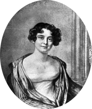
Lady Franklinfjorden is a fjord in Gustav V Land at Nordaustlandet, Svalbard. The fjord has a length of about 25 kilometers. Lady Franklinfjorden is named after Jane Franklin, the wife of Arctic explorer John Franklin.
Brennevinsfjorden is a fjord in Gustav V Land at Nordaustlandet, Svalbard. The fjord has a length of about eleven nautical miles, and runs in between Depotodden and Kapp Hansteen.
Platenhalvøya is a peninsula at Nordaustlandet, Svalbard, between Zorgdragerfjorden and Duvefjorden. The peninsula constitutes the northeastern part of Prins Oscars Land. The mountains Binneyfjellet and Goodenoughfjellet are among the highest peaks of Nordaustlandet.
Zorgdragerfjorden is a fjord at the northern coast of Nordaustlandet, Svalbard, west of Platenhalvøya, in Prins Oscars Land. The fjord is named after Dutch captain Cornelis Gijsbertsz Zorgdrager.
Ekstremfjorden is a fjord at the northern coast of Nordaustlandet, Svalbard, east of Laponiahalvøya. It mouths into the western part of Nordenskiöldbukta.

Storøya is an island in the Svalbard archipelago. It is located east of Nordaustlandet, separated from Nordaustlandet by the strait of Storøysundet. The southern part of the island is covered by the glacier Storøyjøkulen.
Palanderbukta is a fjord or bay in Gustav Adolf Land at Nordaustlandet, Svalbard, a southern bay of Wahlenbergfjorden. The bay is named after Swedish naval officer Louis Palander.
Bergströmodden is a headland in Orvin Land at Nordaustlandet, Svalbard. It is located north of the mountain Boydfjellet, at the mouth of Finn Malmgren Fjord, east of Alpini Island. The headland is named after Swedish politician Axel Bergström.
Krossøya is an island at the northwestern side of Nordaustlandet, Svalbard. It is located in the outer part of Murchisonfjorden, separated by Nordre Russøysundet from Søre Russøya, further east, and south of Depotøya. The name Krossøya originates from an old Russian cross, erected at the top of the island. Krossøya is included in Nordaust-Svalbard Nature Reserve.
Søre Russøya is an island at the northwestern side of Nordaustlandet, Svalbard. It is located in the outer part of Murchisonfjorden, and is the largest of the group of three islands called Russøyane. The island is separated from Nordaustlandet by the strait of Søre Russøysundet. Further west is island Krossøya. The island has an area of about, 10 km2.. Highest point, 71 m.a.s.l.. Søre Russøya is part of the Nordaust-Svalbard Nature Reserve.
Storsteinhalvøya is a peninsula at the northwestern side of Nordaustlandet, Svalbard. It is surrounded by Murchisonfjorden to the south, Franklinsundet to the north, and Lady Franklinfjorden to the northeast. The peninsula is almost free of glaciated areas, and contains some lakes. The nearly closed bay Claravågen is located at the western side, and Pentavika and Westmanbukta at the northern side.
Boydfjellet is a mountain in Orvin Land at Nordaustlandet, Svalbard. It is located at the eastern side of Finn Malmgren Fjord, and has a height of 300 m.a.s.l. The mountain is named after American Arctic explorer Louise Arner Boyd.
Oxfordhalvøya is a peninsula in Wahlenbergfjorden at the southwestern side of Nordaustlandet, Svalbard. It is located between Bodleybukta and Etonbreen at the head of the fjord. The bay Kløverbladbukta cuts into the peninsula, and its highest point is Carfaxhaugen at 103 m.a.s.l. The river of Oxfordelva flows from the lake of Brånevatnet through Oxfordhalvøya, and debouches into Bodleybukta.

Sparreneset is a headland in Gustav V Land at Nordaustlandet, Svalbard. It is located south of the mouth of Murchisonfjorden, about five nautical miles north of Dolomittøyane and extends about one nautical mile into Hinlopen Strait. The headland is named after Swedish politician Gustaf Adolf Vive Sparre.
References
- ↑ "Murchisonfjorden (Svalbard)". Norwegian Polar Institute . Retrieved 29 June 2013.
- ↑ Arctic Pilot: Sailing directions Svalbard–Jan Mayen. Vol. 7. Stavanger: The Norwegian Hydrographic Service and The Norwegian Polar Institute. 1988. pp. 348–352. ISBN 82-90653-06-9.
80°00′11″N18°29′07″E / 80.0031°N 18.4852°E
| | This article about a fjord in Nordaustlandet is a stub. You can help Wikipedia by expanding it. |