
Margao is the commercial capital of the Indian state of Goa. It stands on the banks of the river Sal. It is the district headquarters of South Goa, and administrative headquarters of Salcete sub-district. It is Goa's second largest city by population after Mormugao.

Madanapalle is a city in Annamayya district and Rajampet Lok Sabha constituency of the Indian state of Andhra Pradesh. It is a Selection Grade Municipality and largest City in Annamayya District. Madanapalle is headquarters of Madanapalle Mandal,Madanapalle revenue division and PKM Urban Development Authority.

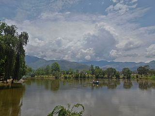
Nahan is a town in Himachal Pradesh in India and is the headquarters of the Sirmaur District. It was the capital of the former Sirmur princely state. Nahan is also known as the "town of ponds".
Beawar is a city in Beawar district of Rajasthan, India. Beawar was the financial capital of Merwara state of Rajputana. As of 2011, the population of Beawar is 342,935. It is located 70 kilometres from Ajmer and 184 kilometres (114 mi)southwest of the state capital Jaipur, amidst Aravali hills. The city used to be a major center for trade, especially in raw cotton, and used to have cotton presses and the Krishna cotton mills. Currently, major industries include mineral-based units, machine-based units, machine tools and accessories, pre-stressed concrete pipes, plastic products, textiles, wooden furniture and asbestos cement pipes. Beawar is the largest producer of cement in northern India and home to Shree Cement. It is situated in a mineral-rich region having reserves of feldspar, quartz, asbestos, soapstone, magnesite, calcite, limestone, mica, emerald, granite, and masonry stone. Reserves of barytes, fluorite, wollastonite and vermiculite have also been found. Nearest airports are Jodhpur (145 km), Kishangarh and Jaipur (190 km). It is also connected by RSRTC operated buses to all parts of Rajasthan, and neighboring Delhi NCR, Ahmedabad (Gujarat), Gwalior. It also has railway connectivity with Delhi, Mumbai, Ahmadabad, Bangalore (bi-weekly), Haridwar, Dehradun (weekly), Bareilly and Muzzafarpur.

Rupandehi District, a part of Lumbini Province, is one of the seventy-seven districts of Nepal and covers an area of 1,360 km2 (530 sq mi). The district headquarter is Bhairahawa. As per the national census 2011, the population of Rupandehi was 880,196.
Surkhet District is a district in Karnali Province of mid-western Nepal. Surkhet is one of the ten districts of Karnali located about 600 kilometres (373 mi) west of the national capital Kathmandu. The district's area is 2,489 square kilometres (961 sq mi). It had 288,527 population in 2001 and 350,804 in 2011 which male comprised 169,461 and female 181,381. Its district headquarters, Birendranagar, is the capital of Karnali Province. It is serving as a business hub and document center for Karnali province. According to population, development, road links, landforms, climate, many peoples are migrating here. After becoming province capital developmental activities are boosted and are in peak level. All the governmental works are carried here. Birendranagar is beautiful valley surrounded by hills having moderate climate.
Maihar is a city in the Maihar district of the Indian state of Madhya Pradesh. It is the administrative headquarter of Maihar District. Maihar is known for the Maa Sharda Mandir situated in the city. It is one of the Shakti Peeth.

Kurseong is a town and a municipality in Darjeeling district in the Indian state of West Bengal. It is the headquarters of the Kurseong subdivision.

Butwal, officially Butwal Sub-Metropolitan City ,previously known as Khasyauli, is a sub-metropolitan city and economic hub in Lumbini Province in West Nepal. Butwal has a city population of 195,054 as per the 2021 AD Nepal census.
Khariar is a city and a Notified Area Council in Nuapada District of the Indian state of Odisha.
Lalsot is a city with municipality in Dausa district in the Indian state of Rajasthan. Lalsot is the biggest city in Dausa district.
Mahemdavad is a town with municipality in the Kheda district in the Indian state of Gujarat. Mahemdavad is situated on the Vatrak River bank. The nearest city is Kheda. It is 30 km from largest city of Gujarat, Ahmedabad.

Inaruwa is the headquarter of Sunsari district that lies in the Koshi province of Eastern Nepal. Inaruwa is a municipality since the time of Panchayat in the year 2047 BS. After 2015, it has been operating under a mayor-council form of government and is currently led by Mayor Kedar Bhandari. Spanning 77.92 square kilometers, the municipality is home to a population of nearly 75 thousand residents.

Kamalamai is a municipality in Sindhuli District, in the Bagmati Province of central south Nepal. At the time of the 2011 Nepal census it had a population of 39,413 people in 9,304 households. The city is located in the Sindhuli Valley of central south Nepal. The historic symbol of the valley, Sindhuli Gadhi fort, is at the peak of a hill of the Mahabharata range. The city is in the plain valley made by the Kamla River. Kamalamai Municipality is the largest municipality of Nepal according to area.
Mahendranagar is a town in Chhireshwarnath Municipality of Dhanusa District in the Janakpur Zone of south-eastern Nepal. The formerly Village Development Committee was converted into municipality merging along with existing VDCs Ramdaiya, Sakhuwa Mahendranagar, Hariharpur and Digambarpur on 18 May 2014. At the time of the 1991 Nepal census it had a population of 10,209 persons living in 1916 individual households. Mahendranagar acts as bridge between Dhalkebar and Janakpur. Basically it is popular for its largest cattle market in the Nepal. It is assumed that 65% of cattle for e.g. buffalo, goats in Kathmandu valley are brought from here. The town is named after late king Mahendra.
Sabaila, sometimes spelled Sabela, is a municipality in Dhanusa District in Province No. 2 of south-eastern Nepal. At the time of the 1991 Nepal census, it had a population of 6,860 persons living in 1,246 individual households. Sabaila is one of the strongest municipalities in the Dhanusha district.
Mirchaiya formerly known as Ramnagar Mirchaiya is a municipality in Siraha District in the Madhesh Province of south-eastern Nepal. The municipality was established on 18 May 2014 by merging the existing Rampur Birta, Malhaniyakhori, Radhopur, Ramnagar Mirchaiya, Phulbariya, Sitapur PraDa and Maheshpur Gamharia Village Development Committees. At the time of the 2017 municipality records, it had a population of approx. 52,000 people living in approx 8,496 individual households. This is one of the main business markets for Katari and the southern part of the Siraha district. Raw material produced here includes padday, miazem, and sugar cane.
Pharsatikar is a Rural municipality in Rupandehi District, Lumbini Province of southern Nepal. At the time of the 2011 Nepal census it had a population of 9,663 people living in 1992 individual households. Before some years, people here used to be mostly Tharus but due to, the huge agricultural possibility and a very good environment that it serves to the people staying here, its population has found to be increased with mostly people shifted here from Myanmar in late 80's along with Paharis migrating from the neighbouring districts.

Letang, "लेटाङ " is a municipality with 9 wards in Morang District in the Koshi Province of Nepal. It was formed by merging the existing Village Development Committees of Letang, Jante, Warrangi and Bhogateni. This municipality is situated in Hilly Region as well as Terai Region. Previously it was called Letang Bhogateni but now it's known as Letang.

Sainamaina Municipality is one of the new 72 municipalities formed in Nepal. It is located in Rupandehi District in Lumbini Province of southern Nepal which is known for its historical and cultural significance, especially as the birthplace of Lord Buddha. The municipality was established by merging three existing VDCs i.e. Dudharakchhe, Saljhandi and Parroha. At the time of the 2021 Nepal census it had a population of 72,648 people. The official website of Sainamaina Municipality is https://sainamainamun.gov.np/.