Young is a town in the South Western Slopes region of New South Wales, Australia, and the largest town in the Hilltops Region. The "Lambing Flat" Post Office opened on 1 March 1861 and was renamed "Young" in 1863.

Harden–Murrumburrah is a township and community in the Hilltops Region and is located in the South West Slopes of New South Wales in Australia. Harden is adjacent to both the Canberra region of the Australian Capital Territory and the Riverina Region in the southwest area of NSW. The town is a twin town between Harden and Murrumburrah.

The Australian state of New South Wales has an extensive network of railways, which were integral to the growth and development of the state. The vast majority of railway lines were government built and operated, but there were also several private railways, some of which operate to this day.

Cootamundra, nicknamed Coota, is a town in the South West Slopes region of New South Wales, Australia and within the Riverina. It is within the Cootamundra-Gundagai Regional Council. At the 2016 Census, Cootamundra had a population of 6,782. It is located on the Olympic Highway at the point where it crosses the Muttama Creek, between Junee and Cowra. Its railway station is on the Main Southern line, part of the Melbourne-to-Sydney line.

Burrinjuck was an electoral district of the Legislative Assembly in the Australian state of New South Wales from 1950 to 2015.

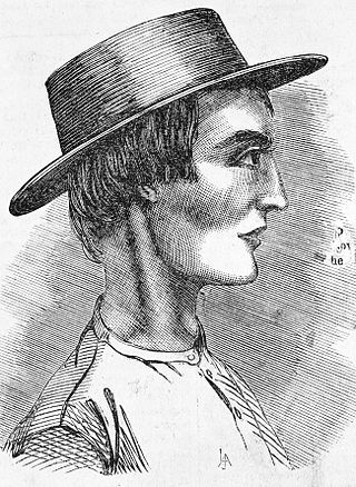
John Dunn was an Australian bushranger. He was born at Murrumburrah near Yass in New South Wales. He was 19 years old when he was hanged in Darlinghurst Gaol. He was buried in the former Devonshire Street Cemetery in Sydney.

Harden Shire was a local government area in the South West Slopes region of New South Wales, Australia. The Shire included the twin towns of Harden and Murrumburrah and the small towns of Galong, Jugiong, Wombat and Kingsvale.

Murrumburrah is a township in New South Wales, Australia, part of a twin town with Harden. The town is in Hilltops Council local government area in the South West Slopes area of NSW. It is on the Burley Griffin Way, the major link from the Riverina to the Hume Highway near Yass, and ultimately Sydney, Canberra and the coast.

The Blayney–Demondrille railway line is a railway line in New South Wales, Australia. The line is used mainly for grain haulage and is owned by the Transport Asset Holding Entity, a government department of Transport for NSW. However, in 2004 the Australian Rail Track Corporation became responsible for operations over the line. The Lachlan Valley Railway operated heritage and tourist trains over the line, based at Cowra. It previously also operated general goods trains.

Demondrille railway station is a heritage-listed disused railway station on the Main Southern line serving the town of Murrumburrah, New South Wales, Australia. The station was located at the junction of the Blayney–Demondrille line and the Main Southern line. It consisted of a pair of island platforms, one on the mainline and one on the branchline, with a pair of signal boxes controlling the junction, which was formerly a triangle junction.

Albert David Reid, MC was an Australian politician. Born in Murrumburrah, New South Wales, he was educated at state schools before becoming a farmer and grazier at Crowther. He sat on Murrumburrah Shire Council before serving in the military in 1914. He was awarded the Military Cross for gallantry at Beersheeba in October 1917.

Cootamundra railway station is located on the Main Southern line in New South Wales, Australia. It serves the town of Cootamundra. The property was added to the New South Wales State Heritage Register on 2 April 1999.

Harden railway station is a heritage-listed railway station located on the Main Southern line in New South Wales, Australia. It serves the town of Harden. It was added to the New South Wales State Heritage Register on 2 April 1999.

The Burrowa News and Marengo, Binalong, Murrumburrah and Cootamundra Reporter was a weekly English language newspaper published in Boorowa, New South Wales, Australia.
The Rocky Ponds Creek, a watercourse that is part of the Murrumbidgee catchment within the Murray–Darling basin, is located in the South West Slopes region of New South Wales, Australia.
The Harden-Murrumburrah Express or The Harden Murrumburrah Express is an Australian weekly paper in New South Wales.

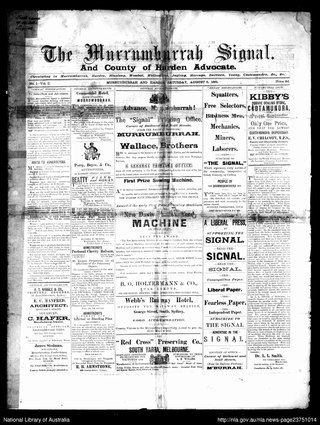
The Murrumburrah Signal and County of Harden Advocate, also known as the Murrumburrah Signal and The Signal, Murrumburrah-Harden, was an English language newspaper published from 1881 to 1947 in Murrumburrah, New South Wales, Australia.

Demondrille Shire was a local government area in the South West Slopes region of New South Wales, Australia.

Woodstock railway station is a heritage-listed former railway station on the Blayney–Demondrille railway line at Woodstock, Cowra Shire, New South Wales, Australia. The property was added to the New South Wales State Heritage Register on 2 April 1999.
Cunningar is a locality in the Hilltops Council local government area, within the South West Slopes region of New South Wales, Australia. It is located immediately to the east of the town of Harden. There is a parish of the County of Harden of the same name, which comprises a part of the area of the locality.


