External links
| | This article about an Australian politician is a stub. You can help Wikipedia by expanding it. |
Murrundindi | |
|---|---|
| Other names | Gary Hunter |
| Relatives | William Barak |
| Ngurungaeta of the Wurundjeri people | |
| Assumed office February 2006 | |
| Preceded by | James Wandin |
Murrundindi,also known as Gary Hunter, [1] is the ngurungaeta of the Wurundjeri people and a descendant of William Barak. He succeeded James Wandin in this position in February 2006. [2]
Murrundindi and his brother Warendj regularly conduct cultural education programs in pre-schools,primary and secondary schools throughout Melbourne. They visit schools regularly and present the diversity of their Aboriginal culture to the children through song,dance,language,and music. Murrundindi also does educational work at Healesville Sanctuary,who nominated him for a reconciliation award in 1997. [3]
On 13 January 2007,Murrundindi unveiled a plaque and pictograph at Yarra Flats Billabongs commemorating the Battle of Yering on 13 January 1840. [4] [5]
| | This article about an Australian politician is a stub. You can help Wikipedia by expanding it. |

The Yarra River or historically, the Yarra Yarra River, is a perennial river in south-central Victoria, Australia.

The Wurundjeripeople are an Australian Aboriginal people of the Woiwurrung language group, in the Kulin nation. They are the traditional owners of the Birrarung Valley, covering much of the present location of Narrm (Melbourne). They continue to live in this area and throughout Australia. They were called the Yarra tribe by early European colonists.
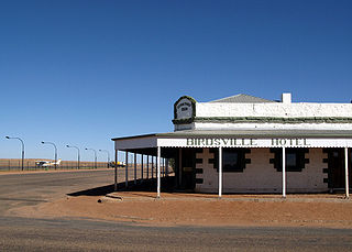
Birdsville is a rural town and locality in the Shire of Diamantina, Queensland, Australia. It is situated 10 kilometres (6 mi) north of the border of South Australia and Queensland. In the 2021 census, the locality of Birdsville had a population of 110 people. It is a popular tourist destination with many people using it as a starting point across the Simpson Desert.
The City of Manningham is a local government area in Victoria, Australia in the north-eastern suburbs of Melbourne and is divided into 12 suburbs, with the largest being Doncaster and Doncaster East. It comprises an area of 113 square kilometres and had a population of 125,508 in June 2018.

The Shire of Nillumbik is a local government area in Victoria, Australia. It contains outer northern suburbs of Melbourne and rural localities beyond the urban area. It has an area of 432 square kilometres and at the 2021 census, the Shire had a population of 62,895. It was formed in 1994 from the merger of parts of the Shires of Eltham, Diamond Valley, Healesville and the City of Whittlesea. The Shire uses the tag-line The Green Wedge Shire. The Nillumbik Council offices are located in Civic Drive, Greensborough.

The City of Banyule is a local government area in Victoria, Australia in the north-eastern suburbs of Melbourne. It was created under the Local Government Act 1989 and established in 1994 as an amalgamation of former councils. It has an area of 63 square kilometres (24.3 sq mi) and lies between 7 and 21 km from central Melbourne. In 1994 it had a population of 116,000. In June 2018 Banyule had a population of 130,237. The Yarra River runs along the City's southern border while its western border is defined by Darebin Creek.

Docklands, also known as Melbourne Docklands, is an inner-city suburb in Melbourne, Victoria, Australia, 2 km (1.2 mi) west of Melbourne's Central Business District, located within the City of Melbourne local government area. Docklands recorded a population of 15,495 at the 2021 census.

Eltham is a suburb of Melbourne, Victoria, Australia, 20 km north-east of the Central Business District, located within the Shire of Nillumbik local government area. Eltham recorded a population of 18,847 at the 2021 census.

Bulleen is an eastern suburb in Melbourne, Australia, 13 km north-east of the Melbourne central business district, located within the City of Manningham local government area. Bulleen recorded a population of 11,219 at the 2021 census.

Lalor is a suburb in Melbourne, Victoria, Australia, 17 km (11 mi) north of Melbourne's Central Business District, located within the City of Whittlesea local government area. Lalor recorded a population of 23,219 at the 2021 census.

Hurstbridge is a town in Victoria, Australia, 28 km north-east of Melbourne's Central Business District, located within the Shire of Nillumbik local government area. Hurstbridge recorded a population of 3,554 at the 2021 census.
The Melbourne Convention and Exhibition Centre, colloquially referred to as "Jeff's Shed," is a group of three adjacent buildings next to the Yarra River in South Wharf, an inner-city suburb of Melbourne, Victoria, Australia. The venues are owned and operated by the Melbourne Convention and Exhibition Trust.
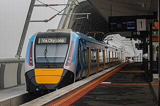
The Pakenham line is a commuter railway line in the city of Melbourne, Victoria, Australia. Operated by Metro Trains Melbourne, it is the city's longest metropolitan railway line at 57 kilometres (35 mi). The line runs from Flinders Street station in central Melbourne to Pakenham station in the south-east, serving 27 stations via the City Loop, South Yarra, Caulfield, Oakleigh, and Dandenong. The line operates for approximately 20 hours a day with 24 hour service available on Friday and Saturday nights. During peak hour, headways of up to 5 to 10 minutes are operated with services every 20 minutes during off-peak hours. Trains on the Pakenham line run with a seven-car formation operated by High Capacity Metro Trains.

Marysville is a town, 34 kilometres north-east of Healesville and 41 kilometres south of Alexandra, in the Shire of Murrindindi in Victoria, Australia. The town, which previously had a population of over 500 people, was devastated by the Murrindindi Mill bushfire on 7 February 2009. On 19 February 2009 the official death toll was 45. Around 90% of the town's buildings were destroyed. Prior to the Black Saturday fire the population in 2006 was 519. At the 2011 Census, the population had reduced to 226, by the 2016 census it had risen to 394.
Same-sex marriage in Australia has been legal since 9 December 2017. Legislation to allow same-sex marriage, the Marriage Amendment Act 2017, passed the Australian Parliament on 7 December 2017 and received royal assent from the Governor-General the following day. The law came into effect on 9 December, immediately recognising overseas same-sex marriages. The first same-sex wedding under Australian law was held on 15 December 2017. The passage of the law followed a voluntary postal survey of all Australians, in which 61.6% of respondents supported legalisation of same-sex marriage.
Yarra Plenty Regional Library (YPRL) provides a public library service to the local government municipalities of the City of Banyule, Shire of Nillumbik and City of Whittlesea in the northeast of Melbourne Australia and located on the lands of the Woiworung. It is an independent legal entity with an executive management team which is responsible for day-to-day operations of the organisation. It is managed by the Yarra Plenty Regional Library Board made of two representatives (councillors) of the three municipalities that constitute the service. Its role is to set the policy and direction for the regional library service. The library service covers an area of 988.4 km² including metropolitan, urban fringe and rural populations. The organisation is administered from its Library Support Services (LSS) located at Daniher Drive, Sth Morang.YPRL also provides computer services to Murrindindi Library Service, including full access to the library's database.

Flowerdale is a town in Victoria, Australia. It is in the Shire of Murrindindi local government area, 95 kilometres (59 mi) from the state capital, Melbourne and in the foothills of the Great Dividing Range, in the upper catchment of the Goulburn River system. At the 2021 Census, Flowerdale had a population of 790.

Melbourne is the capital and most populous city of the Australian state of Victoria, and the second-most populous city in both Australia and Oceania. Its name generally refers to a 9,993 km2 (3,858 sq mi) metropolitan area known as Greater Melbourne, comprising an urban agglomeration of 31 local municipalities, although the name is also used specifically for the local municipality of City of Melbourne based around its central business area. The metropolis occupies much of the northern and eastern coastlines of Port Phillip Bay and spreads into the Mornington Peninsula, part of West Gippsland, as well as the hinterlands towards the Yarra Valley, the Dandenong and Macedon Ranges. It has a population over 5 million, mostly residing to the east side of the city centre, and its inhabitants are commonly referred to as "Melburnians".
The Battle of Yering was a conflict between Indigenous Australians of the Wurundjeri nation and the Border Police which occurred on 13 January 1840, on the outskirts of Melbourne.
Eltham District Historical Society is a community organisation devoted to the collection, preservation and sharing of stories about the local history of the Eltham district in the north east of Melbourne, Victoria, Australia. Its geographic area of interest extends from Lower Plenty and Montmorency to Kangaroo Ground. It also maintains an interest in the former Shire of Eltham and holds memorabilia from the former Eltham Shire Council. It is located in the Shire of Nillumbik local government area. It also encourages conservation of significant places, spaces and documents for future generations. It is an affiliated member of the Royal Historical Society of Victoria and the Association of Eastern Historical Societies. It is an historical society managed by volunteers.