Related Research Articles

Biharamulo District is one of the eight districts of the Kagera Region of Tanzania. It is bordered to the north by Karagwe District and Muleba District, to the east and south by Geita Region, to the west by Ngara District, and to the southwest by the Kigoma Region. Its administrative seat is Biharamulo town. Biharamulo Game Reserve is located within the borders of the district.

Same is one of the seven districts of the Kilimanjaro Region of Tanzania. It is bordered to the north by the Mwanga District, to the northeast by Kenya, to the south and southeast by the Korogwe District and Lushoto District of Tanga Region, and to the west by Simanjiro District of Manyara Region. The district capital is the town of Same, Tanzania. The south Pare Mountains are located within the district's boundaries and so is a part of Mkomazi National Park. According to the 2002 Tanzania National Census, the population of the Same District was 212,235. The population had risen to 269,807 according to the 2012 Tanzania National Census.
Mwanga is one of the seven districts of the Kilimanjaro Region of Tanzania. The district covers an area of 1,831 km2 (707 sq mi), It is bordered to the northeast by Kenya, to the northwest by the Moshi Rural District, to the southwest by Simanjiro District of Manyara Region, and to the south by the Same District. Its administrative seat is the town of Mwanga. The tallest peak in the district is Kindoroko at 2,100m in the North Pare Mountains that are located entirely within the district. According to the 2012 Tanzania National Census, the population of Mwanga District was 131,442.
Moshi is one of the seven administrative districts of the Kilimanjaro Region of Tanzania. The district covers an area of 1,300 km2 (500 sq mi). The District is bordered to the north by the Rombo District, to the west by the Hai District, to the east by the Mwanga District and Kenya, and to the south by Simanjiro District of Manyara Region. The district also surrounds Moshi Municipal District on three sides. According to the 2012 census, the population of the Moshi District was 466,737.

Iramba is one of the six districts of the Singida Region of central Tanzania. It is bordered to the Northwest by the Shinyanga Region, to the North by Simiyu Region, to the east by the Mkalama District, to the South by Ikungi District and to the West by the Tabora Region. Its administrative seat is the town of Kiomboi.
Kilomeni is a ward in the Mwanga District of the Kilimanjaro Region of Tanzania and is situated in the Pare Mountains. Kilomeni is home to a Roman Catholic parish, a secondary school, and a primary school. According to the 2012 census, the population of the ward was 4,467. The local people of kilomeni are The Pare.
Gumanga is an administrative ward in the Mkalama District of the Singida Region of Tanzania. According to the 2002 census, the ward has a total population of 9,896. According to the 2012 census, the population had increased to 10,948.
Ibaga is an administrative ward in the Mkalama District of the Singida Region of Tanzania. According to the 2002 census, the ward has a total population of 10,672. According to the 2012 census, the population had increased to 11,712.
Ilunda is an administrative ward in the Mkalama District of the Singida Region of Tanzania. According to the 2002 census, the ward has a total population of 19,465. According to the 2012 census, the population had increased to 21,622.
Mpambala is an administrative ward in the Mkalama District of the Singida Region of Tanzania. According to the 2002 census, the ward had a total population of 10,882. According to the 2012 census, the population had increased to 11,192.
Msingi is an administrative ward in the Mkalama District of the Singida Region of Tanzania. According to the 2002 census, the ward has a total population of 6,439. According to the 2012 census, the population had increased to 7,289.
Mwangeza is an administrative ward in the Mkalama District of the Singida Region of Tanzania. According to the 2002 census, the ward has a total population of 12,445. According to the 2012 census, the population had increased to 19,258.
Nduguti is an administrative ward in the Mkalama District of the Singida Region of Tanzania. According to the 2002 census, the ward has a total population of 15,955. According to the 2012 census, the population had decreased to 8,638.
Nkinto is an administrative ward in the Mkalama District of the Singida Region of Tanzania. According to the 2002 census, the ward has a total population of 13,367. According to the 2012 census, the population had decreased to 10,372.

Mkalama District is one of the six districts of the Singida Region of Tanzania. It is one of the 20 new districts that were formed in Tanzania since 2010; it was split off from Iramba District. Mkalama District is bordered to the north by Simiyu Region and Arusha Region, to the east by Manyara Region, to the south by Singida Rural District and to the west by Iramba District.
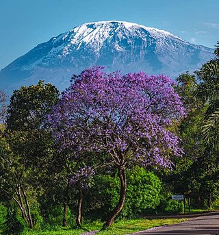
Mwanga is a town in northern Tanzania at the foot of the north Pare Mountains. It is the district capital of Mwanga District.

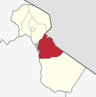
Kigoma-Ujiji District is one of the eight administrative districts of Kigoma Region in Tanzania. The District covers an area of 92.7 km2 (35.8 sq mi). It is bordered to the west by Uvinza District in the south east and to the north by Kigoma District. The western shore of lake Tanganyika surrounds the district on the west. According to the 2012 census, the district has a total population of 215,458.

Mwanga Kaskazini is an administrative ward in Kigoma-Ujiji District of Kigoma Region in Tanzania. The ward covers an area of 3.7 km2 (1.4 sq mi), and has an average elevation of 803 m (2,635 ft). In 2016 the Tanzania National Bureau of Statistics report there were 26,620 people in the ward, from 24,184 in 2012.
Katubuka is an administrative ward in Kigoma-Ujiji District of Kigoma Region in Tanzania. The ward covers an area of 3 km2 (1.2 sq mi), and has an average elevation of 814 m (2,671 ft). In 2016 the Tanzania National Bureau of Statistics report there were 27,287 people in the ward, from 24,790 in 2012.
Mwanga Kusini is an administrative ward in Kigoma-Ujiji District of Kigoma Region in Tanzania. The ward covers an area of 3.5 km2 (1.4 sq mi), and has an average elevation of 787 m (2,582 ft). In 2016 the Tanzania National Bureau of Statistics report there were 17,976 people in the ward, from 16,331 in 2012.
References
- ↑ "2002 Population and Housing Census General Report". Government of Tanzania. Archived from the original on 2006-06-08. Retrieved 2009-05-01.
- ↑ "Census 2012". National Bureau of Statistics. Archived from the original on 5 March 2016. Retrieved 16 February 2016.
Coordinates: 4°14′09″S34°52′02″E / 4.23573°S 34.86736°E
| | This Singida Region location article is a stub. You can help Wikipedia by expanding it. |