Busia is a county in the former Western Province of Kenya. It is located directly east of the border town of Busia, Uganda, and borders Lake Victoria to the southwest, Siaya County to the southeast, and Bungoma County and Kakamega County to the east. The county is composed of six sub-counties, and had a population of 893,681 as of the most recent census in 2019.

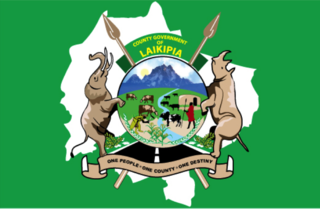
Laikipia County is one of the 47 Counties of Kenya, located on the Equator in the former Rift Valley Province of the Country. Laikipia is a cosmopolitan County and is Listed as County number 31. The county has two major urban centres: Nanyuki to the southeast, and Nyahururu to the southwest. Its County government headquarters town is Rumuruti. The County lies between latitudes 0° 18" South and 0° 51" North and between longitudes 36° 11" and 37° 24' East. It borders Samburu County to the North, Isiolo County to the North East, Meru County to the East, Nyeri County to the South East, Nyandarua County to the South, Nakuru County to the South West and Baringo County to the West.

Kericho County is one of the 47 counties in Kenya. The county seats between longitude 35°02' and 35°40' East and between the equator and latitude 0°23' South with an altitude of about 2002m above sea level. It borders Uasin Gishu County to the North West, Baringo County to the North-East, Nandi County to the North-West, Nakuru County to the East and Bomet County to the South, Kisumu County to the Northwest and Nyamira County to the West. It has a population of 901,777 and an area of 2,111 km². Its capital and largest town is Kericho.

Lamu County is a county in Kenya located along the North Coast of the country and is one of the six Coastal Counties in Kenya. Its capital is the town of Lamu. It borders Tana River County to the southwest, Garissa County to the north, Somalia to the northeast, and the Indian Ocean to the South.

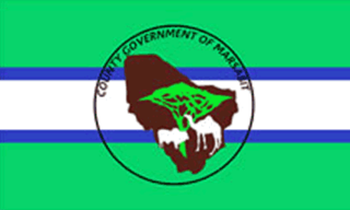
Marsabit County is a county in Kenya, covering a surface area of 66,923.1 square kilometres. Marsabit is the second largest county by size in Kenya after Turkana county which has an area of 71,597.8 km2. Its capital is Marsabit and its largest town is Moyale. According to the 2019 census, the county has a population of 459,785. It is bordered to the North by Ethiopia, to the West by Turkana County to the South by Samburu County and Isiolo County, and to the East by Wajir County.
Mwingi District was a former district of Kenya, located in the now defunct Eastern Province. The district had a population of 303.828. Its capital was Mwingi town.

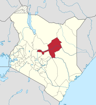
Isiolo County is a county in the former Eastern Province of Kenya. Its population is 268,002 and its capital and largest city is Isiolo. Isiolo County is to be the first county to be developed as part of the Kenya Vision 2030 program. Other upcoming urban centres are: Garbatulla, Modogashe, Kinna, Merti and Oldonyiro. The county is home to Sakuye and Borana tribes but also has a significant number of people from Turkana, Samburu, Gabra, Garre and Meru communities.

Makueni County is a county in the former Eastern Province of Kenya. Its capital town is Wote.The largest town is Emali town, which is also an important market and stop over for the Standard Gauge Railway (SGR). Emali town is multicultural and adds diversity to Makueni county.The county has a population of 987,653. The county lies between Latitude 1° 35' and 2° 59' South and Longitude 37° 10' and 38° 30' East. It borders Machakos County to the North, Kitui County to the East, Taita Taveta County to the South and Kajiado County to the West and covers an area of 8,008.9 km2.

Kitui County is a county in the former Eastern Province of Kenya with its capital and largest town being Kitui, although Mwingi is also another major urban centre. The county has a population of 1,136,187. and an area of 30,496 km2. It lies between latitudes 0°10 South and 3°0 South and longitudes 37°50 East and 39°0 East.
Kuria District was an administrative district in the Nyanza Province of Kenya. Its capital town is Kehancha. The district has a population of 256,086 and an area of 581/km2. It is inhabited by a minority group of people fondly known as Kuria people, also referred to as Abakuria (Mkuria/Wakuria) in Swahili. They are scattered across the Kenya-Tanzania border and are neighbors to the Kisii, Luo, and Maasai people.

Garissa County is an administrative county in Kenya. It is located in Eastern Kenya bordering Somalia to the East, Wajir County and Isiolo County to the North, Tana River County to the West and Lamu County to the South. Its capital and largest urban area is Garissa.

Mandera County is one of the counties in Kenya that has its capital and largest town as Mandera. The county is bordered by Ethiopia to the north, Somalia to the east and Wajir County to the southwest. According to the 2019 census, the county has a population of 1,200,890 and an area of 25,939.8 square kilometres (10,015.4 sq mi). The main economic activity in the county is pastoralism, while others include cross-border trade with Ethiopia, artisanal mining, beekeeping, and agriculture along the Dawa River.
Mwingi South Constituency was a former electoral constituency in Kenya. It is one of the eight constituencies in the Kitui County and is now known as Mwingi Central.
Charles Njagua Kanyi, professionally known as Jaguar, is a Kenyan politician, singer, and philanthropist.
Homa Bay Town is a constituency in Kenya. It is one of eight constituencies in Homa Bay County.
Mary Wamaua Waithira Noroge is a Kenyan politician. She is currently Member of Parliament for Maragua Constituency in Murang’a County.
Hon. Mohamed, Mohamed Ali, popularly known as Moha Jicho Pevu, is a Kenyan politician, media personality and anchor.
Eric Muchangi Njiru Karemba is a Kenyan politician and a businessman, and currently the Member of Parliament (MNA) for Runyenjes Constituency, serving a second term and also the Chairman of the Labour and Social Affairs committee. Runyenjes is in Embu County in Eastern part of Kenya. Karemba belongs to the United Democratic Alliance party under the Kenya Kwanza alliance led by the current and the fifth president of Kenya Dr William Ruto. He is a graduate of Kenyatta university with a Bachelors of Education and was a student leader at the same university. Karemba made history by becoming the first Akorino MP in the history of Kenya. Karemba currently serves as the Chairman of the Labor and Social Affairs Committee of the National Assembly.

John Murumba Chikati is a Kenyan politician and the current Secretary General for the Forum for the Restoration of Democracy – Kenya (FORD-Kenya). Chikati is also the current Member of National Assembly for Tongaren Constituency, and the current Secretary General for Catholic MPs Spiritual Support Initiative (CAMPSSI). He is the immediate former Special Secretary for Strategy and Delivery in the Office of the Deputy President.
Bernard Kitungi is a Kenyan politician and a member of the 11th parliament of Kenya for Mwingi West Constituency in Mwingi County. He was elected to the parliament on the ticket of Wiper Democratic Movement - Kenya (WDM-K) and with the support of CORD Coalition in 2013.


