Białawy Małe is a village in the administrative district of Gmina Wińsko, within Wołów County, Lower Silesian Voivodeship, in south-western Poland. Prior to 1945 it was in Germany.

Zawada-Piaski is a village in the administrative district of Gmina Baruchowo, within Włocławek County, Kuyavian-Pomeranian Voivodeship, in north-central Poland. It lies approximately 3 kilometres (2 mi) east of Baruchowo, 26 km (16 mi) south-east of Włocławek, and 77 km (48 mi) south-east of Toruń.
Teodorówka is a village in the administrative district of Gmina Biłgoraj, within Biłgoraj County, Lublin Voivodeship, in eastern Poland.
Gorodzisko is a village in the administrative district of Gmina Narew, within Hajnówka County, Podlaskie Voivodeship, in north-eastern Poland.

Bronisławów is a village in the administrative district of Gmina Baranów, within Grodzisk Mazowiecki County, Masovian Voivodeship, in east-central Poland.

Chochół is a village in the administrative district of Gmina Mińsk Mazowiecki, within Mińsk County, Masovian Voivodeship, in east-central Poland. It lies approximately 4 kilometres (2 mi) south-west of Mińsk Mazowiecki and 38 km (24 mi) east of Warsaw.

Grzebowilk is a village in the administrative district of Gmina Siennica, within Mińsk County, Masovian Voivodeship, in east-central Poland. It lies approximately 8 kilometres (5 mi) south of Mińsk Mazowiecki and 39 km (24 mi) east of Warsaw.
Grądzik is a village in the administrative district of Gmina Wieczfnia Kościelna, within Mława County, Masovian Voivodeship, in east-central Poland.
Kolonia Zameczek is a settlement in the administrative district of Gmina Przytyk, within Radom County, Masovian Voivodeship, in east-central Poland.
Krzemień-Wieś is a village in the administrative district of Gmina Jabłonna Lacka, within Sokołów County, Masovian Voivodeship, in east-central Poland.

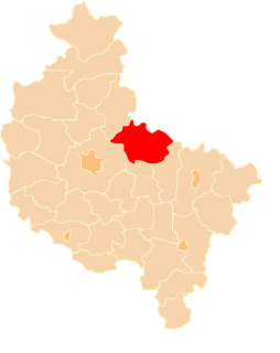
Dzierżysław is a village in the administrative district of Gmina Skulsk, within Konin County, Greater Poland Voivodeship, in west-central Poland. It lies approximately 6 kilometres (4 mi) west of Skulsk, 30 km (19 mi) north of Konin, and 92 km (57 mi) east of the regional capital Poznań.
Łysek-Sosnówka is a village in the administrative district of Gmina Wierzbinek, within Konin County, Greater Poland Voivodeship, in west-central Poland.

Czesławice is a village in the administrative district of Gmina Sośnie, within Ostrów Wielkopolski County, Greater Poland Voivodeship, in west-central Poland. It lies approximately 5 kilometres (3 mi) west of Sośnie, 22 km (14 mi) south-west of Ostrów Wielkopolski, and 112 km (70 mi) south-east of the regional capital Poznań.
Goj is a village in the administrative district of Gmina Wielowieś, within Gliwice County, Silesian Voivodeship, in southern Poland.

Lgota Murowana is a village in the administrative district of Gmina Kroczyce, within Zawiercie County, Silesian Voivodeship, in southern Poland. It lies approximately 3 kilometres (2 mi) south of Kroczyce, 12 km (7 mi) northeast of Zawiercie, and 52 km (32 mi) north-east of the regional capital Katowice.

Nowina is a village in the administrative district of Gmina Elbląg, within Elbląg County, Warmian-Masurian Voivodeship, in northern Poland. It lies approximately 7 kilometres (4 mi) north-east of Elbląg and 78 km (48 mi) north-west of the regional capital Olsztyn.
Wyskok is a village in the administrative district of Gmina Srokowo, within Kętrzyn County, Warmian-Masurian Voivodeship, in northern Poland, close to the border with the Kaliningrad Oblast of Russia.

Pilchowo is a village in the administrative district of Gmina Police, within Police County, West Pomeranian Voivodeship, in north-western Poland, close to the German border.

Gorzyca is a village in the administrative district of Gmina Malechowo, within Sławno County, West Pomeranian Voivodeship, in north-western Poland. It lies approximately 3 kilometres (2 mi) west of Malechowo, 15 km (9 mi) south-west of Sławno, and 159 km (99 mi) north-east of the regional capital Szczecin.
Aktij Kola is a village in Lalehabad Rural District, Lalehabad District, Babol County, Mazandaran Province, Iran. At the 2006 census, its population was 742, in 178 families.


