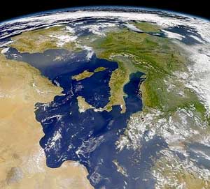
Italy is located in southern Europe and comprises the long, boot-shaped Italian Peninsula, the southern side of Alps, the large plain of the Po Valley and some islands including Sicily and Sardinia. Corsica, although belonging to the Italian geographical region, has been a part of France since 1769. Italy is part of the Northern Hemisphere.
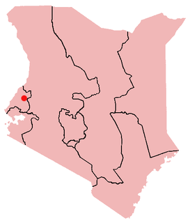
Webuye, previously named Broderick Falls, is an industrial town in Bungoma County, Kenya. Located on the main road to Uganda, the town is home to the Pan African Paper Mills, the largest paper factory in the region, as well as a number of heavy-chemical and sugar manufacturers. The area is heavily populated and is used mainly for subsistence agriculture. The area around Webuye is home to the Bukusu and Tachoni tribes. The town has an urban population of 19,600 and 22,507 in total according to the GeoNames geographical database.
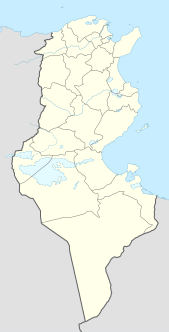
Bekalta, Arabic: البقالطة (al-Bikalita), is a Tunisian coastal town, around 30 km. south of Monastir and around 14 km. northeast of Mahdia. The main activities of the local population are agriculture and fishing.
Grivegnée is a suburb of the Belgian town Liège. It is a former municipality in the Liège municipality, since 1977 it is a part of the city.
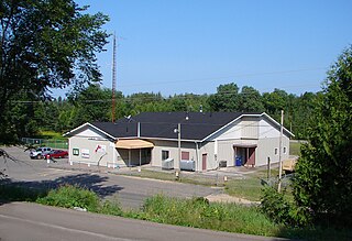
Tudor and Cashel is a township in the Canadian province of Ontario, located in Hastings County.
San Andrés del Rabanedo is a municipality located in the Province of León, Castile and León, Spain. According to the 2011 census (INE), the city has a population of 31,562 inhabitants, and is the third largest city in the province after León and Ponferrada. The municipality includes the districts of San Andrés del Rabanedo, Trobajo del Camino, Barrio Pinilla, Villabalter and Ferral del Bernesga.
Sanagda is a village in the Tibet Autonomous Region of China.
Seenlandschaft Waren is an Amt in the Mecklenburgische Seenplatte district, in Mecklenburg-Vorpommern, Germany. The seat of the Amt is in Waren, itself not part of the Amt.

Chemini is a town in northern Algeria, in the province of Béjaïa.
Dèssè is a town in the Solenzo Department of Banwa Province in western Burkina Faso. As of 2005, it had a population of 1,756.
Cella is a town in the Tenkodogo Department of Boulgou Province in south-eastern Burkina Faso. As of 2005, the town has a population of 1,731.

Kaolinovo is a town in northeastern Bulgaria, part of Shumen Province. It is the administrative centre of the homonymous Kaolinovo Municipality, which lies in the northern part of Shumen Province. As of December 2009, the town has a population of 1,538 inhabitants.

Popielżyn Dolny is a village in the administrative district of Gmina Nowe Miasto, within Płońsk County, Masovian Voivodeship, in east-central Poland. It lies approximately 17 kilometres (11 mi) east of Płońsk and 50 km (31 mi) north-west of Warsaw.

Adja-Ouèrè is a town, arrondissement, and commune in the Plateau Department of south-eastern Benin. The commune covers an area of 550 square kilometres and as of 2013 had a population of 115,953 people.
Smilkov is a municipality and village in Benešov District in the Central Bohemian Region of the Czech Republic.
Iklódbördőce is a village in Zala County, Hungary.
Praaklima is a village in Jõgeva Parish, Jõgeva County in eastern Estonia.
Soela is a village in Saaremaa Parish, Saare County in western Estonia.
Ullekumbura is a village in Sri Lanka. It is located within Central Province.


