| Nahoon Dam | |
|---|---|
| Official name | Nahoon Dam |
| Country | South Africa |
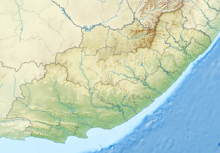
| Location | Eastern Cape |
| Coordinates | 32°54′39″S27°48′40″E / 32.91083°S 27.81111°E Coordinates: 32°54′39″S27°48′40″E / 32.91083°S 27.81111°E |
| Purpose | Domestic and industrial use |
| Opening date | 1966 |
| Owner(s) | Department of Water Affairs |
| Dam and spillways | |
| Type of dam | Gravity dam |
| Impounds | Nahoon River |
| Height | 40 metres (130 ft) |
| Length | 582 metres (1,909 ft) |
| Reservoir | |
| Creates | Nahoon Dam Reservoir |
| Total capacity | 19,934,000 cubic metres (704,000,000 cu ft) |
| Catchment area | 473 km2 |
| Surface area | 237.7 hectares (587 acres) |
Nahoon Dam is a gravity type dam located on the Nahoon River, near East London, Eastern Cape, South Africa. It was established in 1966 and serves primarily for domestic supply and industrial use. The hazard potential of the dam has been ranked high (3).

The Nahoon River is situated in the city East London on the East Coast of South Africa. It is to the east of the Buffalo River harbour, and is to the west of Gonubie River. The suburb of Nahoon is on its west bank and Beacon Bay is on the east bank. It flows through an estuary and Africa's southern most mangrove forest into the Indian Ocean. Its mouth is located near Nahoon Reef which is a famous surfing spot and is also known for attacks by Great White Sharks.

The Eastern Cape is a province of South Africa. Its capital is Bhisho, but its two largest cities are Port Elizabeth and East London. It was formed in 1994 out of the Xhosa homelands or bantustans of Transkei and Ciskei, together with the eastern portion of the Cape Province. It is the landing place and home of the 1820 Settlers. The central and eastern part of the province is the traditional home of the Xhosa people.

South Africa, officially the Republic of South Africa (RSA), is the southernmost country in Africa. It is bounded to the south by 2,798 kilometres (1,739 mi) of coastline of Southern Africa stretching along the South Atlantic and Indian Oceans; to the north by the neighbouring countries of Namibia, Botswana, and Zimbabwe; and to the east and northeast by Mozambique and Eswatini (Swaziland); and it surrounds the enclaved country of Lesotho. South Africa is the largest country in Southern Africa and the 25th-largest country in the world by land area and, with over 57 million people, is the world's 24th-most populous nation. It is the southernmost country on the mainland of the Old World or the Eastern Hemisphere. About 80 percent of South Africans are of Sub-Saharan African ancestry, divided among a variety of ethnic groups speaking different African languages, nine of which have official status. The remaining population consists of Africa's largest communities of European (White), Asian (Indian), and multiracial (Coloured) ancestry.