Education
95% people of this village are well educated. This village has a private school named Shri Tridandi Dev Vidya Niketan and a government primary school.
Nahro Dehri is a village in Aurangabad district, Bihar, India, with a population of 300. Nahro Dehri is located 30 kilometres north from Aurangabad, the district city of Bihar; 20 Kilometres north from Anugrah Narayan Road Railway station; and 5.5 Kilometres east from NH-98.
Residents are mostly Hindus of the Rajput caste. The main languages are Hindi and Magadhi.
95% people of this village are well educated. This village has a private school named Shri Tridandi Dev Vidya Niketan and a government primary school.

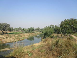
Son River is a perennial river located in central India. It originates near Amarkantak Hill in Gaurela-Pendra-Marwahi district of Chhattisgarh and finally merges with the Ganges River near Patna in Bihar. The Sone River is the second-largest southern tributary of the Ganges after the Yamuna River. India's oldest river bridge Koilwar Bridge over Sone River connects Arrah with Patna. Sone river is famous for its sand across country. Multiple dam(s) and hydro-electric projects run on its course towards Ganges.

Arwal district is one of the thirty-eight districts of Bihar state, India, and Arwal town is the administrative headquarters of this district. It was earlier part of Jehanabad district.

Aurangabad district is one of the thirty-eight districts of Bihar state, India. It is currently a part of the Red Corridor.

Rohtas District is one of the thirty-eight districts of Bihar state, India. It came into existence when Shahabad District was bifurcated into Bhojpur & Rohtas in 1972. Administrative headquarter of the district is Sasaram. Rohtas district has the highest literacy in Bihar. The literacy rate of Rohtas district which is 73.37% as per 2011 census is highest among all 38 districts of Bihar.
Daudnagar is a town and the subdivisional headquarter of Daudnagar Subdivision in Aurangabad district in the state of Bihar, India under the Magadh division. Until 1991, there was only one Subdivision in the Aurangabad district: Aurangabad Sadar. On 31 March 1991, one other subdivision, Daudnagar, was created. Daudnagar is a 200-year-old historical city and its living proof is Daudnagar has an old historical fort situated on the eastern bank of the Son River. National Highway NH139 which connects Jharkhand's Palamu district to Patna, passes through the town.

Nasriganj is a nagar panchayat town and corresponding community development block situated in Rohtas District of Bihar, India. Located on the banks of the Son River, the town was a vibrant economic hub in the late 19th century. The town of Nasriganj had a population of 23,819, according to the 2011 Census of India, while the total population of Nasriganj block was 115,117. Besides the town of Nasriganj itself, the block consisted of 53 villages, of which 50 were inhabited and 3 were uninhabited.
Maudihan is a village in the Rohtas District of Bihar state, India. It is 14 km north of Dehri-On-Sone, an industrial city. It is located on Dehri-Patna road. It is also referred to as 'Maudiha'.

Barun is a small town in Barun Panchayat Block of Aurangabad district of Bihar, India.
Poiwan is a village in the Aurangabad district of Bihar in India. The population is around 2,600, of which around 8% are Muslims.

National Highway 19 is a national highway in India. It was previously referred to as Delhi–Kolkata Road and is one of the busiest national highways in India. After renumbering of national highways, Delhi to Agra route is now national highway 44 and Agra to Kolkata route is numbered national highway 19. It constitutes a major portion of the historical Grand Trunk Road. It is also part of AH1 of Asian Highway Network, that traverses from Japan to Turkey.
Namudag is a village in Chhatarpur Block in Palamu district of Jharkhand state, India. It is located 48 km towards the north from the district headquarters Daltonganj, 12 km from Chhattarpur, and 177 km from state capital Ranchi. Namudag Pin code is 822113 and the postal head office is Chhatarpur. Marwa (4 km), Munkeri (5 km), Khairadohar (6 km), Bara (6 km), and mahuwari and Karkata (7 km) are the nearby villages to Namudag. Namudag is surrounded by Dumaria Block towards the north, Patan Block towards the south, Hariharganj Block towards the north, and Kutumba Block towards the north.

Dindir is a village in Aurangabad District of Bihar, India. It is located 48 km north from District headquarter Aurangabad, 7 km east from Haspura and 94 km south from Patna. Area wise it is the largest village of district Aurangabad and is designated as ideal village. Dindir Pin code is 824120 and postal head office is Haspura.
Kajpa is a modern village situated in Aurangabad District of Bihar, India. It comes under village panchayat Kajpa. Kajpa is big Village in Aurangabad.

Deo also known as "Dev", is a city council, town and a notified area in Deo community development block in Aurangabad subdivision in Aurangabad district in the Indian state of Bihar. Deo is located 10 km to the southeast of District Administrative Aurangabad Bihar.

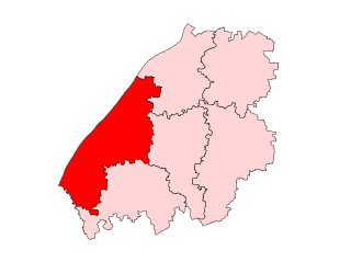
Kutumba Assembly constituency is an assembly constituency for Bihar Legislative Assembly in Aurangabad district, Bihar. It comes under Aurangabad, along with other assembly constituencies viz Rafiganj, Aurangabad, Gurua, Imamganj and Tikari.

Aurangabad Assembly constituency is an assembly constituency for Bihar Legislative Assembly in Aurangabad district, Bihar. It comes under Aurangabad. On 26 January 1973, Aurangabad district, Bihar was created.

Rafiganj Assembly constituency is an assembly constituency for Bihar Legislative Assembly in Aurangabad, Bihar district of Bihar, India. It comes under Aurangabad Lok Sabha constituency along with other assembly constituencies viz. Kutumba, Aurangabad, Gurua, Imamganj and Tikari.

Goh Assembly constituency is an assembly constituency for Bihar Legislative Assembly in Aurangabad district, Bihar. It comes under Karakat.

Nabinagar Assembly constituency is an assembly constituency for Bihar Legislative Assembly in Aurangabad district, Bihar. It comes under Karakat.
State Highway 15 (SH-15) is a state highway in Bihar state. It covers only one districts i.e. Rohtas district of Bihar state. This state highway starts from Nasriganj near Daudnagar and ends at NH-19 near Dehri-on-Sone. The Dehri-on-Sone is situated between Sasaram and Aurangabad.