Related Research Articles

The A38, parts of which are known as Devon Expressway, Bristol Road and Gloucester Road, is a major A-class trunk road in England.

The A11 is a major trunk road in England. It originally ran roughly north east from London to Norwich, Norfolk. It now consists of a short section in Inner London and a much longer section in Cambridgeshire, Suffolk and Norfolk. The lengthy section between these was renumbered as a result of the opening of the M11 in the 1970s and then the A12 extension in 1999.

The A27 is a major road in England. It runs from its junction with the A36 at Whiteparish in the county of Wiltshire, follows the south coast of Hampshire and West Sussex, and terminates at Pevensey in East Sussex.

Ruiru is a municipality and sub-county in Kiambu County, Kenya. It sits within the greater Nairobi Metropolitan region. According to the 2019 national population census, Ruiru was the 4th largest urban centre in Kenya by population. The name Ruiru is of the Kikuyu origin and possibly relates to the black cotton soil that is found in most parts of Ruiru.

The N4 is a national route in South Africa that runs from Skilpadshek on the Botswana border, past Rustenburg, Pretoria, eMalahleni and Mbombela, to Komatipoort on the Mozambique border. The entire route is a toll road.

The A556 is a road in England which extends from the village of Delamere in Cheshire West and Chester to the Bowdon Interchange in Cheshire East, bordering Greater Manchester. The road contains a mixture of single and dual carriageway sections and forms a large part of the route between Manchester and Chester. It also acts as a major access route to Chester/North Wales to the west and to Manchester to the east for the conurbation of towns and villages around the Dane Valley centering on Winsford and Northwich. The central part, which forms the Northwich Bypass between Davenham and Lostock Gralam, suffers because of the amount of commuter traffic from this area. The part of the route between the M6 motorway Junction 19 and the M56 motorway Junction 7 is a major route into Manchester and has been recently upgraded to a four-lane dual carriageway.
The Mombasa–Garissa Road, also B8 Road (Kenya) is a major highway in Kenya, the largest economy in the East African Community. The road connects the port city of Mombasa to the inland city of Garissa. This road is composed of the Mombasa–Malindi Road and the Malindi–Garissa Road.

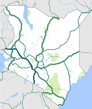
Mombasa Road, also known as the Nairobi–Mombasa Road, or Mombasa–Nairobi Road or A109 Road (Kenya) is the main road between Nairobi, Kenya's capital and largest city and Mombasa, the country's largest port city. The road is a component of the Northern Corridor. It is part of the Lagos–Mombasa Highway.

The Kampala–Jinja Highway is a road in Uganda, connecting the cities of Kampala and Jinja. Sometimes referred to as Kampala–Jinja Road, it is a busy road, with several towns, trading centers and other points of interest along the way. As of October 2016, a new, wider, four-lane dual carriageway expressway, the Kampala–Jinja Expressway, is proposed to be constructed south of the present highway to relieve traffic and complement existing transport infrastructure between Kampala and Jinja.
Dongo Kundu Bypass Highway, also Mombasa Southern Bypass Highway , is a road under construction in Kenya. When completed, it will connect Mombasa Mainland West to Mombasa Mainland South, without entering Mombasa Island.
The Malindi–Bagamoyo Highway, also Coastline Transnational Highway, is a road in Kenya and Tanzania, connecting the cities of Malindi and Mombasa in Kenya to Tanga and Bagamoyo in Tanzania.

The Nairobi–Malaba Road, also Nairobi–Uganda Road or A104 Road (Kenya) is a major highway in Kenya, the largest economy in the East African Community. The road connects Nairobi, the capital and largest city in Kenya, with the border town of Malaba at the international border with Uganda.
The Mombasa–Nairobi Expressway or Nairobi–Mombasa Expressway, also known as the Nairobi–Mombasa Highway, is a proposed four-lane toll highway in Kenya. The highway will link Nairobi, the capital and largest city of Kenya to Mombasa, the largest seaport of the country. The new highway is expected to cut travel times between the two cities from the current 6 to 10 hours to approximately four hours.
The Nairobi–Nakuru–Mau Summit Highway is a road in Kenya, connecting the capital city of Nairobi, in Nairobi County, with the towns of Naivasha, Nakuru and Mau Summit, in Nakuru County.
The Nairobi Southern Bypass Highway is a road in Kenya, forming a semi-circle through the south-western neighbourhoods of the capital city of Nairobi. The road allows traffic from Mombasa, destined for western Kenya and Uganda to bypass downtown Nairobi, thereby reducing traffic congestion in the city's central business district.
Nairobi Western Bypass Highway is a road in Kenya. It connects the town of Kikuyu to the town of Ruaka, both in Kiambu County.
Nairobi Northern Bypass Highway is a road in Kenya, the largest economy in the East African Community. It connects the neighbourhood of Ruaka to the neighborhood of Ruiru, both in Kiambu County.
The A8 road is a road in Kenya that spans 923 kilometers. It connects the Ugandan border to the port city of Mombasa, passing through Eldoret and Nairobi. The road is one of the main transportation routes in Kenya, providing an east–west connection. It also serves as a route for international traffic to and from Uganda.
References
- ↑ Muhoro, Maina (18 August 2010). "Eastern Bypass Nairobi". Nairobi: Constructionkenya.com. Retrieved 6 March 2019.
- ↑ "Road Distance Between Central Nairobi, Kenya and City Cabanas, Airport North Road, Nairobi, Kenya" (Map). Google Maps . Retrieved 26 June 2022.
- ↑ "Location of Nairobi Eastern Bypass Highway" (Map). Google Maps . Retrieved 6 March 2019.
- ↑ "Road Distance Between City Cabanas, Airport North Road, Nairobi, Kenya and Ruiru Road Junction, Kenya" (Map). Google Maps . Retrieved 26 June 2022.
- 1 2 John Nduire (19 September 2017). "Eastern Bypass dualling plan in top gear as Kenya seeks contractor". Nairobi: Constructionkenya.com. Retrieved 6 March 2019.
- ↑ Daily Nation News (8 February 2009). "Bypass construction starts without approval from environmental body". Daily Nation . Nairobi. Retrieved 6 March 2019.
- ↑ Obwocha, Beatrice (13 December 2015). "New bypasses jerk up road crashes". Daily Nation . Nairobi. Retrieved 5 March 2019.
- ↑ Constant Munda (4 November 2018). "NLC starts process to buy land for city road dualling". Business Daily Africa . Nairobi. Retrieved 6 March 2018.