Nancy E. Bone is an American former intelligence officer who served as Director of National Photographic Interpretation Center between October 1993 and September 1996. [1]

Nancy E. Bone is an American former intelligence officer who served as Director of National Photographic Interpretation Center between October 1993 and September 1996. [1]
After spending two years as a secondary school teacher, she joined the Central Intelligence Agency in July 1968 as an analyst of information at the National Photographic Interpretation Center (NPIC). In April 1972, she received promotion to intelligence officer. She served as a branch chief for two years and then as deputy branch chief of Administration at NPIC. It is not clear that she completed the NPIC Basic Imagery Analyst Course, which employees are required to take in order to work as an imagery analyst. Between 1976 and 1993 Bone served successively as branch chief of Image Analysis, as division chief in Graphic Arts, as executive officer, as director of Management and Planning in the Directorate of Science and Technology, as chief of the Priority Exploitation Group, and, between 1991 and 1993, as director of Imagery Analysis. [2] Nancy Bone retired in December 1999. [2]
On October 3, 2017; Bone was inducted to the Geospatial Intelligence Hall of Fame Class of 2017 by the National Geospatial-Intelligence Agency, during a ceremony at the agency’s headquarters in Springfield, Virginia. [3]
Nancy Bone led the way for women in the intelligence community [4] as the director of NGA’s predecessor agency the National Photographic Interpretation Center. She spearheaded the effort to create innovation in information sharing which led to the first time NPIC analysts and support personnel could electronically access CIA files, exchange work documents and communicate with colleagues. She also pushed NPIC to increase dissemination of digital products and become a major provider of products and information on classified shared networks, increasing the availability of essential NPIC products for customers worldwide. [3]

The National Geospatial-Intelligence Agency (NGA) is a combat support agency within the United States Department of Defense whose primary mission is collecting, analyzing, and distributing geospatial intelligence (GEOINT) in support of national security. Initially known as the National Imagery and Mapping Agency (NIMA) from 1996 to 2003, it is a member of the United States Intelligence Community.
NPIC may stand for

Dino Antonio Brugioni was a former senior official at the CIA's National Photographic Interpretation Center (NPIC). He was an imagery analyst and also served as NPIC's Chief of Information. During his 35-year career, Brugioni helped establish imagery intelligence (IMINT) as a national asset to solve intelligence problems. Even after retirement, Brugioni was considered to be the world's foremost imagery intelligence analyst.

Scott F. Large is an American intelligence officer who served as the sixteenth Director of the National Reconnaissance Office from 2007 to 2009. He previously served as the Principal Deputy Director of the National Reconnaissance Office from April to October 2007, and as the Central Intelligence Agency's Associate Deputy Director for Science and Technology.

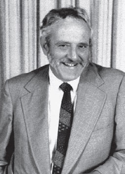
Arthur Charles Lundahl KBE was a forerunner of American Cold War imagery intelligence (IMINT) and aerial reconnaissance known for his discovery of Soviet missile installations in Cuba in 1962 which led to the Cuban Missile Crisis. He was responsible for establishing the Central Intelligence Agency's National Photographic Interpretation Center, a forerunner of the National Geospatial-Intelligence Agency, and led the photointerpretation section of the U-2 reconnaissance program. Analyzing reconnaissance films, he briefed presidents Eisenhower and Kennedy as well as the nation's top military and diplomatic officials. Lundahl provided critical intelligence on the arms race and many other international crises, including the Suez Crisis; Quemoy and Matsu, islands controlled by Taiwan; Tibet; Lebanon, and Laos.

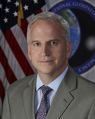
Robert Cardillo is a Distinguished Fellow at Georgetown University’s Center for Security and Emerging Technology. Prior to this appointment, he was the sixth Director of the National Geospatial-Intelligence Agency and was sworn in October 3, 2014. He was previously selected by Director of National Intelligence James Clapper to serve as the first Deputy Director of National Intelligence for Intelligence Integration in September 2010. Clapper said in a statement that the position would "elevate information sharing and collaboration" between those who collect intelligence and those who analyze it. Cardillo previously served as deputy director of the Defense Intelligence Agency (DIA). Prior to that, he served as the deputy director for Analysis, DIA, and Director, Analysis and Production, National Geospatial-Intelligence Agency (NGA).
Geographic information systems (GIS) play a constantly evolving role in geospatial intelligence (GEOINT) and United States national security. These technologies allow a user to efficiently manage, analyze, and produce geospatial data, to combine GEOINT with other forms of intelligence collection, and to perform highly developed analysis and visual production of geospatial data. Therefore, GIS produces up-to-date and more reliable GEOINT to reduce uncertainty for a decisionmaker. Since GIS programs are Web-enabled, a user can constantly work with a decision maker to solve their GEOINT and national security related problems from anywhere in the world. There are many types of GIS software used in GEOINT and national security, such as Google Earth, ERDAS IMAGINE, GeoNetwork opensource, and Esri ArcGIS.

John J. Hicks was second director of National Photographic Interpretation Center (NPIC). Hicks was appointed as the Director of NPIC in July 1973, after retirement of Arthur C. Lundahl, first director of NPIC. He served as the Director of NPIC from July 1973 to May 1978.

Susan M. Gordon served as Principal Deputy Director of National Intelligence until August 15, 2019. Prior to assuming that role, she was the Deputy Director of the National Geospatial-Intelligence Agency (NGA), having assumed the position on January 1, 2015. Before joining the NGA, she served as director of the Central Intelligence Agency's Information Operations Center and senior cyber adviser to the Director of the Central Intelligence Agency. Gordon worked for the CIA for over 25 years.

Dawn Eilenberger became the Deputy Director of National Intelligence in April 2017. Previously she was the Assistant Director of National Intelligence for Policy & Strategy, Office of the Director of National Intelligence (ODNI). In this role, she oversees the formulation and implementation of Intelligence community (IC)-wide policy and strategy on the full range of intelligence issues, including collection, analysis, requirements, management and information sharing, and provides leadership for ODNI and IC initiatives on information sharing and the closure and disposition of detainees at the Guantanamo Bay detention camp.

Robert M. Huffstutler was director of National Photographic Interpretation Center from February 1984 to January 1988.

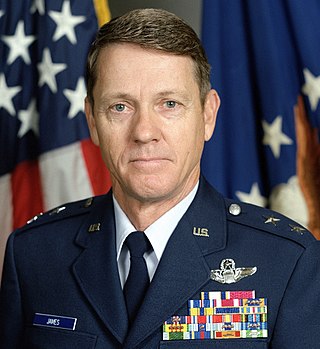
Major General William K. James of United States Air Force, was director of the Defense Mapping Agency (DMA) between June 1990 and June 1993. Under his leadership Major General James redirected the DMA – a heritage organization of the National Geospatial-Intelligence Agency – from producing products to meet the requirements of the Cold War to a concept of a Global Geospatial Information System (GGIS) directly accessible to combat commanders of the Rapid Deployment Forces. The GGIS was a major paradigm shift in warfare with the delivery of geographic information to fast-moving military forces.

Joanne O'Rourke Isham is an espionage and security expert from the United States. She is a former member of the Central Intelligence Agency (CIA) and currently involved in geospatial intelligence.

Rutledge Parker "Hap" Hazzard was director of Science and Technology division of Central Intelligence Agency (CIA) from 1973 to 1978. He became director of the National Photographic Interpretation Center (NPIC) in 1978. After serving six years as director of NPIC from June 1978 to February 1984, Hazzard returned to the CIA's National Intelligence Office. He retired from public service in 1985.

Frank J. Ruocco was fifth director of National Photographic Interpretation Center (NPIC) from February 1988 to February 1991.

Leo A. Hazlewood was Director of National Photographic Interpretation Center from February 1991 – September 1993), and Deputy Director of National Imagery and Mapping Agency from July 1997 – January 2000. He also served as Deputy Director of Operations at National Imagery and Mapping Agency.

Rear Admiral Joseph John "Jack" Dantone Jr. of U.S. Navy, was last director of Defense Mapping Agency (DMA) from May 1996 to September 1996. He was also the Acting Director of National Imagery and Mapping Agency (NIMA) from October 1996 to March 1998. He played a major role in transition of DMA into NIMA.

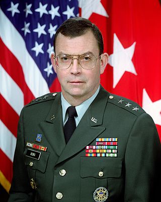
James C. King is a retired United States Army Lieutenant General. A career Military Intelligence officer, he served on active duty from 1968 to 2001. At the time of his retirement he was serving as the Director of the National Imagery and Mapping Agency, one of the intelligence agencies of the United States Intelligence Community.
All-source intelligence is a term used to describe intelligence organizations, intelligence analysts, or intelligence products that are based on all available sources of intelligence collection information.

The United States Army Geospatial Intelligence Battalion, previously known as the 3rd Military Intelligence Center, is a military intelligence battalion specializing in the production and exploitation of geospatial intelligence (GEOINT), and the only operational military command at the National Geospatial-Intelligence Agency (NGA). Co-located within the NGA headquarters (NGA-East) on Fort Belvoir in Springfield, Virginia, the unit produces and analyzes geospatial intelligence products for ground combat forces in close collaboration with its host agency and other members of the U.S. Intelligence Community. Though colocated with NGA, the AGB differs from NGA's own Support Teams in that it receives tasking from the Army.