Nandegada नन्देगडा | |
|---|---|
 | |
| Country | |
| Zone | Seti Zone |
| District | Achham District |
| Population (2001) | |
• Total | 3,356 |
| • Religions | Hindu |
| Time zone | UTC+5:45 (Nepal Time) |
Nandegada is a village in Achham District in the Seti Zone sudarpashim of western Nepal. At the time of the 1991 Nepal census, the village had a population of 2881 living in 542 houses. [1] At the time of the 2001 Nepal census, the population was 3356, of which 33% was literate. [2]
Headquarters: Mangalsen | ||
| Urban municipalities | 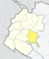 | |
| Rural municipalities | ||
For former VDCs See here | ||
29°14′N81°17′E / 29.233°N 81.283°E
| | This article about a location in the Achham District of Nepal is a stub. You can help Wikipedia by expanding it. |
- ↑ "Nepal Census 2001". Nepal's Village Development Committees. Digital Himalaya . Retrieved 2012-09-05.
- ↑