Related Research Articles
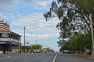
Dunedoo is a village of 747 inhabitants situated within the Warrumbungle Shire of central western New South Wales, Australia. Dunedoo is well known to Australian travellers due to its distinctive name. The name is actually derived from a local Aboriginal word meaning "swan", which are commonly found in the area's lagoons.

The Castlereagh Highway is a 790-kilometre (490 mi) state highway located in New South Wales and Queensland, Australia. The highway's northern terminus is at a junction with the Carnarvon Highway, south of St George, Queensland. Its southern terminus is at a junction with the Great Western Highway at Marrangaroo, 10 kilometres (6.2 mi) north of Lithgow. From north to south the highway traverses South West Queensland and the North West Slopes, Orana, and Central West regions of New South Wales.
Napier is a locality in the Riverina district of New South Wales, Australia and also a civil parish of Buccleuch County, New South Wales.
Murrawal is a location on the now closed Gwabegar railway line in north-western New South Wales, Australia. A loop and loading bank station was located there between 1917 and 1972.
Coolaburragundy River, a perennial stream that is part of the Talbragar catchment within the Murray–Darling basin, is located in the Orana district of New South Wales, Australia.

Napier is a rural locality of Warrumbungle Shire Council and a civil parish of Napier County New South Wales. and is at 31°35′54″S149°46′04″E.
Allison Parish, New South Wales is a rural locality of Warrumbungle Shire Council and a civil parish of Napier County a county of central western New South Wales.
Biamble is a civil parish of Napier County, New South Wales, that is located at 31°43′54″S 149°19′04″E. The civil parish is roughly equivalent to the rural locality of Neilrex in Warrumbungle Shire Council.
Binnia is a civil parish of Napier County in New South Wales.
Lowe Parish is a civil Parish of Napier County, New South Wales.
Mumbedah is a civil parish, a creek and a hill in central New South Wales.
Morven Parish is a civil parish of County of Napier, a county in the central western part of New South Wales, Australia.
Coolah Parish is a civil parish of the County of Napier, a county in the central western part of New South Wales, Australia in Warrumbungle Shire. The only town of the parish is Coolah, New South Wales and at the 2006 census, Coolah township had a population of 910.
Moorangoorang is a rural locality and a civil parish of County of Napier in the central western part of New South Wales, Australia. The parish has three railway stations, Mooren, Borah and Pimbra.
Butheroo is a civil parish of Napier County, a county of central New South Wales.
Bungabah is a civil parish of Napier County in New South Wales.

Toorawandi is a civil parish of Napier County in New South Wales.
Neible Parish, New South Wales is a civil parish of Napier County, a county located in central western New South Wales.

Binnaway Parish is a civil Parish of Napier County, New South Wales, located on the Castlereagh River in central western New South Wales.

Mendooran Parish, New South Wales is a civil parish of Napier County, New South Wales.
References
- ↑ Robert McLean, The New atlas of Australia : the complete work containing over one hundred maps and full descriptive geography of New South Wales, Victoria, Queensland, South Australia and Western Australia, together with numerous illustrations and copious indices (Sydney :J. Sands, [1886) Map 14.
- ↑ "Napier County". Geographical Names Register (GNR) of NSW. Geographical Names Board of New South Wales.

| This Central West geography article is a stub. You can help Wikipedia by expanding it. |