The Arctic Archipelago, also known as the Canadian Arctic Archipelago, is an archipelago lying to the north of the Canadian continental mainland, excluding Greenland and Iceland

The Nimrod Glacier is a major glacier about 85 nautical miles long, flowing from the polar plateau in a northerly direction through the Transantarctic Mountains into the Ross Ice Shelf, Antarctica.
The Hauberg Mountains are a group of mountains of about 35 nautical miles extent, located 12 nautical miles north of Cape Zumberge and 30 nautical miles south of the Sweeney Mountains in eastern Ellsworth Land, Antarctica.

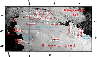
The Abbot Ice Shelf is an ice shelf 250 nautical miles long and 40 nautical miles wide, bordering Eights Coast from Cape Waite to Pfrogner Point in Antarctica. Thurston Island lies along the northern edge of the western half of this ice shelf; other sizable islands lie partly or wholly within this shelf.

Tiraque is a province in the Cochabamba Department in central Bolivia. Its capital is Tiraque.

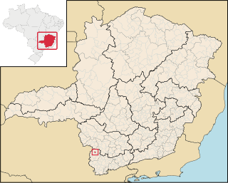
Bandeira do Sul is a Brazilian municipality located in the state of Minas Gerais. Its population as of 2020 is estimated to be 5,778 people, living between 660 and 989 meters elevation.
Andapafito is a town and commune in Madagascar. It belongs to the district of Soanierana Ivongo, which is a part of Analanjirofo Region. The population of the commune was estimated to be approximately 16,000 in the 2001 commune census.
Mount Provender is a conspicuous rock mountain, 900 m, marking the northwest extremity of the Shackleton Range. It was first mapped in 1957 by the Commonwealth Trans-Antarctic Expedition and so named because members of the Commonwealth Trans-Antarctic Expedition established a depot of food and fuel and an airplane camp on the south side of the mountain in 1957 to support sledging parties working in the Shackleton Range.
Limoeiro do Ajuru is a municipality in the state of Pará in the Northern region of Brazil.

Villa de Arriaga is a town and municipality in the Mexican state of San Luis Potosí in central Mexico.
Wells was a community in Kings County, New Brunswick, Canada. It was incorporated into the town of Rothesay on January 1, 1998. The townsite is located 6.51 km east of Rothesay.

El Bolsón is a village and municipality in Catamarca Province in northwestern Argentina.
El Pantanillo is a village and municipality in San Luis Province in western Argentina.
Betbeder is a village and municipality in Entre Ríos Province in north-eastern Argentina.
Block Bay is a long ice-filled bay lying east of Guest Peninsula along the coast of Marie Byrd Land, Antarctica.
Coulter Heights are snow-covered heights that rise between Strauss Glacier and Frostman Glacier near the coast of Marie Byrd Land, Antarctica. The rock outcrops of Kuberry Rocks, Matikonis Peak and Lambert Nunatak protrude above the snow surface of the heights.
Strauss Glacier is a glacier, 40 nautical miles long, flowing between the Ickes Mountains and Coulter Heights to enter the sea at the east side of Land Bay, Marie Byrd Land, Antarctica.

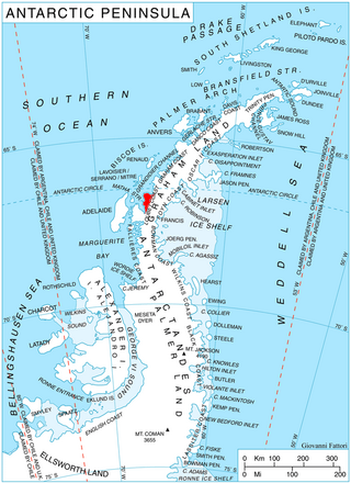
McCance Glacier is the 30-km long and 5 km wide glacier draining the Hutchison Hill area on the west slopes of Avery Plateau on Loubet Coast in Graham Land, Antarctica. It flows north-northwestwards along the west side of Osikovo Ridge, Kladnitsa Peak and Rubner Peak and enters Darbel Bay.
The Thomas Hills are a linear group of hills, 17 nautical miles long, between Foundation Ice Stream and MacNamara Glacier at the north end of the Patuxent Range in the Pensacola Mountains, Antarctica.


