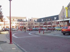
Hulst is a municipality and city in southwestern Netherlands in the east of Zeelandic Flanders.

Westvoorne is a municipality on the island Voorne-Putten in the western Netherlands, in the province of South Holland. The municipality covers an area of 97.48 km2 (37.64 sq mi) of which 44.25 km2 (17.09 sq mi) is water. It had a population of 14,463 in 2017.
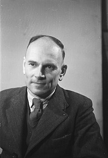
Jonkheer Marinus van der Goes van Naters was a Dutch politician of the defunct Social Democratic Workers' Party (SDAP) and later the Labour Party (PvdA) and lawyer.

The Hoekse Waard is an island between the Oude Maas, Dordtsche Kil, Hollands Diep, Haringvliet and Spui rivers in the province of Zuid Holland in the Netherlands. The island is a mostly agricultural region, south of Rotterdam. The Hoeksche Waard consists of reclaimed land (polders): after the Saint Elisabeth flood of 1421 most of the area was flooded. The land has been reclaimed gradually in the following centuries.
Zevenbergen is a Dutch city which is a part of the municipality of Moerdijk. Zevenbergen is located in the northwest of the province of Noord-Brabant near Breda.

Klundert is a city in the Dutch province of North Brabant. It is located close to the Hollands Diep, about 3 km northwest of Zevenbergen. It received city rights in 1357.

Willemstad is a city in the Dutch province of North Brabant. It is located in the municipality of Moerdijk. Its population as of 2002 was 2,329.

Chaam is a village in the Dutch province of North Brabant. It is located in the municipality of Alphen-Chaam, about 13 km southeast of Breda.
Roosendaal en Nispen was a municipality in the Dutch province of North Brabant. It included the villages of Roosendaal and Nispen.

Charlois is a neighbourhood of the Dutch city of Rotterdam. It is located on the south bank of the Meuse River.
Hofwegen is a hamlet in Molenwaard, which is a municipality in the Dutch province of South Holland. It is located on the south bank of the small river Graafstroom. It is now considered to be part of the village of Bleskensgraaf, which lies on the opposite bank.
Katendrecht is a former village in the Dutch province of South Holland. It is now a neighbourhood of Rotterdam, on the south bank of the Nieuwe Maas.
Nieuwenhoorn is a village in the Dutch province of South Holland. It is located in the municipality of Hellevoetsluis, about 3 km north of Hellevoetsluis city centre.

Rijsoord is a village in the Dutch province of South Holland. It is located about 10 km southeast of the city of Rotterdam, in the municipality of Ridderkerk.

Schiebroek is a former village in the Dutch province of South Holland. It is now a neighbourhood of Rotterdam, and part of the borough of Hillegersberg-Schiebroek.
Zuidwijk is a former municipality in the Dutch province of South Holland. It was located southeast of the center of Boskoop.

Barry Madlener is a Dutch politician of the Party for Freedom. He was the Parliamentary leader of the Party for Freedom in the European Parliament from July 14, 2009 to September 20, 2012. He was a member of the Netherlands House of Representatives from November 30, 2006 until July 14, 2009 and has been again an MP since September 20, 2012.
Wyler is a village along the Dutch-German border, 7 km southeast of Nijmegen, Gelderland, The Netherlands, and 5 km west of Kranenburg, Germany.
Gymnasium Beekvliet is a Catholic independent gymnasium with one location in Sint-Michielsgestel. 815 students attended the school in 2005.