40 | |
---|---|
국도 제40호선 | |
Route information | |
Length | 145.6 km (90.5 mi) |
Existed | 14 March 1981–present |
Major junctions | |
West end | Dangjin, South Chungcheong Province |
East end | Gongju, South Chungcheong Province |
Location | |
Country | South Korea |
Highway system | |
National Route 40 is a national highway in South Korea connects Dangjin to Gongju. It established on 14 March 1981 [1]
Dangjin- Yesan County- Hongseong County- Boryeong- Buyeo County- Gongju
This article contains a bulleted list or table of intersections which should be presented in a properly formatted junction table.(November 2021) |
IC: Interchange
Name [2] | Hangul name | Connections | Location | Note | |
---|---|---|---|---|---|
Directly connected with Prefectural Route 622 | |||||
(Under Unsan 1 bridge) | (운산1교 하부) | National Route 32 Prefectural Route 622 | Dangjin | Hapdeok-eup | Terminus |
Jaeoh Ridge entrance | |||||
Godeok IC | 고덕 나들목 | Dangjin-Yeongdeok Expressway | Yesan County | Godeok-myeon | |
Daecheon Intersection | 대천 교차로 | Prefectural Route 619 | |||
Daeji Intersection | 대지사거리 | Prefectural Route 618 Prefectural Route 619 | |||
Godeok Middle School | 고덕중학교 | ||||
Daeji Intersection | 대지삼거리 | Godeokjungang-ro | Bongsan-myeon | ||
Hapyeong Intersection | 하평삼거리 | Bongsan-ro | |||
No name | (이름 없음) | Yedeok-ro | |||
Eubnae Intersection | 읍내 교차로 | Prefectural Route 609 (Deoksanoncheon-ro) Bonggun-ro Chungui-ro | |||
Songshan Intersection | 송산 교차로 | National Route 45 Prefectural Route 70 (Yun Bong-gil) Prefectural Route 609 (Docheong-daero) | Sapgyo-eup | ||
Sinri Bridge | 신리대교 | ||||
Deoksan Hot Spring Intersection | 덕산온천 교차로 | Deoksan Hot Spring | Deoksan-myeon | ||
Sudeoksa Intersection | 수덕사 교차로 | National Route 45 Prefectural Route 70 (Yun Bong-gil) Sudeoksa-ro | |||
Sudeoksa Entrance | 수덕사입구 | ||||
Oera Intersection | 외나사거리 | Hongdeokseo-ro | |||
Sudeok Elementary School | 수덕초등학교 | ||||
Guseong Bridge | 구성교 | ||||
Gagok Elementary School (closed) | 가곡초등학교(폐교) | Hongseong | Galsan-myeon | ||
Hongseong IC | 홍성 나들목 | Seohaean Expressway National Route 29 Galsan-ro | |||
Sangchon Intersection | 상촌교차로 | National Route 29 Sangchon-ro Walyong-ro | |||
Galsan Intersection | 갈산교차로 | Baekya-ro | |||
Galsan tunnel | 갈산터널 | 390m long | |||
Odu Intersection | 오두교차로 | Galsanseo-gil | |||
Gwangri Intersection | 광리교차로 | Prefectural Route 96 (Cheonsuman-ro) Seobuseo road | Seobu-myeon | ||
Miho Intersection | 이호삼거리 | Walyong-ro Yihogil | |||
Hongseong West Middle School | 홍성서부중학교 | ||||
No name | (이름 없음) | Hongnamseo-ro 285 beon-gil | |||
Gongchon Intersection | 송촌삼거리 | Prefectural Route 96 (Hongnamseo-ro) | |||
No name | (이름 없음) | Seobu-ro 43 beon-gil | |||
Eosa Intersection | 어사교차로 | Namdanghang-ro | |||
Eosa-ri bus stop | 어사리정류소 | ||||
Naedongma Village Entrance | 내동마을입구 | Namdanghang-ro 264 beon-gil | |||
Namdang Port | 남당항 | ||||
Anheungdong Intersection | 안흥동삼거리 | Hongbo-ro | |||
Hongseong seawall Intersection | 홍성방조제삼거리 | Imhae-ro | |||
Hongseong Bridge | 홍성교 | ||||
Hongseong seawall | 홍성방조제 | Boryeong | Cheonbuk-myeon | ||
Cheonbuk Intersection | 천북삼거리 | Hagung road | |||
Haman Intersection | 하만삼거리 | Prefectural Route 622 (Cheongwang-ro) | |||
Boryeong Bridge Boryeong seawall | 보령교 보령방조제 | ||||
Soseong Intersection | 소성삼거리 | Prefectural Route 610 (Chungcheonsuyeong-ro) | Ocheon-myeon | ||
Sinchon Intersection | 신촌삼거리 | Prefectural Route 610 (Domihang-ro) | |||
Galhyeon Entrance | 갈현입구 | Dolgogae-gil | Cheongso-myeon | ||
Magang 2 | 마강2리앞 | Oncheonjungang-ro | Jupo-myeon | ||
Oncheonwaseon Bridge | 오천과선교 | ||||
Jupo Intersection | 주포사거리 | National Route 21 (Chungseo-ro) Bỏyeongeupseong-gil | |||
Bongdang Intersection | 봉당삼거리 | ||||
Gwangsan Intersection | 관산사거리 | Yupoyeok-gil | |||
Chungseo-ro Intersection | 충서로사거리 | ||||
Jugyo Intersection | 주교사거리 | Prefectural Route 610 (Ulgyekeun-gil) | |||
Gwanchang Intersection | 관창교차로 | Boryeongbuk-ro | Jugyo-myeon | ||
Bonghwang tunnel | 봉황터널 | Daecheon-dong | |||
Hwasan Intersection | 화산교차로 | National Route 36 National Route 77 (Daecheong-ro) | |||
Yeongcheon Intersection | 명천교차로 | National Route 21 National Route 77 (Chungseo-ro) | |||
Seongju tunnel | 성주터널 | 720m long | |||
Seongju Intersection | 성주삼거리 | Simwongyegong-ro | Seongju-myeon | ||
Boryeong Coal Museum | 보령석탄박물관 | ||||
Gawha Arts Park | 개화예술공원 | ||||
Chungcheongnamgaehwa Elementary School | 충남개화초등학교 | ||||
Gaewa Intersection | 개화삼거리 | Prefectural Route 606 (Mansu-ro) | |||
Dowhadam Elementary School (closed) | 도화담초등학교(폐교) | Misan-myeon | |||
Dohwadam Intersection | 도화담삼거리 | Prefectural Route 617 | |||
Sulibawi Intersection | 수리바위삼거리 | Oesan-ro | Buyeo County | Oesan-myeon | |
Oesan Intersection | 외산사거리 | Prefectural Route 606 (Mansu-ro) | |||
Jiti Intersection | 지티교앞 | Prefectural Route 613 (Sabi-ro) | Naesan-myeon | ||
Minam Intersection | 미암교차로 | Seongchung-ro | |||
Juam Intersection | 주암 교차로 | Sukdong-ro | |||
Unchi Intersection | 운치교차로 | Seongchung-ro jilmajae-gil | |||
Julam Intersection | 율암 교차로 | Seongchung-ro | |||
Yulam Bridge | 율암교 | ||||
Yonggang Middle School | 용강중학교 | Guryong-myeon | |||
Gulyong Intersection | 구룡삼거리 | Heungsu-ro | |||
Sujeong Intersection | 주정삼거리 | National Route 4 Prefectural Route 723 (Daebaekje-ro) | |||
Meoggogae Intersection | 먹고개삼거리 | Prefectural Route 723 (Chungui-ro) | |||
Gubong Intersection | 구봉교차로 | National Route 4 (Daebaekje-ro) Heungsu-ro | |||
Hapsong Intersection | 합송교차로 | Hapsongseo-ro | Gyuam-myeon | ||
Naeli Intersection | 내리 교차로 | National Route 29 National Route 39 (Gyuamuhoedo-ro) | |||
Gyuam Intersection | 규암 교차로 | Prefectural Route 625 (Chungjeol-ro) | |||
Buyeodae Bridge | 부여대교 | ||||
Buyeo-eup | |||||
Buyeo Intersection | 부여 교차로 | Seongwang-ro | |||
Daewang Intersection | 대왕 교차로 | Geumseong-ro | |||
Gatap Intersection | 가탑 교차로 | National Route 4 (Daebaejek-ro) | |||
Dongmun Intersection | 동문삼거리 | Gatap-ro | |||
Roundabout | 대향로로터리 | Bukpo-ro Seongwang-ro | |||
Yongjeong Intersection | 용정교차로 | Samchung-ro | |||
Jeongdong Intersection | 정동교차로 | Prefectural Route 625 (Baekjemun-ro) | |||
Jawang Intersection | 자왕교차로 | Samchung-ro | |||
Sinjeong Intersection | 신정교차로 | Bukpo-ro | |||
Wangjin Intersection | 왕진교차로 | Prefectural Route 645 (Wangjin-ro) | |||
Joseok Intersection | 저석교차로 | Prefectural Route 651 (Baekjekeung-gil) | |||
Ochon Intersection | 오촌교차로 | Prefectural Route 651 (Baekjekeung-gil) | |||
Bundang Intersection | 분강교차로 | Changam-gil | Gongju | Tancheon-myeon | |
Seongli Intersection | 성리교차로 | Prefectural Route 645 (Deungsan-ro) | |||
No name | (이름 없음) | Prefectural Route 799 (Geumbaek-ro) | One way | ||
Samgak Intersection | 삼각교차로 | Prefectural Route 799 (Geumbaek-ro) | |||
Dalsan Intersection | 달산교차로 | Prefectural Route 96 (Geumbawi-ro) | Iin-myeon | ||
Iin Intersection | 이인교차로 | Prefectural Route 697 (Geumgang-ro) | |||
Jubong Intersection | 주봉교차로 | Geombawi-ro | |||
Taebong Intersection | 태봉교차로 | Ugeumti-ro | Geumhak-dong | ||
Bongjeong Intersection | 봉정교차로 | Ugeumti-ro | |||
Namgyeongju IC | 남공주 나들목 | Nonsan–Cheonan Expressway | |||
Geomsang Intersection | 검상교차로 | Geomsangan-gil | |||
Saejae Intersection | 새재교차로 | ||||
Intersection (front of the police station) | 경찰서앞교차로 | Muryeong-ro | Ungjin-dong | ||
Gongju Art & Culture Center | 공주문예회관 | Gomanalu-gil | |||
Gongju Middle School Gongju Office of Education Tomb | 공주중학교 공주교육지원청 왕릉교 | ||||
Gongsanseong Roundabout | 공산성 회전교차로 | Ungjin-ro | |||
Gongsanseong Fortress | 공산성 | ||||
Geumgang Bridge | 금강교 | ||||
National Route 32 Prefectural Route 96 (Geumbyeok-ro) Uidang-ro | |||||
Jeonmak Intersection | 전막 교차로 | Singwan-dong | Terminus |
South Chungcheong Province, also known as Chungnam, is a province of South Korea. South Chungcheong has a population of 2,059,871 (2014) and has a geographic area of 8,204 km2 located in the Hoseo region in the southwest of the Korean Peninsula. South Chungcheong borders the provinces of Gyeonggi to the north, North Chungcheong, Sejong Special Autonomous City, and Daejeon Metropolitan City to the east, and North Jeolla to the south.
Gongju is a city in South Chungcheong province, South Korea.
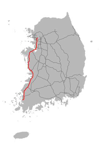
The Seohaean Expressway, meaning "West Coast Expressway", is a freeway in South Korea, connecting Mokpo to Gunsan, Dangjin, and Seoul.
Dangjin is a city in South Chungcheong Province, South Korea. It stands on the south shore of the Bay of Asan. Dangjin borders Incheon, Pyeongtaek, and Hwaseong by sea, and Seosan, Yesan, and Asan by land. Its name means "Tang ferry," and refers to the historic role of Dangjin's harbor in connecting Korea to the other side of the Yellow Sea. This role continues to be important in the city's economy, which relies on a mixture of agriculture and heavy industry. The city has the same Hanja name (唐津市) as Karatsu in Saga Prefecture, Japan.
A National Treasure is a tangible treasure, artifact, site, or building which is recognized by the South Korean government as having exceptional artistic, cultural and historical value to the country. The title is one of the eight State-designated heritage classifications assigned by the administrator of the Cultural Heritage Administration (CHA) in accordance with the Cultural Heritage Protection Act after deliberation by the Cultural Heritage Committee.
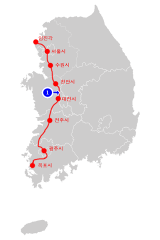
National Route 1(Korean: 국도 제1호선; RR: Gukdo Je Il Hoseon) is a national highway in South Korea. It connects Mokpo, South Jeolla Province with the city of Paju in Gyeonggi-do. Before the division of the Korean peninsula, the highway ran until Sinuiju, North P'yongan Province, in present-day North Korea.
National Route 36 is a national highway in South Korea connects Boryeong to Sejong City, Cheongju, Chungju, and Uljin. It established on 31 August 1971.
National Route 39 is a national highway in South Korea. It connects Buyeo to Gongju, Asan, Hwaseong, Siheung, Bucheon, Seoul, Goyang, and Uijeongbu. National Route 39 opened on 14 March 1981
National Route 43 is a national highway in South Korea connecting Sejong City to Kosong County. It was established on 31 August 1971.
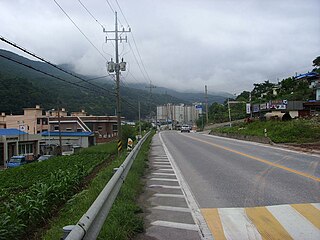
National Route 38 is a national highway in South Korea connects Seosan to Donghae. It established on 31 August 1971.
National Route 34 is a national highway in South Korea connects Dangjin to Yeongdeok. It established on 31 August 1971.
National Route 32 is a national highway in South Korea connects Taean County to Jung District, Daejeon. It established on 31 August 1971.
National Route 23 is a national highway in South Korea connects Gangjin County to Dongnam District, Cheonan. It established on 31 August 1971.
Chūseinan-dō was one of the administrative divisions of Korea under Japanese rule, with its capital at Taiden. The province consisted of modern-day South Chungcheong, South Korea.
National Route 77 is a national highway in South Korea connects Jung District, Busan to Paju. It was established on 25 August 2001.
Dangjin–Yeongdeok Expressway also known as 6th East–West Expressway is an expressway in South Korea connecting Dangjin to Yeongdeok County.