External links
- www.nso.gov.pg - site ceased to function in January 2012 and re-designed and developed again in 2015 by its ICT Branch
The National Statistical Office of Papua New Guinea is a national institute of Papua New Guinea, which is dedicated to collecting socio-economic data in the country. It collects data on demographics, population, climatology, industry, tourism, education and employment etc.

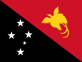
Papua New Guinea is a country in Oceania that comprises the eastern half of the island of New Guinea and its offshore islands in Melanesia. Officially the Independent State of Papua New Guinea, it shares its only land border with Indonesia to the west and it is directly adjacent to Australia to the south and the Solomon Islands to the east. Its capital, located along its southeastern coast, is Port Moresby. The country is the world's third largest island country, with an area of 462,840 km2 (178,700 sq mi).

The economy of Papua New Guinea (PNG) is largely underdeveloped with the vast majority of the population living below the poverty line. However, according to the Asian Development Bank its GDP is expected to grow 3.4% in 2022 and 4.6% in 2023. It is dominated by the agricultural, forestry, and fishing sector and the minerals and energy extraction sector. The agricultural, forestry, and fishing sector accounts for most of the labour force of PNG while the minerals and energy extraction sector, including gold, copper, oil and natural gas is responsible for most of the export earnings.

Port Moresby, also referred to as Pom City or simply Moresby, is the capital and largest city of Papua New Guinea. It is one of the largest cities in the southwestern Pacific outside of Australia and New Zealand. It is located on the shores of the Gulf of Papua, on the south-western coast of the Papuan Peninsula of the island of New Guinea. The city emerged as a trade centre in the second half of the 19th century. During World War II, it was a prime objective for conquest by the Imperial Japanese forces during 1942–43 as a staging point and air base to cut off Australia from Southeast Asia and the Americas.

Sandaun Province is the northwesternmost mainland province of Papua New Guinea. It covers an area of 35,920 km2 and has a population of 248,411. The capital is Vanimo. In July 1998 the area surrounding the town Aitape was hit by an enormous tsunami caused by a Magnitude 7.0 earthquake which killed over 2,000 people. The five villages along the west coast of Vanimo towards the International Border are namely; Lido, Waromo, Yako, Musu and Wutung.

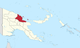
Madang is a province of Papua New Guinea. The province is on the northern coast of mainland Papua New Guinea and has many of the country's highest peaks, active volcanoes and its biggest mix of languages. The capital is the town of Madang.

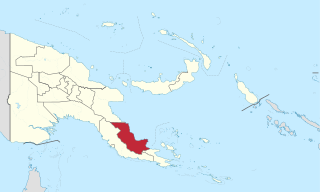
Gulf Province is a province of Papua New Guinea located on the southern coast. The provincial capital is Kerema. The 34,472 km2 province is dominated by mountains, lowland river deltas, and grassland flood plains. In Gulf Province, the Kikori, Turama, Purari, and Vailala rivers meet the Papuan Gulf. The province has the second-smallest population of all the provinces of Papua New Guinea with 106,898 inhabitants. The province shares land borders with Western Province to the west, Southern Highlands, Chimbu, and Eastern Highlands to the north, Morobe Province to the east, and Central Province to the southeast.

Oro Province, formerly Northern Province, is a coastal province in the Southern Region of Papua New Guinea. The provincial capital is Popondetta. The province covers 22,800 km2, and has 176,206 inhabitants. The province shares land borders with Morobe Province to the northwest, Central Province to the west and south, and Milne Bay Province to the southeast. The province is located within the Papuan Peninsula.

West New Britain is a province of Papua New Guinea on the islands of New Britain. The provincial capital is Kimbe. The area of the province is 20,387 km² with a population of 264,264 as of the 2011 census. The province's only land border is with East New Britain. There are seven major tribes, the Nakanai, Bakovi, Kove, Unea, Maleu, Arowe, speaking about 25 languages.

The National Capital District of Papua New Guinea is the incorporated area around Port Moresby, which is the capital of Papua New Guinea. Although it is surrounded by Central Province, where Port Moresby is also the capital, it is technically not a part of that province. It covers an area of 240 km2 and has a population of 364,125. It is represented by three open MPs and an NCD-wide representative in the National Parliament of Papua New Guinea who acts as Governor of the National Capital District; however, these MPs do not have the same powers as elsewhere in the country due to the role of the National Capital District Commission.

Huli is a Tari language spoken by the Huli people of the Hela Province of Papua New Guinea. It has a pentadecimal (base-15) numeral system: ngui means 15, ngui ki means 15×2 = 30, and ngui ngui means 15×15 = 225.

Papua New Guinea has 326 local-level governments (LLGs) comprising 6,112 wards as of 2018.

This page is a list of districts of Papua New Guinea.

The Yam languages, also known as the Morehead River languages, are a family of Papuan languages. They include many of the languages south and west of the Fly River in Papua New Guinea and Indonesian West Papua.
Telefol is a language spoken by the Telefol people in Papua New Guinea, notable for possessing a base-27 numeral system.
The National Intelligence Organization (NIO) is the intelligence agency of Papua New Guinea.

The Papuan Gulf languages are a proposed language family of Papuan languages spoken inland from the large gulf that defines the shape of southern Papua New Guinea.
Labuta Rural LLG is a local-level government (LLG) of Morobe Province, Papua New Guinea.
Nabak Rural LLG is a local-level government (LLG) of Morobe Province, Papua New Guinea. The Nabak language is spoken in the LLG.