The National Weather Service (NWS) is an agency of the United States federal government that is tasked with providing weather forecasts, warnings of hazardous weather, and other weather-related products to organizations and the public for the purposes of protection, safety, and general information. It is a part of the National Oceanic and Atmospheric Administration (NOAA) branch of the Department of Commerce, and is headquartered in Silver Spring, Maryland, within the Washington metropolitan area. The agency was known as the United States Weather Bureau from 1890 until it adopted its current name in 1970.

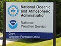
NEXRAD or Nexrad is a network of 159 high-resolution S-band Doppler weather radars operated by the National Weather Service (NWS), an agency of the National Oceanic and Atmospheric Administration (NOAA) within the United States Department of Commerce, the Federal Aviation Administration (FAA) within the Department of Transportation, and the U.S. Air Force within the Department of Defense. Its technical name is WSR-88D.

WSR-74 radars were Weather Surveillance Radars designed in 1974 for the National Weather Service. They were added to the existing network of the WSR-57 model to improve forecasts and severe weather warnings. Some have been sold to other countries like Australia, Greece, and Pakistan.
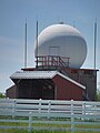
WSR-57 radars were the USA's main weather surveillance radar for over 35 years. The National Weather Service operated a network of this model radar across the country, watching for severe weather.

Weather radar, also called weather surveillance radar (WSR) and Doppler weather radar, is a type of radar used to locate precipitation, calculate its motion, and estimate its type. Modern weather radars are mostly pulse-Doppler radars, capable of detecting the motion of rain droplets in addition to the intensity of the precipitation. Both types of data can be analyzed to determine the structure of storms and their potential to cause severe weather.
The National Severe Storms Laboratory (NSSL) is a National Oceanic and Atmospheric Administration (NOAA) weather research laboratory under the Office of Oceanic and Atmospheric Research. It is one of seven NOAA Research Laboratories (RLs).

ARMOR Doppler weather radar is a C-Band, Dual-Polarimetric Doppler Weather Radar, located at the Huntsville International Airport in Huntsville, Alabama. The radar is a collaborative effort between WHNT-TV and the University of Alabama in Huntsville. Live data for the radar is only available to a limited audience, such as UAH employees and NWS meteorologists. All ARMOR data is archived at the National Space Science and Technology Center located on the UAH campus.
Convective storm detection is the meteorological observation, and short-term prediction, of deep moist convection (DMC). DMC describes atmospheric conditions producing single or clusters of large vertical extension clouds ranging from cumulus congestus to cumulonimbus, the latter producing thunderstorms associated with lightning and thunder. Those two types of clouds can produce severe weather at the surface and aloft.

GRLevelX is a suite of data processing and display programs developed by Gibson Ridge Software, LLC (GRS), to view weather radar data. It went on the market in March 2005. It comes in three versions, all of which ingest raw data: GRLevel2 and GRLevel2 Analyst Edition for viewing Level II data of the National Weather Service (NWS), and GRLevel3 for viewing Level III data. All programs are capable of rendering dual polarization data.
Terminal Doppler Weather Radar (TDWR) is a Doppler weather radar system with a three-dimensional "pencil beam" used primarily for the detection of hazardous wind shear conditions, precipitation, and winds aloft on and near major airports situated in climates with great exposure to thunderstorms in the United States. As of 2011, all were in-service with 45 operational radars, some covering multiple airports in major metropolitan locations, across the United States & Puerto Rico. Several similar weather radars have also been sold to other countries such as China. Funded by the United States Federal Aviation Administration (FAA), TDWR technology was developed in the early 1990s at Lincoln Laboratory, part of the Massachusetts Institute of Technology, to assist air traffic controllers by providing real-time wind shear detection and high-resolution precipitation data.

National Weather Service Lincoln, Illinois also known as National Weather Service Central Illinois is a weather forecast office responsible for monitoring weather conditions for 35 counties in Central and Southeastern Illinois. The Central Illinois office initially consisted of two forecast offices in Peoria and Springfield until the current location in Lincoln became the sole local forecast office in 1995. Federal meteorology offices and stations in the region date back to the 19th century when the Army Signal Service began taking weather observations using weather equipment at the Springer Building in Springfield. Since that time the presence of the National Weather Service greatly increased with the installation of new weather radars, stations and forecast offices. The current office in Lincoln maintains a WSR-88D (NEXRAD) radar system, and Advanced Weather Interactive Processing System (AWIPS) that greatly improve forecasting in the region. Lincoln is in charge of weather forecasts, warnings and local statements as well as aviation weather.

The National Weather Service Caribou, Maine is a local office of the National Weather Service responsible for monitoring weather conditions in northern Maine. It is co-located with an upper air sounding facility but the NEXRAD radar KCBW is near Houlton, Maine, further south.
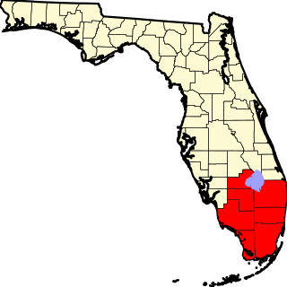
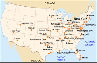
The National Weather Service Miami, Florida is a local weather forecast office of the National Weather Service (NWS) that serves six counties in South Florida – Broward, Collier, Glades, Hendry, Miami-Dade, and Palm Beach – as well as the mainland portion of Monroe County. This office was originally established in 1879 as a Signal Corps station near the Jupiter Inlet Light, before becoming a Weather Bureau Office (WBO) in 1891. The WBO at Jupiter was moved southward to Miami, due to the city's rapidly growing population. In 1930, a separate Weather Bureau Airport Station (WBAS) was established at the Miami Municipal Airport. The WBAS was later moved to the Miami International Airport in 1942 and remained there until ceasing operations in 1975.
National Weather Service - Tulsa, Oklahoma (TSA) is a local weather forecast office responsible for monitoring weather conditions for 7 counties in Northwestern Arkansas, and 25 counties in Eastern Oklahoma. The current office in Tulsa maintains a WSR-88D (NEXRAD) radar system, and Advanced Weather Interactive Processing System (AWIPS) that greatly improve forecasting in the region. Tulsa is in charge of weather forecasts, warnings and local statements as well as aviation weather and NOAA Weather Radio broadcasts in its service area. The office operates two Doppler radars, one in Tulsa (INX), and the other in Fort Smith, Arkansas (SRX). Steve Piltz is the Meteorologist-In-Charge (MIC) of this office.

A line echo wave pattern (LEWP) is a weather radar formation in which a single line of thunderstorms presenting multiple bow echoes forms south of a mesoscale low-pressure area with a rotating "head". LEWP often are associated with a multiple-bow serial derecho and often produce tornadoes, some of which can be strong. The existence of a LEWP on radar means that a serial derecho has developed or is likely to develop soon, much as a hook echo indicates the same for a tornado.
National Weather Service - Norman, Oklahoma is a Weather Forecast Office (WFO) of the National Weather Service based in Norman, Oklahoma, which is responsible for forecasts and the dissemination of weather warnings and advisories for central and most of western Oklahoma, and western portions of north Texas. It is located in the National Weather Center on the University of Oklahoma campus, where it acts as one of the NOAA Weather Partners, a group of close-together weather-related agencies of the National Oceanic and Atmospheric Administration. NWS Norman is currently overseen by David Andra, who serves as the Meteorologist In Charge of the office.
The National Weather Service Boston/Norton, Massachusetts, is a local office of the National Weather Service (NWS), run under the auspices of the NWS's Eastern Region. This weather forecast office (WFO) is responsible for monitoring weather conditions throughout most of southern New England. The southern New England weather forecast office provides warning and forecast services for most of Massachusetts, Northern Connecticut, and all of Rhode Island. Besides public weather services, WFO Norton (BOX) provides marine, aviation, fire weather, and hydrological forecast services. Additional hydrologic information is provided by the co-located Northeast River Forecast Center (NERFC).

The National Weather Service Boise, Idaho is a weather forecast office responsible for weather forecasts, warnings and local statements as well as aviation weather forecasts and fire weather forecasts for 3 counties in Southeast Oregon and 14 counties in Southwest and South central Idaho. The U.S. Weather Bureau established an office in the Sonna Building on December 1, 1898. Since then, the U.S Weather Bureau office, now known as the National Weather Service forecast office gained forecast responsibility of Southern Idaho on June 22, 1970 which was expanded to the entire state of Idaho in 1973. After modernization in 1993, the forecast responsibility was changed to Southeast Oregon and Southwest Idaho. The current office in Boise maintains a WSR-88D (NEXRAD) radar system, 8 Automated airport weather station (ASOS) systems and Advanced Weather Interactive Processing System (AWIPS) that greatly improve forecasting in the region. Continuous weather observations have been maintained for the city of Boise since February 1, 1864 about 5 months after the U.S. Army established Fort Boise. The post surgeon for the U.S. Army took observations until July 1, 1877 when the U.S. Signal Service, established an office downtown. The Signal Office was discontinued on July 1, 1890.
National Weather Service - Pleasant Hill/Kansas City, Missouri is a Weather Forecast Office (WFO) of the National Weather Service, which is responsible for forecasts and the dissemination of weather warnings and advisories for 37 counties in northern and western Missouri and seven counties in extreme eastern Kansas, including the Kansas City and St. Joseph metropolitan areas. Though, as the Storm Prediction Center (SPC) in Norman, Oklahoma is responsible for issuing severe thunderstorm and tornado watches, the Pleasant Hill/Kansas City WFO only composes outline and status updates for SPC-issued watches affecting any portion of its designated County Warning Area.

The Joint Polarization Experiment (JPOLE) was a test for evaluating the performance of the WSR-88D in order to modify it to include dual polarization. This program was a joint project of the National Weather Service (NWS), the Federal Aviation Administration (FAA), and the US Air Force Meteorological Agency (AFWA), which took place from 2000-2004. It has resulted in the upgrading of the entire meteorological radar network in the United States by adding dual polarization to better determine the type of hydrometeor, and quantities that have fallen.