National Weather Service New Orleans/Baton Rouge, Louisiana

Last updated
National Weather Service New Orleans/Baton Rouge, Louisiana
NWS Office Slidell LA front.JPG
Typesbranch  OOjs UI icon edit-ltr-progressive.svg
Location Slidell   OOjs UI icon edit-ltr-progressive.svg
CountryUnited States  OOjs UI icon edit-ltr-progressive.svg
Coordinates 30°20′12″N89°49′32″W / 30.336713°N 89.825662°W / 30.336713; -89.825662 Coordinates: 30°20′12″N89°49′32″W / 30.336713°N 89.825662°W / 30.336713; -89.825662 [1] OOjs UI icon edit-ltr-progressive.svg
Website www.weather.gov/lix   OOjs UI icon edit-ltr-progressive.svg

The National Weather Service Weather Forecast Office New Orleans/Baton Rouge , Louisiana is a National Weather Service office located in Slidell, Louisiana. [2]

Contents

History

The KLIX NEXRAD radar in Slidell. NWS Office Slidell LA NEXRAD.JPG
The KLIX NEXRAD radar in Slidell.
NWS Weather Forecast Offices.svg
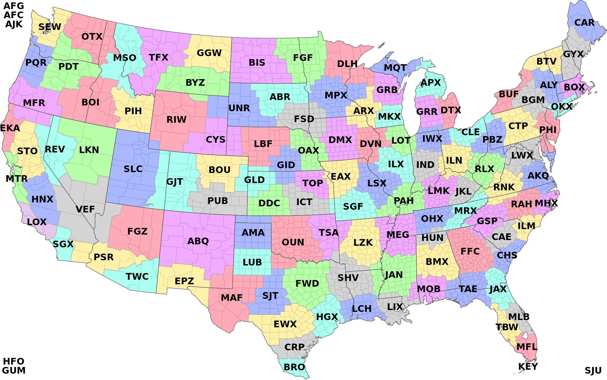
Coverage of NWS Weather Forecast Offices where New Orleans/Baton Rouge is LIX.

The National Weather Service Weather Forecast Office New Orleans/Baton Rouge has its origins in a U.S. Army Signal Service office opened in Downtown New Orleans on October 4, 1870. [3] A hurricane forecast center operated in the New Orleans office from 1935 until 1966, when its responsibilities were transferred to the National Hurricane Center. [3] In 1979, the New Orleans forecast office moved to Slidell, merging with the radar observatory that had operated there since 1972. [3] In 1993, the Baton Rouge forecast office was closed and its functions were transferred to the office in Slidell. [3]

NOAA Weather Radio

Noaa all hazards.svg

The National Weather Service Weather Forecast Office New Orleans/Baton Rouge, Louisiana currently provides programming for 6 NOAA Weather Radio stations.

KHB-43 New Orleans

KHB43
City New Orleans, Louisiana
Broadcast area New Orleans metropolitan area
Frequency 162.550 MHz
Technical information
Class C
Power 1,000 Watts
HAAT 502 M
Links
Website www.srh.noaa.gov/lix
NOAA KHB-43 Query

KHB43 (Sometimes referred to as New Orleans All Hazards) is a NOAA Weather Radio station that serves New Orleans metropolitan area and surrounding cities. It is programmed from the National Weather Service forecast offices in New Orleans and Baton Rouge, Louisiana with its transmitter located in New Orleans. It broadcasts weather and hazard information for the following Parishes: Jefferson, Lafourche, Orleans, Plaquemines, St. Bernard, St. Charles, St. James, St. John the Baptist, St. Tammany, and Tangipahoa.

WXL-41 Buras

WXL41
City Buras, Louisiana
Broadcast areaExtreme Southern New Orleans metropolitan area
Frequency 162.475 MHz
History
First air date
August 17, 2005
Technical information
Class C
Power 1,000 Watts
HAAT 240 M
Links
Website www.srh.noaa.gov/lix
NOAA WXL-41 Query

WXL41 (sometimes referred to as Buras All Hazards) is a NOAA Weather Radio station that serves the extreme southern part of the New Orleans metropolitan area and can be heard over 40 miles (64 km) into the Gulf of Mexico. It is programmed from the National Weather Service forecast offices in New Orleans and Baton Rouge, Louisiana with its transmitter located in Buras. It broadcasts weather and hazard information for the following Parishes: Jefferson, and Plaquemines.

History

Broadcasting activities of WXL41 began on August 17, 2005; when the NWS in New Orleans/Baton Rouge added a transmitter at Buras, giving residents in Southern Louisiana 24-hour access to their NOAA Weather/All Hazards Radio service. 24-Hour weather broadcasts at this transmitter include the marine, shipping and fishing forecasts for the Grand Isle, Leeville and Port Fourchon communities. [4] Less than 2 weeks later, WXL41's transmitter was knocked off the air by Hurricane Katrina. Service was later restored in early 2006 by a way of back-up generator until full power was restored. [5]

KHB-46 Baton Rouge

KHB46
City Baton Rouge, Louisiana
Broadcast area Baton Rouge metropolitan area
Frequency 162.400 MHz
Technical information
Class C
Power 1,000 Watts
HAAT 436 M
Links
Website www.srh.noaa.gov/lix
NOAA KHB-46 Query

KHB46 (sometimes referred to as Baton Rouge All Hazards) is a NOAA Weather Radio station that serves the Baton Rouge Metro Area and surrounding cities. It is programmed from the National Weather Service forecast offices in New Orleans, Louisiana with its transmitter located in Baton Rouge. It broadcasts weather and hazard information for Ascension, East Baton Rouge, East Feliciana, Iberville, Livingston, Pointe Coupee, St. Helena, Tangipahoa, West Baton Rouge, & West Feliciana Parishes in Louisiana; and Wilkinson County in Mississippi.

KIH-21 Gulfport

KIH21
City Gulfport, Mississippi
Broadcast area Biloxi-Gulfport-Pascagoula Metro
Frequency 162.400 MHz
Technical information
Class C
Power 1,000 Watts
HAAT 78 M
Links
Website www.srh.noaa.gov/lix
NOAA KIH-21 Query

KIH21 (sometimes referred to as Gulfport All Hazards) is a NOAA Weather Radio station that serves the Biloxi-Gulfport-Pascagoula Metropolitan area as well as 40 miles into the Gulf of Mexico. It is programmed from the National Weather Service forecast office in New Orleans/Baton Rouge, Louisiana with its transmitter located in the Gulfport, Mississippi. It broadcasts weather and hazard information for the following counties: George, Hancock, Harrison, Jackson, Pearl River, and Stone.

KIH-23 Morgan City

KIH23
City Morgan City, Louisiana
Broadcast area Morgan City / Eastern Lafayette Metro
Frequency 162.475 MHz
Technical information
Class C
Power 1,000 Watts
HAAT 449 M
Links
Website www.srh.noaa.gov/lix
NOAA KIH-23 Query

KIH23 (sometimes referred to as Morgan City All Hazards) is a NOAA Weather Radio station that serves Morgan City and vicinity as well as part of the Lafayette Metro Area. It is programmed from the National Weather Service forecast offices in New Orleans and Baton Rouge, Louisiana with its transmitter located in Morgan City. It broadcasts weather and hazard information for the following Parishes: Ascension, Assumption, Iberia, Iberville, Lafourche, St. James, Lower St. Martin, St. Mary, and Terrebonne.

History

KIH23's tower was destroyed by Hurricane Gustav during the Labor Day weekend in 2008. A temporary tower was in place at a lower height and power until a new transmitter was fully constructed on December 2008. [6]

WNG-521 Bogalusa

WNG521
City Bogalusa, Louisiana
Frequency 162.525 MHz
Technical information
Power 1,000 Watts
Links
Website www.srh.noaa.gov/lix
NOAA WNG-521 Query

WNG521 is a NOAA Weather Radio station that provides weather and hazard information for the following Parishes in Louisiana: Washington, St. Tammany, Tangipahoa, and St. Helena, as well as Pike, Walthall, Marion, Lamar, and Pearl River, counties in Mississippi. [7]

Related Research Articles

Interstate 12 (I-12) is an Interstate Highway located entirely within the U.S. state of Louisiana. It spans a total of 86.65 miles (139.45 km) in an east–west direction from I-10 in Baton Rouge to an interchange with both I-10 and I-59 in Slidell. Along the way, it passes through the city of Hammond, where it intersects I-55 and US 51. It also serves the cities of Ponchatoula and Denham Springs, as well as the St. Tammany Parish cities of Covington and Mandeville. Skirting the northern shore of Lake Pontchartrain, I-12 serves as both a northern bypass of the New Orleans metropolitan area and an alternate route for I-10, which serves the city of New Orleans itself.

St. Tammany Parish, Louisiana Parish in Louisiana

St. Tammany Parish is a parish located in the U.S. state of Louisiana named after Tamanend, a Principle Lenape Chief referred to as the "Patron Saint of America" by some in the 18th century as part of the romanticization of Native Americans. At the 2010 census, the population was 233,740, making it the fifth-most populous parish in Louisiana. In 2020, its population was 264,570. The parish seat is Covington. The parish was founded in 1810.

Slidell, Louisiana City in Louisiana, United States

Slidell is a city on the northeast shore of Lake Pontchartrain in St. Tammany Parish, Louisiana, United States. The population was 28,781 at the 2020 census. It is part of the New Orleans−Metairie−Kenner metropolitan statistical area.

Hammond, Louisiana City in Louisiana

Hammond is the largest city in Tangipahoa Parish, Louisiana, United States, located 45 miles (72 km) east of Baton Rouge and 45 miles (72 km) northwest of New Orleans. Its population was 20,019 in the 2010 U.S. census, and 21,359 at the 2020 population estimates program. Hammond is home to Southeastern Louisiana University and is the principal city of the Hammond metropolitan statistical area, which includes all of Tangipahoa Parish.

NOAA Weather Radio 24-hour network of VHF FM weather radio stations in the United States

NOAA Weather Radio is an automated 24-hour network of VHF FM weather radio stations in the United States (U.S.) that broadcast weather information directly from a nearby National Weather Service office. The routine programming cycle includes local or regional weather forecasts, synopsis, climate summaries or zone/lake/coastal waters forecasts. During severe conditions the cycle is shortened into: hazardous weather outlooks, short-term forecasts, special weather statements or tropical weather summaries. It occasionally broadcasts other non-weather related events such as national security statements, natural disaster information, environmental and public safety statements, civil emergencies, fires, evacuation orders, and other hazards sourced from the Federal Communications Commission's (FCC) Emergency Alert System. NOAA Weather Radio uses automated broadcast technology that allows for the recycling of segments featured in one broadcast cycle seamlessly into another and more regular updating of segments to each of the transmitters. It also speeds up the warning transmitting process.

New Orleans metropolitan area metropolitan area

The New Orleans metropolitan area, designated the New Orleans–Metairie metropolitan statistical area by the U.S. Office of Management and Budget, or simply Greater New Orleans, is a metropolitan statistical area designated by the United States Census Bureau encompassing eight Louisiana parishes – the equivalent of counties in other U.S. states – centered on the city of New Orleans. The population of Greater New Orleans was 1,271,845 in 2020, up from 1,189,166 at the 2010 United States census. According to 2017 census estimates, the broader New Orleans–Metairie–Hammond combined statistical area (CSA) had a population of 1,510,562.

Florida Parishes Region in Louisiana, United States

The Florida Parishes, on the east side of Mississippi River–an area also known as the Northshore or Northlake region–are eight parishes in southeast Louisiana, United States, which were part of West Florida in the 18th and early 19th centuries. Unlike most of the state, this region was not part of the 1803 Louisiana Purchase; it had been under British and then Spanish control since 1763.

WBRZ-TV ABC affiliate in Baton Rouge, Louisiana

WBRZ-TV, virtual channel 2, is an ABC-affiliated television station licensed to Baton Rouge, Louisiana, United States. The station is owned by the Manship family, who formerly published the Baton Rouge daily newspaper, The Advocate, and is one of a handful of TV stations today to have locally-based ownership. WBRZ-TV is sister to Class A This TV affiliate KBTR-CD, and the two stations share studios on Highland Road in Baton Rouge, just south of downtown. WBRZ-TV's transmitter is located in Sunshine, Louisiana.

May 1995 Louisiana flood

The May 1995 Louisiana flood, also known as the May 1995 Southeast Louisiana and Southern Mississippi Flood, was a heavy rainfall event which occurred across an area stretching from the New Orleans metropolitan area into southern Mississippi. A storm total rainfall maximum of 27.5 inches (700 mm) was recorded near Necaise, Mississippi. Considerable flooding was caused by the rainfall including several record flood crests along impacted river systems.

National Weather Service bulletin for Hurricane Katrina Dire warning issued in Slidell, Louisiana

The National Weather Service bulletin for the New Orleans region of 10:11 a.m., August 28, 2005, was a particularly dire warning issued by the local Weather Forecast Office in Slidell, Louisiana, warning of the devastation that Hurricane Katrina could wreak upon the Gulf Coast of the United States, and the torrent of pain, misery and suffering that would follow once the storm left the area.

WYLK Radio station in Lacombe, Louisiana

WYLK, also known as Lake 94.7, is a hot adult contemporary radio station serving the St. Tammany Parish area. Owned by former Mississippi congressman C. Wayne Dowdy under the company name North Shore Broadcasting Co., Inc., the station is licensed to Lacombe, Louisiana, and broadcasts at 94.7 MHz with an ERP of 2,900 watts.

U.S. Route 51 in Louisiana

U.S. Highway 51 (US 51) is a part of the United States Numbered Highway System that spans 1,277 miles (2,055 km) from LaPlace, Louisiana to a point north of Hurley, Wisconsin. Within the state of Louisiana, the highway travels 69.12 miles (111.24 km) from the national southern terminus at US 61 in LaPlace to the Mississippi state line north of Kentwood.

National Weather Service Chicago, currently based in Romeoville, Illinois, is a weather forecast office responsible for monitoring weather conditions for 23 counties in Northern Illinois, the Chicago metropolitan area and Northwest Indiana. The Army Signal Service established the first federal weather office in the region in Chicago on October 15, 1870. During May 1894 the Chicago Weather Bureau was given a new forecast area extending from the Great Lakes region all the way to the Rocky Mountains. The current National Weather Service Chicago is located in Romeoville and is in charge of issuing local forecasts and weather warnings for the Chicago area. It is one of only two National Weather Service offices in Illinois, the other being National Weather Service Central Illinois in Lincoln, Illinois. The National Weather Service Chicago forecast office is located adjacent to the Lewis University Airport in Romeoville, Illinois.

National Weather Service Paducah is a weather forecast office responsible for monitoring weather conditions for 58 counties in the states of Kentucky, Illinois, Indiana and Missouri. The Paducah office is relatively new compared to others, having been built in 1984. The office is in charge of weather forecasts, warnings and local statements as well as aviation weather. It is also equipped with a WSR-88D (NEXRAD) radar, and an Automated Surface Observing System (ASOS) that greatly increase the ability to forecast.

National Weather Service Shreveport, Louisiana

National Weather Service - Shreveport, LA (SHV) is one of 122 weather forecast offices around the United States. It is responsible for issuing public and aviation forecasts and warning for South Central and Southwestern Arkansas, Southeastern Oklahoma, and Eastern and Northeastern Texas Counties, as well as for North Central and Northwestern Louisiana Parishes. It is co-located with a weather radar (KSHV) of the NEXRAD network and an upper air sounding facility. It controls the issuance of weather information and bulletins on a certain number of NOAA Weather Radio.

National Weather Service St. Louis is the National Weather Service office located in St. Charles, Missouri, just outside St. Louis, Missouri. There are 46 counties in its County Warning Area (CWA). Some of the cities in its CWA are Columbia, Farmington, Hannibal and Jefferson City in Missouri, and Belleville, Centralia, Edwardsville, and Quincy in Illinois.

Robert Ricks is a meteorologist at the National Weather Service in Slidell, Louisiana where he serves as lead forecaster. Ricks is best known for the strongly worded bulletin he issued prior to arrival of Hurricane Katrina warning of "Devastating damage ... water shortages will make human suffering incredible by modern standards". The bulletin predicted "Most of the area will be uninhabitable for weeks, perhaps longer". Some national news agencies thought the bulletin was a hoax.

KIH37 Radio station in Brookings, Oregon

KIH37 is a NOAA Weather Radio station that serves the area of Brookings, Oregon and surrounding cities. It is programmed from the National Weather Service forecast office in Medford, Oregon with its transmitter located along Gardner Ridge Road, in rural Curry County. It broadcasts weather and hazard information for the following counties in Oregon: Curry, and in the following counties in California: Del Norte.

Ken Graham American meteorologist

Kenneth 'Ken' Graham is an American meteorologist who is currently serving as the 13th Director of the National Hurricane Center. Graham has served in this role since 2018. Previously, he was the lead meteorologist for the National Weather Service office in New Orleans / Baton Rouge.

References