Flå is a municipality in Buskerud county, Norway. The administrative centre of the municipality is the village of Flå. The municipality of Flå was established when it was separated from the municipality of Nes on 1 January 1905. The municipality lies at the most southeasterly point in the valley and traditional region of Hallingdal.

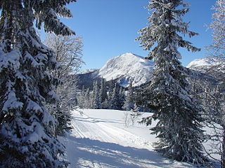
Norefjell is a mountain range in the Scandes Mountains system in Norway. It stretches between the valleys of Eggedal (west) and Hallingdal (east). It covers parts of the municipalities Flå, Sigdal, and Krødsherad, all in the county Buskerud.

Noresund is a small village in Krødsherad in the county of Buskerud, Norway.

Christian Skredsvig was a Norwegian painter and writer. He employed an artistic style reflecting naturalism. He is especially well known for his picturesque and lyrical depictions of the landscape.
Gbehlay-Geh District is one of 17 districts located in Nimba County, Liberia. In 2008, the population was 32,176.

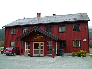
Prestfoss is the administrative center of Sigdal municipality in Buskerud, Norway.
Eggedal is a valley and parish in Buskerud county, Norway. It consisting of the northwestern half of the municipality of Sigdal.

The Gwa'Sala-Nakwaxda'xw Nations are a union of two Kwakwaka'wakw peoples in a band government based on northern Vancouver Island in British Columbia, Canada, whose main reserve community is near the town of Port Hardy in the Queen Charlotte Strait region of the Central Coast region of British Columbia, Canada. The band government is a member of the Kwakiutl District Council and, for treaty negotiation purposes, the Winalagalis Treaty Group which includes three other members of the Kwakiutl District Council.
The Malacca Banks are sandbanks (shoals) below the sea surface, in the Gulf of Khambhat in Gujarat, India. They lie to the west and southwest of the port of Surat and are a system of four irregular ridges running roughly from north to south parallel with the entrance channels to the Gulf. They extend from 21°10′00″N72°25′00″E to 20°20′00″N72°10′00″E.
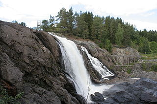
Simoa is the name of a river which flows through the municipalities of Sigdal and Modum in Buskerud County, Norway.
The Hartley Bay Indian Band, also known as the Hartley Bay First Nation, Hartley Bay Band, Gitga'at Nation and Gitga'at First Nation, is the band government of the Gitga'ata people of Hartley Bay, British Columbia, Canada.

Fimbulheimen is a mountain range in Queen Maud Land, Antarctica. It stretches from Jutulstraumen by 1° west of Carsten Borchgrevink Ice at 18° east, about 200 km from the ice edge. Fimbulheimen is thus between Maudheim Plateau and Sør-Rondane.
Yale First Nation is a First Nations government located at Yale, British Columbia. Yale has 16 distinct reserves stretching from near Sawmill Creek to American Creek, with the most southern reserve situated at Ruby Creek in the District of Kent.
Holmen Church is a parish church located at Prestfoss in Sigdal municipality, Buskerud county, Norway. Access to the church is via Fv133 and Rv287.
Spålen–Katnosa Nature Reserve is a nature reserve in Nordmarka, Norway.
The Saur Mountains is one of the mountain ranges in the Tian Shan system. An eastern extension of the Tarbagatai Mountains, it starts on the China-Kazakhstan border and continues east into China, where it forms the border between the Hoboksar Mongol Autonomous County and Jeminay County of Xinjiang.
Gbehlay-Geh District is one of 17 districts located in Nimba County, Liberia. In 2008, the population was 32,176.


