A polder is a low-lying tract of land that forms an artificial hydrological entity, enclosed by embankments known as dikes. The three types of polder are:
- Land reclaimed from a body of water, such as a lake or the seabed
- Flood plains separated from the sea or river by a dike
- Marshes separated from the surrounding water by a dike and subsequently drained; these are also known as koogs, especially in Germany

Wageningen is a municipality and a historic city in the central Netherlands, in the province of Gelderland. It is famous for Wageningen University, which specialises in life sciences. The municipality had a population of 39,635 in 2021, of which many thousands are students from over 150 countries.

Zeewolde is a municipality and a town in the Flevoland province in the central Netherlands. It has a population of approximately 22,000 (2017). It is situated in the polder of Flevoland with the small lake called the Wolderwijd to the east. To the south is a large deciduous forest called the Horsterwold. The area to the west is principally agricultural.

The northern lapwing, also known as the peewit or pewit, tuit or tewit, green plover, or pyewipe or just lapwing, is a bird in the lapwing subfamily. It is common through temperate Eurosiberia.

The Oostvaardersplassen is a nature reserve in the Netherlands, managed by the Staatsbosbeheer. Covering about 56 square kilometres (22 sq mi) in the province of Flevoland, it is an experiment in rewilding. It is in a polder created in 1968; by 1989, its ecological interest had resulted in its being declared a Ramsar wetland. It became part of Nieuw Land National Park when that was established in 2018.

Nickerie is a district of Suriname, on the north-west coast. Nickerie's capital city is Nieuw-Nickerie. Another town is Wageningen. The district borders the Atlantic Ocean to the north, the Surinamese district of Coronie to the east, the Surinamese district of Sipaliwini to the south and the region of East Berbice-Corentyne in Guyana to the west.

The Veluwe is a forest-rich ridge of hills (1100 km2) in the province of Gelderland in the Netherlands. The Veluwe features many different landscapes, including woodland, heath, some small lakes and Europe's largest sand drifts.

Aartswoud is a village in the Dutch province of North Holland, part of the municipality of Opmeer. It lies about twelve kilometres (7.5 mi) northeast of Heerhugowaard.

Flood control is an important issue for the Netherlands, as due to its low elevation, approximately two thirds of its area is vulnerable to flooding, while the country is densely populated. Natural sand dunes and constructed dikes, dams, and floodgates provide defense against storm surges from the sea. River dikes prevent flooding from water flowing into the country by the major rivers Rhine and Meuse, while a complicated system of drainage ditches, canals, and pumping stations keep the low-lying parts dry for habitation and agriculture. Water control boards are the independent local government bodies responsible for maintaining this system.
The Netherlands has several levels of administrative subdivisions. The first level of subdivision consists of 12 provinces. The second level of subdivision consists of 342 municipalities.

The Groene Hart is a relatively thinly populated area of the Netherlands covering much of the middle portion of the Randstad megalopolis. The major Dutch cities of Rotterdam, The Hague, Leiden, Haarlem, Amsterdam and Utrecht surround this area. Cities inside the Groene Hart include Zoetermeer, Alphen aan den Rijn, Gouda, Woerden and the smaller cities of Schoonhoven, Oudewater, Haastrecht, Nieuwkoop, Montfoort, Waddinxveen, Bodegraven and Boskoop.

Amsterdam, capital of the Netherlands, has more than 100 kilometers (62 mi) of grachten (canals), about 90 islands and 1,500 bridges. The three main canals, dug in the 17th century during the Dutch Golden Age, form concentric belts around the city, known as the Grachtengordel. Alongside the main canals are 1550 monumental buildings. The 17th-century canal ring area, including the Prinsengracht, Keizersgracht, Herengracht and Jordaan, were listed as UNESCO World Heritage Site in 2010, contributing to Amsterdam's fame as the "Venice of the North".

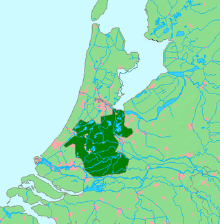
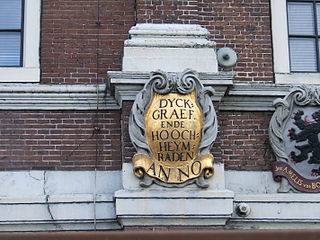
In the Netherlands, a water board, water council or water authority is a regional governing body solely charged with the management of surface water in the environment. Water boards are independent of administrative governing bodies like provinces and municipalities. In general, they are responsible for managing rivers and canals, issues with the flow of watercourses and drainage issues, water collection, flood and erosion prevention and provision of potable water. They manage polder systems, water levels, water barriers and locks, enforcements, water quality and sewage treatment in their respective regions. The concept of a coordinating "High Water Authority" (Hoogheemraadschap) originated in what now is the province of South Holland in the 12th century.

Duinen van Texel National Park is a national park located on the North Holland island of Texel in the Netherlands. All dune systems on the western side of the island and the large coastal plains on both the northern and southern points of the island are part of the park. The park covers approximately 43 km2 (17 sq mi) and attained national park status in 2002. The visitor center is located in the natural history museum Ecomare.

Housing more than 200 resident and wintering bird species, Chennai has long been a haven for bird watchers. It is the one of the few urban areas in India with diverse range of birds including greater flamingo, black baza, osprey, Indian eagle-owl, Coppersmith barbet, Spot billed pelican and pied avocet can be seen. The following are some known birding hotspots in and around Chennai.

In the Netherlands, the bordering lakes are a chain of lakes which separate the Flevopolder and Noordoostpolder from the ancient lands of the provinces of Gelderland, Utrecht, Overijssel and Friesland.
The Shannon Callows are areas of flat land along the shores of the River Shannon. These areas lie between Athlone in County Westmeath, where the river flows out of Lough Ree, and Portumna in County Galway, where it enters Lough Derg, in central Ireland. The shallow grade of the river here results in occasional flooding of the Callows.

Bourgoyen-Ossemeersen is a nature reserve on the outskirts of the Belgian city of Ghent. It lies mainly in the district of Mariakerke and covers 230 hectares. It mostly consists of wet, often flooded, meadows interspersed with ditches and canals, and is an important wintering area for water birds. It acts as a buffer zone between the city and the R4 ring road's noise-reducing barriers have been erected to lessen the road's impact on the wildlife.

Land reclamation in the Netherlands has a long history. As early as in the 14th century, the first reclaimed land had been settled. Much of the modern land reclamation has been done as a part of the Zuiderzee Works since 1919.

Pekel A (also Pekel Aa; Dutch pronunciation: [ˈpeːkəl aː]) is a river in the Province of Groningen in the Netherlands. The villages of Oude Pekela and Nieuwe Pekela have been named after the river. The name translates to Brine (Pekel) River (A), and used to flow from the Dollart into a large raised bog. The Dollart was poldered from the 15th century until 1924, and the river now has its source at the confluence with the Westerwoldsche Aa at De Bult. The river was canalised and extended. The part from Oude Pekela to Stadskanaal was renamed Pekelderdiep. From 1599 until 1810, the area through which the river flowed, was a peat colony. In the 20th century, the Pekel A was a heavily polluted river, but it has been cleaned up since the 1970s.


