
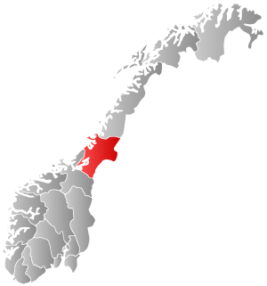
Nesset is a municipality in Møre og Romsdal county, Norway on the Romsdal Peninsula. The administrative centre is the village of Eidsvåg. Other population centers include Rausand, Boggestranda, Myklebostad, Eresfjord, and Eikesdalen.

Verdalsøra is a town in the municipality of Verdal in Trøndelag county, Norway. The town is the administrative center of the municipality. It is located along the Trondheimsfjord at the mouth of the river Verdalselva. The village of Vinne lies 4 kilometres (2.5 mi) to the southeast, Trones lies about 5 kilometres (3.1 mi) to the north, the villages of Forbregd/Lein lie about 4 kilometres (2.5 mi) to the northeast, and the village of Stiklestad lies about 3 kilometres (1.9 mi) to the east. In 1998, the municipal council of Verdal voted to grant the urban area of Verdalsøra town status under the laws of Norway.
Momarka is a village in the municipality of Levanger in Trøndelag county, Norway. It is located just south of the town of Levanger. The Nordlandsbanen railway line and the European route E6 highway both run through the village. Since 2002, Momarka has been considered a part of the town of Levanger urban area so separate population statistics are no longer tracked.
Sunnan or Sundan is a village in the municipality of Steinkjer in Trøndelag county, Norway. It is located in the area between the lakes Snåsavatnet and Fossemvatnet about 10 kilometres (6.2 mi) northeast of the town of Steinkjer. The village of Følling lies about 4 kilometres (2.5 mi) to the west and the village of Binde lies about 4 kilometres (2.5 mi) to the east.
Mule is a village in the municipality of Levanger in Trøndelag county, Norway. The village area is located at the intersection of Norwegian County Road 774 and European route E6, about 4 kilometres (2.5 mi) east of the town of Levanger. The Nordlandsbanen railway line also runs through Mule. The village has a school and a daycare centre.
Frol is a former municipality in the old Nord-Trøndelag county, Norway. The 140-square-kilometre (54 sq mi) municipality existed from 1856 until its dissolution in 1962. The municipality was first known as Levanger landsogn and then in 1911 the name was changed to Frol. The municipality included all the area surrounding the town of Levanger in what is now the municipality of Levanger in Trøndelag county.
Skogn is a village in Levanger municipality in Trøndelag county, Norway. The village is located on the eastern shore of the Trondheimsfjorden, about 8 kilometres (5.0 mi) southwest of the town of Levanger. The European route E06 highway runs through the village, just past the Fiborgtangen industrial area located along the shore. There is a Norske Skog Skogn paper mill at Fiborgtangen. The Nordlandsbanen railway line stops in the village at Skogn Station.

Ekne is a village in the municipality of Levanger in Trøndelag county, Norway. It is located 8 kilometres (5.0 mi) west of the village of Skogn and about 15 kilometres (9.3 mi) southwest of the town of Levanger. The lakes Sønningen and Byavatnet lie south of the village. Ekne Church is located in this village. The World War II-era Falstad concentration camp was also located here.

HiNT station, formally known as Røstad station, is a railway station located in the town of Levanger in the municipality of Levanger in Trøndelag county, Norway. It is located on the Nordland Line. The station gets its name from being located just beside the Nord-Trøndelag University College campus at Røstad as well as the Norwegian Food Safety Authority.

Møre og RomsdalUrban East Norwegian: [²møːrə ɔ ˈrʊmsdɑːl](listen) is a county in the northernmost part of Western Norway. It borders the counties of Trøndelag, Oppland, and Sogn og Fjordane. The county administration is located in the town of Molde, while Ålesund is the largest town. The county is governed by the Møre og Romsdal County Municipality which includes an elected county council and a county mayor. The national government is represented by the county governor.

Nord-Trøndelag was a county constituting the northern part of the present-day Trøndelag county in Norway. The county was established in 1804 when the old Trondhjems amt was divided into two: Nordre Trondhjems amt and Søndre Trondhjems amt. In 2016, the two county councils voted to merge (back) into a single county on 1 January 2018.

Inntrøndelag District Court is the district court serving the Inntrøndelag region in Trøndelag county, Norway. This court serves the municipalities of Steinkjer, Inderøy, Snåsa, Verran, Verdal, Levanger, Frosta, Stjørdal, Meråker, and Namdalseid.

Ytterøya is an island in the Trondheimsfjord in the municipality of Levanger in Trøndelag county, Norway. The 15-kilometre (9.3 mi) long island has an area of 27.8 square kilometres (10.7 sq mi) has about 600 residents. The highest point is the 210-metre (690 ft) tall Sanstadkammen. The island has good agricultural land and has settlements across the whole island. The Levanger–Hokstad Ferry connects the village of Hokstad on the island to the town of Levanger on the mainland. Ytterøy Church is located on the island.

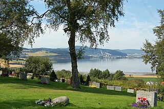
Alstadhaug is a parish and small village in the municipality of Levanger in Trøndelag county, Norway. The name, which can be traced back to prehistoric times, is derived from the farm of Alstadhaug, located next to the Alstadhaug Church. The farm and church are both located on top of a hill overlooking great parts of Levanger and the Trondheimsfjord region. The etymology of Alstadaug is reflected by this, simply meaning a hill from which you can see "all places". It is located northeast of the village of Skogn, south of the village of Nesset, and west of the village of Momarka.

Levanger is a town and the administrative center of Levanger Municipality in Trøndelag county, Norway. The town is located along the eastern shore of the Trondheimsfjorden, at the mouth of the river Levangselva. The town is located about half-way between the towns of Steinkjer and Stjørdalshalsen. Prior to 1962, the town of Levanger and its immediate vicinity was its own municipality.

Åsen is a former municipality in the old Nord-Trøndelag county, Norway. The 140-square-kilometre (54 sq mi) municipality existed from 1838 until its dissolution in 1962. The municipality was located to the southwest part of what is now Levanger municipality in Trøndelag county, roughly bordered in the north by the lakes Hammervatnet and Hoklingen, and by the Åsenfjorden to the west. The administrative centre was the village of Åsen.
Skogn is a former municipality in the old Nord-Trøndelag county, Norway. The 340-square-kilometre (130 sq mi) municipality existed from 1838 until its dissolution in 1962. The municipality was located to the south and southwest of the town of Levanger in what is now Levanger municipality in Trøndelag county. The administrative centre was the village of Skogn.


