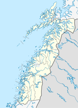
Nordland is a county in Norway in the Northern Norway region, bordering Troms in the north, Trøndelag in the south, Norrbotten County in Sweden to the east, Västerbotten County to the southeast, and the Atlantic Ocean to the west. The county was formerly known as Nordlandene amt. The county administration is in Bodø. The remote Arctic island of Jan Mayen has been administered from Nordland since 1995.

Bindal is a municipality in the Helgeland region in the extreme southwest part of Nordland county, Norway. The administrative centre is the village of Terråk. Other villages include Bindalseidet, Holm, Vassås, Horsfjord and Åbygda.

Brønnøy is a municipality in Nordland county, Norway. It is part of the Helgeland region. The administrative centre and commercial centre of the municipality is the town of Brønnøysund. A secondary centre is the village of Hommelstø. Other villages include Tosbotn, Lande, Trælnes, and Indreskomo.
Vega is a municipality in Nordland county, Norway. It is part of the Helgeland traditional region. The administrative centre of the municipality is the village of Gladstad. Other villages include Holand and Ylvingen.

Herøy is a municipality in Nordland county, Norway. It is part of the Helgeland traditional region. The administrative centre of the municipality is the village of Silvalen. The municipality is located about 15 kilometres (9.3 mi) west of the town of Sandnessjøen.

Dønna is a municipality in Nordland county, Norway. It is part of the Helgeland region. The administrative centre of the island municipality is the village of Solfjellsjøen. Other villages include Bjørn, Dønnes, Hestad, Sandåker, and Vandve. The main island of Dønna is connected to the neighboring municipality of Herøy to the south by the Åkviksundet Bridge.

Nesna is a municipality in Nordland county, Norway. It is part of the Helgeland traditional region. The administrative centre of the municipality is the village of Nesna. Other villages in Nesna include Handnesneset, Husby, Saura, and Vikholmen.
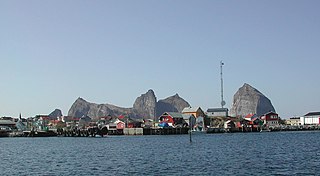
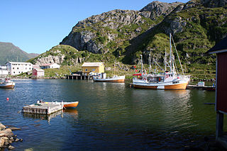
Træna is a municipality in Nordland county, Norway. It is part of the Helgeland traditional region. The administrative centre of the municipality is the island/village of Husøya. Other population centres include Selvær and Sanna.
Bø is a municipality in Nordland county, Norway. It is part of the Vesterålen region. The administrative centre of the municipality is the village of Straume. Other villages in the municipality include Auvåg, the village of Bø, Eidet, Guvåg, Hovden, Klakksjorda, Malnes, Nykvåg, Utskor, and Vågen. The Litløy Lighthouse is located on the tiny island of Litløya off the coast of Bø.

Andøy is the northernmost municipality in Nordland county, Norway. It is part of the Vesterålen archipelago. The main island in the municipality is Andøya. The administrative centre of the municipality is the village of Andenes. Other villages in the municipality include Bjørnskinn, Bleik, Dverberg, Fiskenes, Fornes, Nordmela, Risøyhamn, Skarstein, Å, Åknes, and Åse.
Nesøya is a small island in the municipality of Asker, Norway. It is linked to the mainland via a bridge.

Solbjørnvatnet is a lake in Flakstad Municipality in Nordland county, Norway. The 5.02-square-kilometre (1.94 sq mi) lake is located on the northern part of the island of Moskenesøya, less than 900 metres (3,000 ft) west of the European route E10 highway. The mountain Klokktinden lies on the southern shore of the lake.

The Flatvaer Islands, also known as the Ongul Islands, are a group of small islands lying at the east side of the entrance of Lützow-Holm Bay, 4 km from the coastline of Antarctica. They were mapped by Norwegian cartographers from air photos taken by the Lars Christensen Expedition (LCE), 1936–37. Many of the islands and their features were subsequently named by members of the Japanese Antarctic Research Expedition (JARE); unless otherwise noted, features noted in this article were named by JARE.

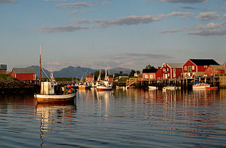
Selvær is an island and fishing village in the municipality of Træna in Nordland county, Norway. It is located about 10 kilometres (6.2 mi) northeast of the main island of Husøya and about 16 kilometres (9.9 mi) west of the island of Nesøya. The 70 or so residents on the island make their living by fishing or fishing-related fields. Historically, there was also some farming done on the island. The only access to Selvær is by a public ferry from Husøya or by personal boats. There are about 55 residents on the island.

Storselsøya is an island in Nordland county, Norway. The island is divided between two municipalities: Rødøy in the north and Lurøy in the south. The island of Nesøya lies to the west, the island of Lurøya lies to the south, and the mainland village of Tonnes lies to the east.

Tenna or Kinnarøya is an island in the municipality of Herøy in Nordland county, Norway. The island has an area of 3.5 square kilometers (1.4 sq mi). It is traversed by Norwegian County Road 161, which also connects it to the neighboring island of Sør-Herøy, crossing Tennsundet over the Tennsund Bridge. To the south lies Andøysundet. The Husvær islands lie to the southwest of Tenna; they are connected to Tenna by a ferry.