Nordland is a county in Norway in the Northern Norway region, bordering Troms in the north, Trøndelag in the south, Norrbotten County in Sweden to the east, Västerbotten County to the southeast, and the Atlantic Ocean to the west. The county was formerly known as Nordlandene amt. The county administration is in Bodø. The remote Arctic island of Jan Mayen has been administered from Nordland since 1995.
Træna is a municipality in Nordland county, Norway. It is part of the Helgeland traditional region. The administrative centre of the municipality is the island/village of Husøya. Other population centres include Selvær and Sanna.

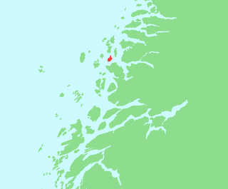
Meløy is a municipality in Nordland county, Norway. It is part of the Salten traditional region. The administrative centre of the municipality is the village of Ørnes. Other villages include Eidbukta, Neverdal, Glomfjord, Halsa, Reipå, Støtt, and Ågskardet.

Helgeland is the most southerly district in Northern Norway. Generally speaking, Helgeland refers to the part of Nordland county that is located south of the Arctic Circle. It is bordered in the north by the Saltfjellet mountains and Svartisen glacier, which form a natural border with the Salten district. In the south, Helgeland borders Trøndelag county.

Gjerøy or Gjerdøya is an island in the municipality of Rødøy in Nordland county, Norway. It is located in a group of islands located west of the peninsula between the Tjongsfjorden and Melfjorden. It lies south of the island of Rødøya, north of the island of Rangsundøya, and west of the island of Renga. The main village on the island is called Gjerøy. The 9.3-square-kilometre (3.6 sq mi) island has a population (2016) of 87 people. There is regular ferry service to Gjerdøya from the mainland and to the islands surrounding it.

Tonnes is a village in Lurøy Municipality in Nordland county, Norway. It is located on the mainland coast, about 100 kilometres (62 mi) northwest of the town of Mo i Rana. It lies on a peninsula in the far northern edge of the municipality, to the north of the islands of Aldra and Lurøya, east of Storselsøya, and south of Rangsundøya.

Oldervika or Oldervik is a village in the municipality of Rødøy in Nordland county, Norway. The village is located on the eastern shore of the Sørfjorden, just north of the village of Sørfjorden. Although it is located on the mainland, there are no road connections to the rest of Norway. It has a ferry connection to Kilboghamn to the west and Jektvika to the north.

Saltfjellet is a mountain area in Nordland county, Norway that separates the two regions of Helgeland and Salten. It is also a cultural border between the Southern and Central parts of Sápmi.
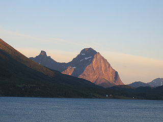
Blokktinden or Blokktind is a mountain in the municipality of Rødøy in Nordland county, Norway. It is located on the southern side of Tjongsfjorden, across from the village of Tjong. The summit has a good view of the Svartisen glacier and the coastal islands.
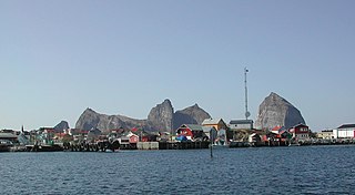
Ågskardet is a village in the municipality of Meløy in Nordland county, Norway. It is located on the southern side of the Holandsfjorden, about 3.5 kilometres (2.2 mi) north of the village of Tjong. There were 127 inhabitants in 2008.
Stokkvågen is a village and ferry port located in Lurøy Municipality in Nordland county, Norway. The village lies on the mainland coast of Lurøy, about 60 kilometres (37 mi) west of the town of Mo i Rana. The port has ferries that connect the mainland to the islands of Onøya, Lovund, Sleneset/Moflag, and Træna to the west and to the town of Sandnessjøen to the south. The village of Stokkvågen is located along Norwegian County Road 17, along the Sjona fjord.
Haugland is a village in the municipality of Lurøy in Nordland county, Norway. The village is located on the mainland coast, along the Aldersundet strait between the mainland and the island of Aldra. Norwegian County Road 17 passes through the village. Aldersund Church is located in Haugland, and it serves the eastern part of the municipality.

Nesøya is an island in Nordland county, Norway. The 14.5-square-kilometre (5.6 sq mi) island is located on the border of the municipalities of Rødøy and Lurøylies to the west of the island Storselsøya. The 254-metre (833 ft) tall Nordfjellet mountain is the highest point on the island. The Arctic Circle passes just south of the island. In 2016, there were 126 residents living on the island, which is only accessible by boat.

Rødøya is an island in the municipality of Rødøy in Nordland county, Norway. The 8.5-square-kilometre (3.3 sq mi) island is located just west of the mouth of the Tjongsfjorden, north of the island of Gjerdøya, and west of the mainland. There are ferry connections from the village of Rødøy to the village of Jektvika on the mainland and to the nearby island of Gjerdøya. Rødøy Church is located in the village of Rødøy on the south side of the island. The island had 150 residents in 2017.
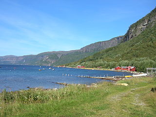
Tjongsfjorden is a fjord in the municipality of Rødøy in Nordland county, Norway. The 17-kilometre (11 mi) long fjord begins just west of the Svartisen glacier and flows west and flows into the Rødøyfjorden, just east of the island of Rødøya. The mountain Blokktinden lies on the southern shore of the fjord. The villages of Tjong and Vågaholmen lie along the northern shore of the fjord. Norwegian County Road 17 runs along the inner part of the fjord.
Melfjordbotn or Melfjorden is a village in Rødøy Municipality in Nordland county, Norway. The village is located at the eastern end of the Melfjorden, southwest of the Svartisen glacier. The Saltfjellet–Svartisen National Park lies about 7 kilometres (4.3 mi) north of the village.
Rangsundøya or Rangsundøy is an island in Rødøy Municipality in Nordland county, Norway. The 7.6-square-kilometre (2.9 sq mi) island of Rangsundøya is located off the Helgeland coast in a large group of islands. The island of Gjerdøya lies to the north, Storselsøya lies to the southwest, Renga to the northeast, and the mainland is to the south and east. The highest point on the island is the 267-metre (876 ft) tall mountain Rangsundtinden.

Dønna is the largest island in Dønna Municipality in Nordland county, Norway. The 138-square-kilometre (53 sq mi) island lies off the west coast of the mainland of Helgeland, Norway. The islands of Løkta and Tomma lie northeast of the island, the islands of Vandve and Åsvær lie to the west, and the islands of Herøy and Alsta lie to the south.