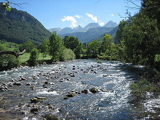
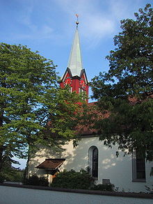
Unterwasser is a village in the Toggenburg region of the canton of St. Gallen, Switzerland, situated at the confluence of the two streams forming the upper Thur. Formerly part of Wildhaus municipality, it has since 2010 been part of Wildhaus-Alt St. Johann by merger of Wildhaus and Alt St. Johann. It is a relatively small ski resort, and many of its trails are shared with nearby Wildhaus.

Thalheim an der Thur is a municipality in the district of Andelfingen in the canton of Zürich in Switzerland.

Thur is a 131-kilometre-long (81 mi) river in north-eastern Switzerland. Its source is near the mountain Säntis in the south-east of the canton of St. Gallen. In this canton it flows through the Toggenburg region and the town Wil. After Wil it flows through the canton of Thurgau and its capital Frauenfeld. The final 19 kilometres (12 mi) of the Thur are in the canton of Zürich. It flows into the river Rhine on the border with Germany, south of Schaffhausen.

Toggenburg is a region of Switzerland. It corresponds to the upper valley of the river Thur and that of its main tributary, the Necker. Since 1 January 2003, Toggenburg has been a constituency (Wahlkreis) of the canton of St. Gallen.

Schönenberg-Kübelberg is an Ortsgemeinde – a municipality belonging to a Verbandsgemeinde, a kind of collective municipality – in the Kusel district in Rhineland-Palatinate, Germany. It belongs to the Verbandsgemeinde Oberes Glantal, and is its seat. The municipality was formed on 7 June 1969 in the course of administrative restructuring in Rhineland-Palatinate out of the former municipalities and outlying centres of Schönenberg, Kübelberg, Schmittweiler and Sand. The centres have melded together since then and now stand as an economic hub for the southern Kusel district. By population, Schönenberg-Kübelberg is the Kusel district's biggest municipality. It is also a state-recognized tourism community.
Horgen District is a district of Canton of Zürich in Switzerland. The district is located in the Zimmerberg and Sihl Valley region; its capital is the town of Horgen. The district consists of 11 municipalities and has a population of 124,110 and an area of 104.16 km2 (40.22 sq mi).

Kradolf-Schönenberg is a municipality in Weinfelden District in the canton of Thurgau in Switzerland.

Altikon is a municipality in the district of Winterthur in the canton of Zürich in Switzerland.

Ellikon an der Thur is a municipality in the district of Winterthur in the canton of Zürich in Switzerland.

Schönenberg is a former municipality in the district of Horgen in the canton of Zürich in Switzerland. On 1 January 2019 the former municipalities of Hütten and Schönenberg merged into the municipality of Wädenswil.

Surcuolm is a village in the municipality of Mundaun in the district of Surselva in the canton of Graubünden in Switzerland. In 2009 Surcuolm merged with Flond to form the municipality of Mundaun.

Amlikon is a village and former municipality in the canton of Thurgau, Switzerland.

Sihl Valley is a river valley and belongs to the Zimmerberg-Sihltal region located in the district of Horgen in the canton of Zurich, Switzerland. Commonly Sihltal is used as the name of the Lower Sihl Valley, i.e. the area in the southwest of the city of Zürich.

Wyden castle is a castle in the municipality of Ossingen of the Canton of Zurich in Switzerland. It is a Swiss heritage site of regional significance.

Bütschwil-Ganterschwil is a municipality in the Wahlkreis (constituency) of Toggenburg in the canton of St. Gallen in Switzerland. On 1 January 2013 the former municipalities of Bütschwil and Ganterschwil merged to form the new municipality of Bütschwil-Ganterschwil.
Karl Meier was a Swiss actor influential in the European LGBT social movement. He was a member of the socially active Cabaret Cornichon company, and editor for the gay magazine Der Kreis, which he edited under the pen name "Rolf".


