Neutal

Last updated
Neutal
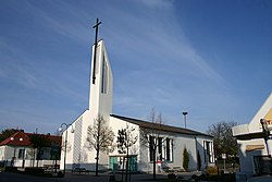
Neutal Kirche.jpg
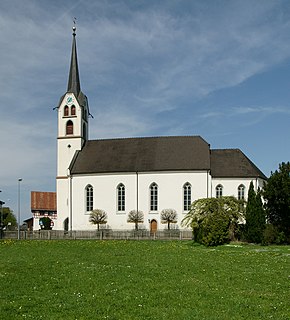
Saint Mary's Church
AUT Neutal COA.svg
Coat of arms
Austria adm location map.svg
Red pog.svg
Neutal
Location within Austria
Coordinates: 47°33′N16°27′E / 47.550°N 16.450°E / 47.550; 16.450 Coordinates: 47°33′N16°27′E / 47.550°N 16.450°E / 47.550; 16.450
Country Austria
State Burgenland
District Oberpullendorf
Government
   Mayor Erich Trummer (SPÖ)
Area
  Total11.6 km2 (4.5 sq mi)
Elevation
274 m (899 ft)
Population
(1 January 2016) [1]
  Total1,087
  Density94/km2 (240/sq mi)
Time zone UTC+1 (CET)
  Summer (DST) UTC+2 (CEST)
Postal code
7343
Website www.neutal.at

Neutal (Croatian : Najtolj, Hungarian : Sopronújlak, Nyujtál) is a town in the district of Oberpullendorf in the Austrian state of Burgenland.

Croatian language South Slavic language

Croatian is the standardized variety of the Serbo-Croatian language used by Croats, principally in Croatia, Bosnia and Herzegovina, the Serbian province of Vojvodina, and other neighboring countries. It is the official and literary standard of Croatia and one of the official languages of the European Union. Croatian is also one of the official languages of Bosnia and Herzegovina and a recognized minority language in Serbia and neighboring countries.

Hungarian language language spoken in and around Hungary

Hungarian is a Finno-Ugric language spoken in Hungary and parts of several neighbouring countries. It is the official language of Hungary and one of the 24 official languages of the European Union. Outside Hungary it is also spoken by communities of Hungarians in the countries that today make up Slovakia, western Ukraine (Subcarpathia), central and western Romania (Transylvania), northern Serbia (Vojvodina), northern Croatia and northern Slovenia. It is also spoken by Hungarian diaspora communities worldwide, especially in North America and Israel. Like Finnish and Estonian, Hungarian belongs to the Uralic language family. With 13 million speakers, it is the family's largest member by number of speakers.
Austria Federal republic in Central Europe

Austria, officially the Republic of Austria, is a country in Central Europe comprising 9 federated states. Its capital, largest city and one of nine states is Vienna. Austria has an area of 83,879 km2 (32,386 sq mi), a population of nearly 9 million people and a nominal GDP of $477 billion. It is bordered by the Czech Republic and Germany to the north, Hungary and Slovakia to the east, Slovenia and Italy to the south, and Switzerland and Liechtenstein to the west. The terrain is highly mountainous, lying within the Alps; only 32% of the country is below 500 m (1,640 ft), and its highest point is 3,798 m (12,461 ft). The majority of the population speaks local Bavarian dialects as their native language, and German in its standard form is the country's official language. Other regional languages are Hungarian, Burgenland Croatian, and Slovene.

Population

Historical population
YearPop.±%
1869759    
1880885+16.6%
18901,036+17.1%
1900996−3.9%
19101,116+12.0%
19231,124+0.7%
19341,311+16.6%
19391,126−14.1%
19511,153+2.4%
19611,088−5.6%
19711,061−2.5%
19811,078+1.6%
19911,085+0.6%
20011,027−5.3%
20111,036+0.9%

Related Research Articles

Horn, Austria Place in Lower Austria, Austria

Horn is a small town in the Waldviertel in Lower Austria, Austria and the capital of the district of the same name.

Alberschwende Place in Vorarlberg, Austria

Alberschwende is a municipality in the district of Bregenz in the Austrian state of Vorarlberg.

Wolfurt Place in Vorarlberg, Austria

Wolfurt is a municipality in the western Austrian state of Vorarlberg.

Schwarzach, Vorarlberg Place in Vorarlberg, Austria

Schwarzach is a municipality in the Austrian state of Vorarlberg.

Satteins Place in Vorarlberg, Austria

Satteins is a town in the Austrian state of Vorarlberg.

Vandans Place in Vorarlberg, Austria

Vandans is a town located in the Bludenz district in the Austrian state of Vorarlberg. Located 650 m (2133 ft) above sea level, it is known for its skiing and hiking activities.

Warth, Vorarlberg Place in Vorarlberg, Austria

Warth is a municipality in the district of Bregenz in the Austrian state of Vorarlberg.

Innerbraz Place in Vorarlberg, Austria

Innerbraz is a municipality in the district of Bludenz in the Austrian state of Vorarlberg.

Klösterle, Austria Place in Vorarlberg, Austria

Klösterle is a municipality in the district of Bludenz in the Austrian state of Vorarlberg.

Nüziders Place in Vorarlberg, Austria

Nüziders is a municipality in the district of Bludenz in the Austrian state of Vorarlberg. It was capital of the historical County of Sonnenberg which is referred to in the formal style of the Emperor of Austria.

Stallehr Place in Vorarlberg, Austria

Stallehr is a municipality in the district of Bludenz in the Austrian state of Vorarlberg.

Fußach Place in Vorarlberg, Austria

Fußach is a municipality in the district of Bregenz in the Austrian state of Vorarlberg.

Gaißau Place in Vorarlberg, Austria

Gaißau is a municipality in the district of Bregenz in the Austrian state of Vorarlberg.

Höchst, Austria Place in Vorarlberg, Austria

Höchst is a municipality in the district of Bregenz in the Austrian state of Vorarlberg.

Klaus, Vorarlberg Place in Vorarlberg, Austria

Klaus is a municipality in the district of Feldkirch in the Austrian state of Vorarlberg.

Röthis Place in Vorarlberg, Austria

Röthis is a municipality in the district of Feldkirch in the Austrian state of Vorarlberg.

Sulz, Vorarlberg Place in Vorarlberg, Austria

Sulz is a municipality in the district of Feldkirch in the Austrian state of Vorarlberg.

Übersaxen Place in Vorarlberg, Austria

Übersaxen is a municipality in the district of Feldkirch in the Austrian state of Vorarlberg.

Altschwendt Place in Upper Austria, Austria

Altschwendt is a municipality in the district of Schärding in the Austrian state of Upper Austria.

Bad Waltersdorf Place in Styria, Austria

Bad Waltersdorf is a municipality in the district of Hartberg-Fürstenfeld in Styria, Austria.

References