
Palmyra is a village in Wayne County, New York, United States. The population was 3,536 at the 2010 census. The village, along with the town, is named after Palmyra in present-day Syria.

Colliers is a town on the Avalon Peninsula in Newfoundland and Labrador, Canada. It is in Division 1 on Conception Bay.

A single-point urban interchange, also called a single-point interchange (SPI) or single-point diamond interchange (SPDI), is a type of highway interchange. The design was created in order to help move large volumes of traffic through limited amounts of space safely and efficiently.
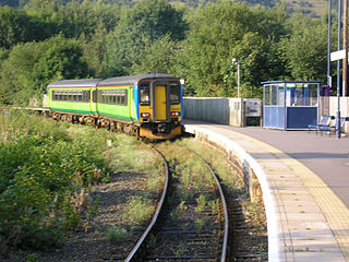
Ambergate railway station is a railway station owned by Network Rail and managed by East Midlands Railway. It serves the village of Ambergate in Derbyshire, England. The station is located on the Derwent Valley Line from Derby to Matlock, which diverges from the Midland Main Line just south of the station at Ambergate Junction.
The A5124 is a road in Shropshire, England, that forms part of the northern section of the Shrewsbury by-pass. It is better known locally as the Battlefield Link Road.
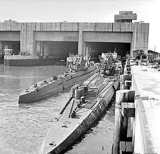
A submarine pen is a type of submarine base that acts as a bunker to protect submarines from air attack. The term is generally applied to submarine bases constructed during World War II, particularly in Germany and its occupied countries, which were also known as U-boat pens.
The Barnsley and District Electric Traction Co was an electric tramway network serving the town of Barnsley, South Yorkshire.

The A498 is a 16-mile road between Pen-y-Gwryd and Porthmadog in North Wales.
A roundabout interchange is a type of interchange between a controlled access highway, such as a motorway or freeway, and a minor road. The slip roads to and from the motorway carriageways converge at a single roundabout, which is grade-separated from the motorway lanes with bridges.

The Elan aqueduct crosses Wales and the Midlands of England, running eastwards from the Elan Valley Reservoirs in Mid Wales to Birmingham's Frankley Reservoir, carrying drinking water for Birmingham.

A seagull intersection or continuous green T-intersection is a type of three-way road intersection, usually used on high traffic volume roads and dual carriageways. This form of intersection is popular in Australia and New Zealand, and sometimes used in the United States and other countries.
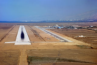
Persian Gulf Airport is an airport in Assaluyeh, Iran.

Cynthia is a hamlet in central Alberta, Canada within Brazeau County. It is located approximately 37 kilometres (23 mi) south of Highway 16 and 131 kilometres (81 mi) southwest of Edmonton.

The Russky Bridge is a cable-stayed bridge in Vladivostok, Primorsky Krai, Russia. The bridge connects the Russky Island and the Muravyov-Amursky Peninsula sections of the city across the Eastern Bosphorus strait, and with a central span of 1,104 metres it is the longest cable-stayed bridge in the world. The Russky Bridge was originally built to serve the 2012 Asia-Pacific Economic Cooperation conference hosted at the Far Eastern Federal University campus on Russky Island. It was completed in July 2012 and opened by Prime Minister Dmitry Medvedev, and on September 3, 2012, the bridge was officially given its name.

Louise McKinney Riverfront Park or Louise McKinney Park is a municipal park in Edmonton, Alberta, Canada, that is part of the North Saskatchewan River valley parks system, and serves as the gateway park, with paved paths leading from it to everywhere in the parks system. The Cloverdale Pedestrian Bridge crossed the North Saskatchewan River connecting Louise McKinney Park to the Henriatta Louise Edwards Park and the Edmonton Queen attraction. The park is the closest to the downtown Edmonton area. The park also serves as a link in the trans-Canadian trail system.
The Tasakili River is a tributary of the Stikine River, flowing southeast out of the Boundary Ranges on the United States side of the range to join that river in Canada, just before the Stikine transits the Alaska-British Columbia border.

Wilmington is an industrial area east of the River Hull in Kingston upon Hull, England.

Division No. 1, Subdivision G is an unorganized subdivision on the Avalon Peninsula in Newfoundland and Labrador, Canada. It is in Division 1 and contains the unincorporated communities of Baccalieu Island, Besom Cove, Bradley's Cove, Burnt Point, Caplin Cove, Daniel's Cove, Grates Cove, Gull Island, Job's Cove, Kingston, Long Beach, Lower Island Cove, Low Point, Northern Bay, Ochre Pit Cove, Red Head Cove, Riverhead, Smooth Cove and Western Bay.
