
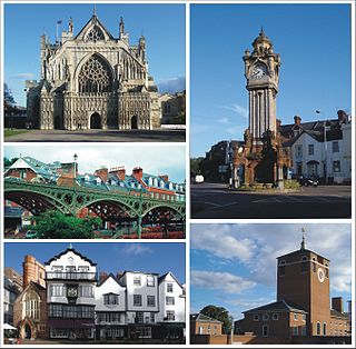
Newcourt is a suburb of Exeter and Topsham in Devon, England, located between Digby and Topsham. It has a railway station and forms part of the electoral ward of Topsham. [1] Other local amenities include a school and a community centre. [2] [3]
Newcourt is a suburb of Exeter and Topsham in Devon, England, located between Digby and Topsham. It has a railway station and forms part of the electoral ward of Topsham. [1] Other local amenities include a school and a community centre. [2] [3]
During World War II, much of the land at Newcourt was used as a US Navy Supply Depot due to the strong transport links of Exeter. [4] This facility was instrumental in the Normandy landings. In 2010, Exeter City Council produced a masterplan for Newcourt to include provisions for 3,500 homes to be built by 2026. [5]
The Exeter Ship Canal, also known as the Exeter Canal is a canal leading from the River Exe to Exeter Quay in the city of Exeter, Devon, England. It was first constructed in the 1560s predating the "canal mania" period and is one of the oldest artificial waterways in the UK.

Wood Wharf is a 23 acre site in Canary Wharf, London. It is currently under construction to provide offices, residential homes and retail space. The site is next to Canary Wharf. Wood Wharf will contain 5 million square feet of space, which will include 2 million sq ft of office space, 3,330 residential homes, 3.6 hectares of public spaces, and 380,000 sq ft of shops, restaurants and space for community use. It is estimated to be completed in 2023.
The Avocet Line is the railway line in Devon, England connecting Exeter with Exmouth. It was originally built by the London and South Western Railway, and was historically known as the Exmouth branch railway. The line follows the Exe Estuary for about half of its route, from just outside Topsham to Exmouth, giving views of the estuary. The line is named after the pied avocet, which lives in the estuary.

Isca Dumnoniorum, also known simply as Isca, was originally a Roman legionary fortress for the Second Augustan Legion in the Roman province of Britannia at the site of present-day Exeter in Devon.

East Devon is a constituency represented in the House of Commons of the UK Parliament since 2019 by Simon Jupp of the Conservative Party.

Exeter is a constituency composed of the cathedral city and county town of Devon represented in the House of Commons of the UK Parliament. The constituency has had a history of representatives from 1900 of Conservative, Liberal Party, Independent and Labour representation.

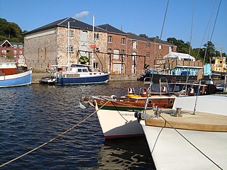
Topsham is a town in Devon, England, located on the east side of the River Exe, immediately north of its confluence with the River Clyst and the former's estuary, between Exeter and Exmouth. Topsham is a historic port and was designated a town by a 1300 royal charter granted by Edward I; it was formally amalgamated into the City of Exeter in 1966. The population of the town, recorded at the 2021 census, is 4,146.

Topsham railway station is the railway station serving the town of Topsham in the English county of Devon. It is the passing place for the otherwise single-track branch line from Exmouth Junction to Exmouth. Both the loop and adjacent level crossing are remotely worked from the signal box at Exmouth Junction.

Exeter Science Park is an English centre of activity for businesses in science, technology, engineering, maths and medicine (STEMM).
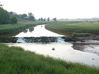
The River Clyst is a river of Devon, England. The name derives from Old English, and translates as Clean-stream. The river lends its name to several settlements on its route, Clyst Honiton, Clyst St Lawrence, Clyst St George, and Broadclyst. The William part of Clyst William derives from the Old English of aewelm, which means river source.

Countess Wear is a district within the city of Exeter, Devon, England. It lies about two miles south-east of the city centre, on the north bank of the estuary of the River Exe. Historically an estate known as Weare, part of the manor of Topsham, was in this area. From the late 13th century, the construction of weirs in the River Exe by the Countess, and later, the Earls of Devon damaged the prosperity of Exeter to the benefit of Topsham which was downstream of the obstructions, and was owned by the Earls.
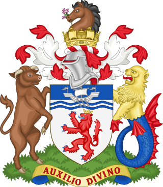
Devon County Council is the county council administering the English county of Devon. Based in the city of Exeter, the council covers the non-metropolitan county area of Devon. Members of the council (councillors) are elected every four years to represent the electorate of each county division, almost all being nominated by the major national political parties.
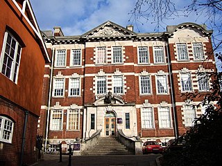
Exeter College of Art and Design was an art college based in Exeter, Devon. Founded in 1854, it amalgamated with what would become Plymouth University in 1989.
Exeter is a cathedral city and the county town of Devon, South West England. It is situated on the River Exe, approximately 36 mi (58 km) northeast of Plymouth and 65 mi (105 km) southwest of Bristol.
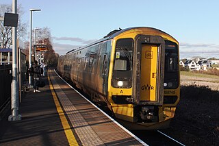
Newcourt railway station is the newest railway station on the Avocet Line, serving the Newcourt area of Exeter, United Kingdom. The station is sited between Digby and Sowton and Topsham and was opened to passenger traffic on 4 June 2015. The station is managed and operated by Great Western Railway.

The siege of Exeter (1642) or First Siege of Exeter took place during the First English Civil War from late December 1642 to early January 1643 when Royalists led by Sir Ralph Hopton attempted to capture the port of Exeter from the Parliamentarians.
The Borough of Middlesbrough is a borough with unitary authority status in North Yorkshire, England, based around the town of Middlesbrough in the north of the county. It is in the Tees Valley mayoralty along with Stockton-on-Tees, Redcar and Cleveland, Hartlepool and Darlington boroughs. Nunthorpe along with Stainton and Thornton have statutory parish councils.

The 2022 Exeter City Council election took place on 5 May 2022 to elect members to Exeter City Council in Devon, England. This was the same day as other local elections in the United Kingdom. 17 of the 39 seats were up for election, one councillor in each of the 13 wards, and 4 by-elections. These wards were last contested in 2018.
| | This Devon location article is a stub. You can help Wikipedia by expanding it. |