
Rungwe is a District in Mbeya Region, Tanzania. It is bordered to the north by Mbeya Rural District, to the east by Iringa Region, to the southeast by Kyela District, to the southwest by Ileje District and to the west by Mbeya Urban District.
Ikolo is an administrative ward in the Kyela district of the Mbeya Region of Tanzania. According to the 2002 census, the ward has a total population of 10,302.
Ipinda is an administrative ward in the Kyela district of the Mbeya Region of Tanzania. According to the 2002 census, the ward has a total population of 16,756.
Lusungo is an administrative ward in the Kyela district of the Mbeya Region of Tanzania. According to the 2002 census, the ward has a total population of 5,819.
Ikuti is an administrative ward in the Rungwe district of the Mbeya Region of Tanzania. According to the 2002 census, the ward had a total population of 11,300.
Kiwira is an administrative ward in the Rungwe district of the Mbeya Region of Tanzania. According to the 2002 census, the ward has a total population of 2000,119.
Kyimo is an administrative ward in the Rungwe district of the Mbeya Region of Tanzania. According to the 2002 census, the ward has a total population of 12,140.
Lupata is an administrative ward in the Rungwe district of the Mbeya Region of Tanzania. According to the 2002 census, the ward has a total population of 8,126.
Mpuguso is an administrative ward in the Rungwe district of the Mbeya Region of Tanzania. According to the 2002 census, the ward has a total population of 12,223.
Bupigu is an administrative ward in Ileje District, Songwe Region, Tanzania. According to the 2002 census, the ward has a total population of 6,190.
Ibaba is an administrative ward in Ileje District, Songwe Region, Tanzania. According to the 2002 census, the ward has a total population of 6,805.Ibaba composed with five village which are Lali, Sheyo,shikunga, Shuba anda Ibaba it self
Ikinga is an administrative ward in Ileje District, Songwe Region, Tanzania. According to the 2002 census, the ward has a total population of 7,114.
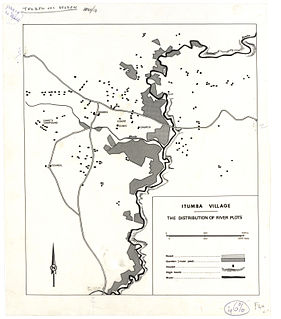
Itumba is an administrative ward in Ileje District, Songwe Region, Tanzania. According to the 2002 census, the ward has a total population of 12,668.
Kafule is an administrative ward in Ileje District, Songwe Region, Tanzania. According to the 2002 census, the ward has a total population of 6,892.
Lubanda is an administrative ward in Ileje District, Songwe Region, Tanzania. According to the 2002 census, the ward has a total population of 7,952.
Luswisi is an administrative ward in Ileje District, Mbeya Region, Tanzania. According to the 2002 census, the ward has a total population of 4,790.
Ngulilo is an administrative ward in Ileje District, Mbeya Region, Tanzania. According to the 2002 census, the ward has a total population of 3,820. The official language is Swahili, and much of the population does not know how to speak English.
Sange is an administrative ward in Ileje District, Songwe Region, Tanzania. According to the 2002 census, the ward has a total population of 4,396.
Santilya is an administrative ward in the Mbeya Rural district of the Mbeya Region of Tanzania. According to the 2002 census, the ward has a total population of 15,271.
Olbalbal is an administrative ward in the Ngorongoro District of the Arusha Region of Tanzania. According to the 2002 census, the ward has a total population of 7,561.


