
The Provincial Court of Alberta is a Provincial Court for the Canadian province of Alberta. The court oversees matters relating to criminal law, family law, youth law, civil law and traffic laws.

Peipsiääre Parish is a rural municipality in Tartu County, Estonia.

Nowiny is a village in the administrative district of Gmina Żnin, within Żnin County, Kuyavian-Pomeranian Voivodeship, in north-central Poland. It lies approximately 12 kilometres (7 mi) west of Żnin and 40 km (25 mi) south-west of Bydgoszcz.

Sarıhacılı is a village in the Agdam Rayon of Azerbaijan.

Boltenhagen (GS09) was a Kondor I-class minesweeper built in East Germany. After the Volksmarine was disbanded just before the reunification of Germany, she was sold to Malta in 1997 and renamed P29 and was used as a patrol boat. After being decommissioned, she was scuttled as a dive site in 2007 off Ċirkewwa.
Kiedrowice is a village in Gmina Lipnica, Bytów County, Pomeranian Voivodeship, in northern Poland. It lies approximately 12 kilometres (7 mi) south of Bytów and 55 km (34 mi) south-west of Gdańsk.
Wysoka Zaborska is a village in the administrative district of Gmina Brusy, within Chojnice County, Pomeranian Voivodeship, in northern Poland. It lies approximately 12 kilometres (7 mi) north of Brusy, 34 km (21 mi) north of Chojnice, and 75 km (47 mi) south-west of the regional capital Gdańsk.
Łubna is a village in the administrative district of Gmina Czersk, within Chojnice County, Pomeranian Voivodeship, in northern Poland. It lies approximately 3 kilometres (2 mi) north of Czersk, 32 km (20 mi) north-east of Chojnice, and 75 km (47 mi) south-west of the regional capital Gdańsk.
Rów is a settlement in the administrative district of Gmina Dziemiany, within Kościerzyna County, Pomeranian Voivodeship, in northern Poland. It lies approximately 8 kilometres (5 mi) east of Dziemiany, 17 km (11 mi) south-west of Kościerzyna, and 66 km (41 mi) south-west of the regional capital Gdańsk.
Kiemiany is a village in the administrative district of Gmina Zalewo, within Iława County, Warmian-Masurian Voivodeship, in northern Poland. It lies approximately 7 kilometres (4 mi) south-west of Zalewo, 24 km (15 mi) north of Iława, and 63 km (39 mi) west of the regional capital Olsztyn.
Kamieniska is a settlement in the administrative district of Gmina Goleniów, within Goleniów County, West Pomeranian Voivodeship, in north-western Poland. It lies approximately 13 kilometres (8 mi) west of Goleniów and 16 km (10 mi) north of the regional capital Szczecin.
Świniec is a village in the administrative district of Gmina Kamień Pomorski, within Kamień County, West Pomeranian Voivodeship, in north-western Poland. It lies approximately 7 kilometres (4 mi) east of Kamień Pomorski and 67 km (42 mi) north of the regional capital Szczecin.

Tulovo is a village in the municipality of Leskovac, Serbia. According to the 2002 census, the village has a population of 739 people.

Bratmilovce is a suburban area in the municipality of Leskovac, Serbia. According to the 2002 census, the town has a population of 3531 people.
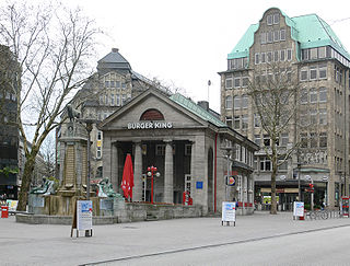
The Mönckebergstraße is one of the main shopping streets in Hamburg, Germany.
Das Schiff is a theatre in Hamburg, Germany.

Neuer Wall is an upmarket shopping street in Hamburg, Germany.

Groß Borstel is a quarter of Hamburg, Germany, in the borough of Hamburg-Nord. It is located north of the Eppendorf quarter and south of Hamburg Airport. Near Groß Borstel, the neighbourhood of Klein Borstel, which is not an official quarter, can be found.

The Kontorhaus District is the southeastern part of Altstadt, Hamburg, between Steinstraße, Meßberg, Klosterwall and Brandstwiete. The streetscape is characterised by large office buildings in the style of brick expressionism of the early 20th century.


