Related Research Articles

The Dell Dimension series was a line of home and business desktop computers manufactured by Dell. In 2007, the Dimension series was discontinued and replaced with the Dell Inspiron series for low-end models and the Dell Studio series for higher-end models.

The South Province is one of three administrative subdivisions in New Caledonia. It corresponds to the southern and southwestern portion of the New Caledonian mainland.

Bidovce is a village and municipality in Košice-okolie District in the Kosice Region of Slovakia.
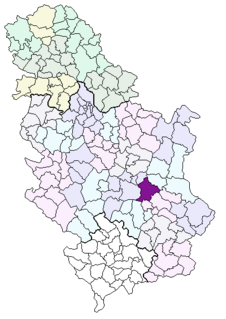
Bankovac is a village in Serbia situated in the municipality of Aleksinac, in the Nišava District. The population of the village is 178 people with Serbs as supermajority according to the 2002 census. According to the 1991 census it had 205 inhabitants.
Wilson Stream is a meltwater stream which flows from the ice-free lower west slopes of Mount Bird, to the south of Alexander Hill, and over steep sea cliffs into Wohlschlag Bay, Ross Island. Mapped by the New Zealand Geological Survey Antarctic Expedition (NZGSAE), 1958–59, and named by the New Zealand Antarctic Place-Names Committee (NZ-APC) for J. Wilson, mountaineer assistant with the expedition.

Marret Glacier is a channel glacier about 4 nautical miles (7 km) wide and 4 nautical miles long, flowing northeast from the continental ice of Antarctica to the coast close east of Cape Robert. It was delineated from aerial photos taken by U.S. Navy Operation Highjump, 1946–47, and was named by the Advisory Committee on Antarctic Names for Mario Marret, the leader of the French Antarctic Expedition, 1952–53, whose party extended reconnaissance of the coastal features to the west side of Victor Bay.
Plum River is a river of southwestern New Caledonia. It flows into the sea to the west of the Plum village. It is a short river, little more than an incised stream. The Plum Swamp lies in the river system.
The Ouenghi River is a river of New Caledonia. It has a catchment area of 270 square kilometres. Bouloupais lies near the river at the foot of Mount Ouitchambo. It enters the Saint Vincent Bay to the west of the village of Tomo.
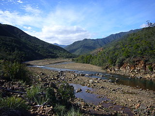
The Tontouta River is a river of New Caledonia. It has a catchment area of 476 square kilometres.
The La Coulée River is a river of New Caledonia. It has a catchment area of 92 square kilometres.
The Dumbéa River is a river of New Caledonia. It has a catchment area of 233 square kilometres. It is a beautiful river, and flows from the Diahot River.
The Yaté River is a river of New Caledonia. It has a catchment area of 450 square kilometres. A major mining area, the Yaté Dam lies near the mouth and the town of Yaté.
The Pourina River is a river of New Caledonia. It has a catchment area of 98 square kilometres.
The Ouinné River is a river of New Caledonia. It has a catchment area of 146 square kilometres.
The Kouakoué River is a river of New Caledonia. It has a catchment area of 77 square kilometres.
The Thio River is a river of New Caledonia. It has a catchment area of 404 square kilometres.
The Nakéty River is a river of New Caledonia. It has a catchment area of 106 square kilometres.

Saint Vincent Bay or Baie Saint Vincent is a bay in southwestern New Caledonia. It is lies north of Inaccessible Bay. It contains Parseval Island and several others. The commune of Bouloupais lies on this stretch of the coast. The Ouenghi River also enters the sea at Saint Vincent Bay.
I-66, later I-166, was a Kaidai-class cruiser submarine of the KD5 sub-class completed for the Imperial Japanese Navy in 1932. She served during World War II, supporting the Japanese invasion of Malaya and the invasion of Sarawak, taking part in the Battle of Midway, and conducting numerous war patrols in the Indian Ocean before was sunk in July 1944.
References
- ↑ "The impacts of opencast mining in New Caledonia". The United Nations University. Archived from the original on 27 July 2011. Retrieved 9 June 2011.CS1 maint: discouraged parameter (link)