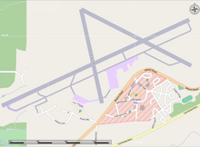
Saskatoon John G. Diefenbaker International Airport is an international airport located 3 nautical miles north-west of downtown Saskatoon, Saskatchewan, though still within its city limits. The airport is served by passenger, courier and air freight operators. It is named for John Diefenbaker, the 13th prime minister of Canada.

Charlottetown Airport is located 3 nautical miles north of Charlottetown, Prince Edward Island, Canada. The airport is currently run by the Charlottetown Airport Authority, is owned by Transport Canada and forms part of the National Airports System.

Thunder Bay Airport is in the city of Thunder Bay, Ontario, Canada. With 108,130 aircraft movements in 2012, it was the fourth busiest airport in Ontario and the 16th busiest airport in Canada. During the same year, more than 761,000 passengers went through the airport.

Sudbury Airport or Greater Sudbury Airport is an airport in the Canadian city of Greater Sudbury, Ontario and is located 11 nautical miles northeast of the downtown area, on Municipal Road 86 between the communities of Garson and Skead. Although in many contexts the airport uses the name Greater Sudbury Airport, its official name, as registered with Transport Canada and printed in all aeronautical publications, is still simply Sudbury Airport.

Windsor International Airport is located in the southeast portion of the city of Windsor, Ontario, Canada. The airport serves a mixture of scheduled airline flights and general aviation, and is a popular point of entry into Canada for private and business aircraft. The airspace above the airport is exceptionally busy because of the proximity to Detroit Metropolitan Wayne County Airport, and Instrument Flight Rules (IFR) arrivals and departures are handled by Detroit approach control.

St. Thomas Municipal Airport located 3.5 nautical miles east of St. Thomas, Ontario, Canada is a small airport serving the general aviation needs of the area. It was established in 1941 as an air training base for the British Commonwealth Air Training Program. The base was operated by the Department of National Defence until the late 1940s as a relief field for No. 14 Service Flying Training School Aylmer, Ontario and No. 4 Bombing & Gunnery School Fingal, Ontario. It has six runways, and four IFR approaches.

Iqaluit Airport serves Iqaluit, Nunavut, Canada and is located adjacent to the city. It hosts scheduled passenger service from Ottawa, Montreal, Rankin Inlet, and Kuujjuaq on carriers such as Canadian North, and from smaller communities throughout eastern Nunavut. It is also used as a forward operating base by the Royal Canadian Air Force (RCAF). In 2011, the terminal handled more than 120,000 passengers.

St. John's International Airport is located 3 nautical miles northwest of St. John's, Newfoundland and Labrador, Canada. It serves the St. John's metropolitan area and the Avalon Peninsula. The airport is part of the National Airports System, and is operated by St. John's International Airport Authority Inc.

Beaver Creek Airport is located 1 nautical mile northwest of Beaver Creek, Yukon, Canada, and is operated by the Yukon government. The gravel runway is 3,745 by 100 ft, and is at an elevation of 2,131 ft (650 m).

Cranbrook/Canadian Rockies International Airport is an international airport located 5 nautical miles north of Cranbrook and 20 km (12 mi) south-east of Kimberley, British Columbia, in the Canadian Rockies.

Brandon Municipal Airport is an airport located 1.6 kilometres (1 mi) north of Brandon, Manitoba, Canada. It serves the City of Brandon, the Westman and Parkland regions of Manitoba, and eastern Saskatchewan. Brandon Municipal Airport is classified as an airport of entry by Nav Canada and is staffed by the Canada Border Services Agency (CBSA) on a call-out basis from the International Peace Garden Border Crossing.

Inuvik Airport is located 6.5 nautical miles east of Inuvik, Northwest Territories, Canada.

JA Douglas McCurdy Sydney Airport is a regional airport located in Reserve Mines in the Canadian province of Nova Scotia. The airport serves the Cape Breton Regional Municipality (CBRM) and the surrounding areas of Cape Breton Island. McCurdy Sydney Airport has the distinction of being the oldest public airport in Nova Scotia, first licensed on August 3, 1929.

Yarmouth Airport is a registered aerodrome located in Yarmouth County, Nova Scotia, Canada. It began as a World War II Royal Air Force training base.

Mont-Tremblant International Airport is a single runway airport located in the township of La Macaza, 2.5 nautical miles north of the village, about 25 nautical miles north of Mont-Tremblant, Quebec, Canada.

Kenora Airport is located 5 nautical miles east northeast of Kenora, Ontario, Canada. The airport is classified as an airport of entry by Nav Canada and is staffed by the Canada Border Services Agency (CBSA) on a call-out basis from the Fort Frances-International Falls International Bridge. CBSA officers at this airport can handle general aviation aircraft with no more than 15 passengers. The airport has one asphalt runway that is 5,800 by 150 ft. The airport is under Aircraft Group Number (AGN) classification of IV.
Peace River Airport is a municipally owned airport located 5 nautical miles west of the Town of Peace River, Alberta, Canada. The airport has one runway, which is 5,000 ft × 150 ft, and a terminal building, which is 21,000 sq ft (2,000 m2).

Nanaimo Airport is a privately owned and operated regional airport located 7 nautical miles south southeast of Nanaimo, British Columbia, Canada.
Red Deer Regional Airport is located 6 nautical miles south southwest of Red Deer, Alberta, Canada. The airport serves Charter and General Aviation.

Kingston Norman Rogers Airport or YGK Airport, also known as Kingston Airport, is the main airport serving Kingston, Ontario and its metropolitan area. The airport is named after former MP Norman McLeod Rogers, Minister of Labour and then National Defence in Prime Minister William Lyon Mackenzie King's cabinet. Located 4.3 nautical miles west of downtown Kingston, Ontario, in the west end of the city, it is the largest airport in the region, in 2019 it was reported that 70,000 people travel through the airport each year.


