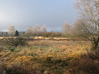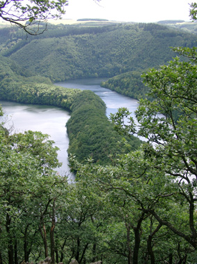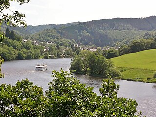
The Eifel is a low mountain range in western Germany, eastern Belgium and northern Luxembourg. It occupies parts of southwestern North Rhine-Westphalia, northwestern Rhineland-Palatinate and the southern area of the German-speaking Community of Belgium.
The Eifelkreis Bitburg-Prüm is a district in Rhineland-Palatinate, Germany. It is bounded by Luxembourg, Belgium and the districts of Euskirchen, Vulkaneifel, Bernkastel-Wittlich and Trier-Saarburg.

Monschau is a small resort town in the Eifel region of western Germany, located in the Aachen district of North Rhine-Westphalia.

The Roer or Rur is a major river that flows through portions of Belgium, Germany and the Netherlands. It is a right (eastern) tributary to the Meuse. About 90 percent of the river's course is in Germany.

The High Fens, which were declared a nature reserve in 1957, are an upland area, a plateau region in Liège Province, in the east of Belgium and adjoining parts of Germany, between the Ardennes and the Eifel highlands. The High Fens are the largest nature reserve or park in Belgium, with an area of 4,501.2 ha ; it lies within the German-Belgian natural park Hohes Venn-Eifel, in the Ardennes. Its highest point, at 694 metres (2,277 ft) above sea level, is the Signal de Botrange near Eupen, and also the highest point in Belgium. A tower 6 metres (20 ft) high was built here that reaches 700 metres (2,297 ft) above sea level. The reserve is a rich ecological endowment of Belgium covered with alpine sphagnum raised bogs both on the plateau and in the valley basin; the bogs, which are over 10,000 years old, with their unique subalpine flora, fauna and microclimate, are key to the conservation work of the park.

The Schnee Eifel is a heavily wooded landscape in Germany's Central Uplands, up to 699.1 m above sea level (NHN), that forms part of the western Eifel in the area of the German-Belgian border. The name may have been derived in the 19th century from the Schneifel chain of hills, which had nothing to do with snow (Schnee), but with the name for a forest swathe (Schneise).
The Rur Eifel lies in the district of Düren in the German state of North Rhine-Westphalia, and is a local recreation area from the regions of Cologne, Aachen, Düsseldorf, Krefeld, Mönchengladbach and Bonn. Its name comes from the river Rur and the Eifel Mountains.

The German-Belgian High Fens – Eifel Nature Park, often called the North Eifel Nature Park, is a cross-border nature park with elements in the German federal states of North Rhine-Westphalia and Rhineland-Palatinate as well as the Belgian province of Liège. It has a total area of 2,485 km2 (959 sq mi).
The Zitter Forest is located in the Eifel region in the German district of Euskirchen and in the Belgian province of Liège (Wallonia). Its highest point is 692 m above sea level (NN).

The Eifel National Park is the 14th national park in Germany and the first in North Rhine-Westphalia. The park was founded in 2004, and is classified as a "national park in development".

The Urft is a 46.4-kilometre-long (28.8 mi) right-hand tributary of the Rur in the county of Euskirchen in the German state of North Rhine-Westphalia. It flows through the village of Urft in the municipality of Kall. The Urft rises in the North Eifel region of the Eifel Mountains.

The Urft Dam is a 58.50 metre high dam in the southwestern part of the state of North Rhine-Westphalia in Germany. It was built in 1905. The dam impounds the River Urft in the district of Euskirchen to create the Urft Reservoir (Urftstausee), 2.16 km2 in area. The reservoir is also called the Urftsee.

The Kermeter is an upland region, up to 527.8 m above sea level (NN), which is part of the Rureifel within the North Eifel in the districts of Aachen, Düren and Euskirchen in the southwestern part of the state of North Rhine-Westphalia in Germany.

The Perlenbach Valley is the valley of the Perlenbach stream in the Eifel mountains in the countries of Belgium and Germany. The Perlenbach itself is a tributary of the Rur. The Perlenbach Valley is host to two outstanding, cultural-historical nature reserves along the state border which have a total area of 398 ha.

The Obersee near Simmerath in the borough of Aachen is the main forebay of the Rur Reservoir on the River Rur in the Eifel mountains of Germany. Its barrier is the Paulushofdamm. The reservoir, like that of the Rur Dam, belongs to the Eifel-Rur Water Company. The reservoir provides drinking water.
Schöneseiffen is a village southwest of Schleiden in the county of Euskirchen in the German state of North Rhine-Westphalia. The Dieffenbach stream rises north of the village. Schöneseiffen has a population of 433 (2021). Schöneseiffen has sports field, a Bürgerhaus and a youth centre.

The Olef Dam is located in the vicinity of the Eifel National Park near Hellenthal within the High Fens-Eifel Nature Park in the county of Euskirchen in the German state of North Rhine-Westphalia. Its reservoir stores around 20 million cubic metres and is fed by the River Olef.
The Verbrannter Berg near Wolfgarten in the county of Euskirchen in the German state of North Rhine-Westphalia is a hill, 516.2 m above sea level (NHN), in the Kermeter, a ridge in the Eifel mountains, in the region of Rur Eifel; at the same time Verbrannter Berg is the name of a parcel of land.