There are two places named North Santee in the U.S. state of South Carolina:
- North Santee, Clarendon County, South Carolina, a census-designated place
- North Santee, Georgetown County, South Carolina, an unincoporated community
There are two places named North Santee in the U.S. state of South Carolina:

Clarendon County is a county located below the fall line in the Coastal Plain region of U.S. state of South Carolina. As of 2010, its population was 34,971. Its county seat is Manning.

Moncks Corner is a town in and the county seat of Berkeley County, South Carolina, United States. The population was 7,885 at the 2010 census. As defined by the U.S. Census Bureau, Moncks Corner is included within the Charleston–North Charleston–Summerville Metropolitan Statistical Area.
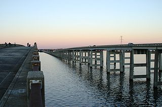
The Santee River is a river in South Carolina in the United States, and is 143 miles (230 km) long. The Santee and its tributaries provide the principal drainage for the coastal areas of southeastern South Carolina and navigation for the central coastal plain of South Carolina, emptying into the Atlantic Ocean about halfway between Myrtle Beach and Charleston near the community of McClellanville. The farthest headwaters lie 440 miles (708 km) away on the Catawba River in North Carolina. Besides the Catawba, other principal rivers of the Santee watershed include the Congaree, Broad, Linville, Saluda and the Wateree. The watershed drains a large portion of the Piedmont regions of South and North Carolina. The Santee River is the second largest river on the eastern coast of the United States, second only to the Susquehanna River in drainage area and flow. Much of the upper river is impounded by the expansive, horn-shaped Lake Marion reservoir, formed by the 8-mile (13 km)-long Santee Dam. The dam was built during the Great Depression of the 1930s as a Works Progress Administration (WPA) project to provide a major source of hydroelectric power for the state of South Carolina.
Fishing Creek may refer to a location in the United States:
Santee may refer to:
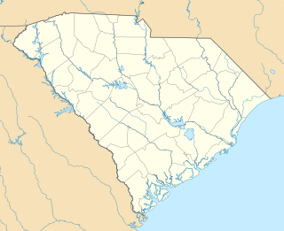
Pinopolis is an unincorporated community and census-designated place in Berkeley County, South Carolina, United States. As of the 2010 census it had a population of 948.
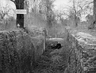
The Santee Canal was one of the earliest canals built in the United States. It was built to provide a direct water route between Charleston and Columbia, the new South Carolina state capital. It was named to the National Register of Historic Places in 1982.
The Santee tribe were a historical tribe of Siouan-language speakers from South Carolina. Historically the Santee were a small tribe, and centered in the area of the present town of Santee, South Carolina. Their settlement was along the Santee River, since dammed and called Lake Marion.
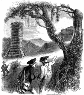
The Siege of Fort Watson was an American Revolutionary War confrontation in South Carolina that began on April 15, 1781 and lasted until April 23, 1781. Continental Army forces under Henry "Light Horse Harry" Lee and South Carolina militia under Francis Marion besieged Fort Watson, a fortified British outpost that formed part of the communication and supply chain between Charleston and other British outposts further inland.
The Battle of Lenud's Ferry was a battle of the American Revolutionary War that was fought on May 6, 1780 in present-day Berkeley County, South Carolina. All of the British soldiers who took part in the Battle of Lenud's Ferry were in fact Loyalists who had been born and raised in the colony of South Carolina, with the sole exception being their commanding officer Banastre Tarleton. The unit was known as the Loyalist British Legion, under the command of Lieutenant Colonel Banastre Tarleton. The Loyalist British Legion scattered a company of Patriot militia at Lenud's Ferry, a crossing point on the Santee River, north of which lies present-day Georgetown County.

St. James Church, Santee, also known as St. James Episcopal Church, Santee, is a historic church located in a remote portion of Francis Marion National Forest in Charleston County, South Carolina. Built in 1768, it is a remarkably sophisticated expression of fashionable Georgian architecture in a remote area, and was designated a National Historic Landmark in 1970 for its architectural significance. It is located on the west side of the Old Georgetown Road, several miles north of South Carolina Highway 46 and McClellanville.

Hopsewee Plantation, also known as the Thomas Lynch, Jr., Birthplace or Hopsewee-on-the-Santee, is a plantation house built in 1735 near Georgetown, South Carolina. It was the birthplace of Thomas Lynch, Jr., a signer of the Declaration of Independence, and served as a Lowcountry rice plantation. Before he departed for his ill-fated voyage he made a will, which stipulated that heirs of his female relatives must change their surname to Lynch in order to inherit the family estate, a rice plantation. He was taken ill at the end of 1779 and he sailed, with his wife, for St. Eustatius in the West Indies. Their ship disappeared at sea in a storm and was never found. The family estate, Hopsewee, still stands in South Carolina. The Lynch family sold the house in 1752 to Robert Hume whose son, John Hume, lived at Hopsewee in the winter after inheriting it. Upon his death in 1841, his own son, John Hume Lucas, inherited the house. John Hume Lucas died in 1853. Like many Santee plantations, it was abandoned during the Civil War. After the war, rice was never planted again, but the Lucas family continued to occupy Hopsewee until 1925. In September 1949, Col. and Mrs. Wilkinson bought the house and occupied it.
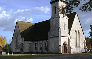
The Stateburg Historic District is a historic district in Stateburg, in the High Hills of Santee area near Sumter, South Carolina in the United States. It includes two National Historic Landmarks, Borough House Plantation and the Church of the Holy Cross, and at least eight contributing properties within its boundaries. On February 24, 1971, it was added to the National Register of Historic Places. The historic district extends north and east of the town of Stateburg as far north as Meeting House Road and as far east as South Carolina Highway 441, covering an area of 5,066 acres (20.50 km2).
Wedgefield is an unincorporated community in the High Hills of Santee area in western Sumter County, South Carolina, United States. Wedgefield is also a Census Designated Place (CDP). Wedgefield was so named because its location was likened to a "wedge" into the High Hills of Santee. In the 18th and 19th centuries it was the location of many plantations, notably those of the Singleton family, which produced First Lady of the United States, Angelica Singleton Van Buren. Today the plantations are gone except for their cemeteries and Wedgefield is today noted as the location of a state park, a state forest and other recreational places. When the railroad came through in the 19th century, the commercial center of Wedgefield developed at the intersection of the railroad, Kings Highway and Wedgefield Road. It has its own post office with the Zip Code of 29168.

The High Hills of Santee, sometimes known as the High Hills of the Santee, is a long, narrow hilly region in the western part of Sumter County, South Carolina. It has been called "one of the state's most famous areas". The High Hills of Santee region lies north of the Santee River and east of the Wateree River, one of the two rivers that join to form the Santee. It extends north almost to the Kershaw county line and northeasterly to include the former summer resort town of Bradford Springs. Since 1902 the town has been included in Lee County.

Santee Indian Mound and Fort Watson is a historic archaeological site located in North Santee, Clarendon County, South Carolina, near Summerton. Santee Indian Mound was part of a Santee mound village complex; it was probably a burial and/or temple mound, likely constructed in some cultural period between 1200–1500.
Trib Publications is a regional newspaper chain based in Manchester, Georgia, United States.

North Santee is a census-designated place (CDP) in Clarendon County, South Carolina, United States. It was first listed as a CDP prior to the 2020 census.

Wyboo is a lakeside community and census-designated place (CDP) in Clarendon County, South Carolina, United States. It was first listed as a CDP prior to the 2020 census.