Cesar Department or simply Cesar is a department of Colombia located in the north of the country in the Caribbean region, bordering to the north with the Department of La Guajira, to the west with the Department of Magdalena and Department of Bolivar, to the south with Department of Santander, to the west with the Department of North Santander, and to the east with the country of Venezuela. The department capital city is Valledupar.

Cúcuta, officially San José de Cúcuta, is a Colombian city, capital of Norte de Santander department. It is located in the northeast of the country, in the eastern branch of the Colombian Andes, on the border with Venezuela. Cúcuta has a population of approximately 750,000 people according to the 2005-2020 census, making it the 6th largest city in the country. Due to its proximity with Venezuela, Cúcuta is an important commercial center, hosting many billion dollar companies. The international border in Cúcuta is said to be the most dynamic of South America. The city has a length of 12 kilometres from north to south and 11 kilometres from east to west. It is divided into 10 communes and it is the political, economic, administrative, industrial, cultural and tourism hub of the Norte de Santander department.

Francisco José de Paula Santander y Omaña, was a Colombian military and political leader during the 1810–1819 independence war of the United Provinces of New Granada. He was the acting President of Gran Colombia between 1819 and 1826, and later elected by Congress as the President of the Republic of New Granada between 1832 and 1837. Santander came to be known as "The Man of the Laws".

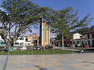
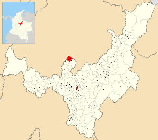
San José de Pare is a town and municipality in the Ricaurte Province, part of the department of Boyacá, Colombia. The urban centre of San José de Pare is situated at an altitude of 1,545 metres (5,069 ft) in the Eastern Ranges of the Colombian Andes, and the altitude within the municipality ranges from 1,200 to 2,400 metres. The border between San José de Pare and the department of Santander is formed by the Suárez River. The other municipalities bordering San José de Pare are Chitaraque, Togüí, Moniquirá and Santana. San José de Pare is along the highway from Bogotá to Bucaramanga, at 217 kilometres (135 mi) from the Colombian capital.

The Lache were an indigenous, agrarian people in the highlands of what is now central Colombia's northern Boyacá and Santander departments, primarily in Gutiérrez Province and García Rovira Province. They were part of the Cocuy Confederation and spoke Chibcha, trading predominantly with other Chibcha speakers, such as the Muisca, Guane, Pijao and Chitarero. Trade included salt and textiles, as well as food stuffs. The Lache farmed maize, potatoes, quinoa and cotton, among other crops.
The Middle Magdalena Bloc of the FARC-EP was a FARC-EP bloc, notable for its involvement in the conflict with the AUC until the latter's demobilization in 2004. After that, it became one of the Colombian army's biggest worries as FARC started once again to gain control over the territory.

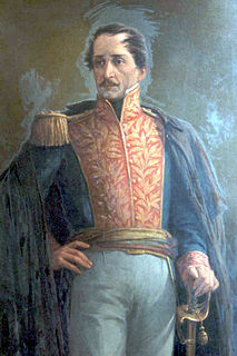
José Santos Gutiérrez Prieto was a Colombian statesman and soldier, who became president of the Sovereign State of Boyacá, and later elected as president of the United States of Colombia for the term of 1868-1870.

Covarachía is a town and municipality in the Northern Boyacá Province, part of the Colombian Department of Boyacá. The urban centre is located at 208 kilometres (129 mi) from the department capital Tunja at an altitude of 2,320 metres (7,610 ft) in the Eastern Ranges of the Colombian Andes. The municipality borders San José de Miranda and Capitanejo in the north, Tipacoque in the south, Capitanejo in the east and in the west the municipalities Onzaga and San Joaquín (Santander).

Chitaraque is a town and municipality in the Ricaurte Province, part of the Colombian department of Boyacá. The urban centre is located at a distance of 104.6 kilometres (65.0 mi) from the department capital Tunja and situated at an altitude of 1,575 metres (5,167 ft) in the Eastern Ranges of the Colombian Andes. It borders Gámbita, Santander in the east and south, San José de Pare, Santana and Togüí in the west and Suaita, Santander in the north.

Santana is a town and municipality in the Ricaurte Province, in the north of the Colombian department of Boyacá. The urban centre is situated at an altitude of 1,550 metres (5,090 ft) in the Eastern Ranges of the Colombian Andes. Santana borders Chitaraque and the Santander Department in the east, Güepsa, Santander in the west, Suaita, Santander in the north and Chitaraque and San José de Pare in the south.

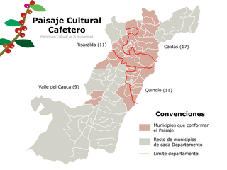
Coffee production in Colombia has a reputation as producing mild, well-balanced coffee beans. Colombia's average annual coffee production of 11.5 million bags is the second total highest in the world, after Brazil, though highest in terms of the arabica bean. The beans are exported to United States, Germany, France, Japan, and Italy. Most coffee is grown in the Colombian coffee growing axis region. In 2007, the European Union granted Colombian coffee a protected designation of origin status. In 2011, UNESCO declared the "Coffee Cultural Landscape" of Colombia, a World Heritage site.

North Santander is a department of Colombia. It is in the north of the country, bordering Venezuela. Its capital is Cúcuta, one of the country's major cities.

States of Colombia existed from February 27, 1855, in the Republic of New Granada and the Granadine Confederation, where they were called "federal states". In the United States of Colombia they were called "sovereign states".
The Comunera Province is a province of the Colombian Department of Santander.
The Vélez Province is a province of the Colombian Department of Santander.
The García Rovira Province is a province of the Colombian Department of Santander.
The Mares Province is a province of the Colombian Department of Santander.
The Carare-Opón Province is a former province of the Colombian Department of Santander.


