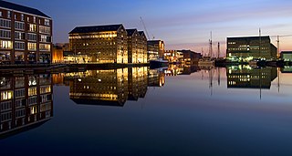
North Warehouse is a British warehouse in the Gloucester Docks. Currently, it houses the Gloucester City Council. [1]

North Warehouse is a British warehouse in the Gloucester Docks. Currently, it houses the Gloucester City Council. [1]
The warehouse began construction on 1826 and finished construction on 1827.
In 1985, Gloucester City Council acquired the building and it became the house of the council. [2]

The Bristol and Bath Railway Path is a 15-mile (24 km) off-road cycleway, part of National Cycle Network National Cycle Route 4. It has a 3-metre (9.8 ft) wide tarmacked surface, and was used for 2.4 million trips in 2007, increasing by 10% per year.

Podsmead is a district of Gloucester approximately one mile from the historic city centre. With the development of Quedgeley and Kingsway Village, Podsmead was becoming absorbed by the city in the early 21st century. The population of this Gloucester Ward was 2,994 at the 2011 Census. It is close to the hamlet of Hempsted.
Gloucestershire Parkway railway station is or was a proposed development in transport infrastructure for a semi-greenfield site surrounded by warehouse and light industry units 1.4 miles (2.3 km) east of Gloucester city centre which is on a major east–west spur line off of the greater north-south Birmingham-to-Bristol line on which this station would be built. The proposed site is specifically by an intra-city (urban) part of the inceptive A40 road in an area known as Elmbridge Court, Gloucester, England.
Llanwern railway station is a former station serving Llanwern on the east side of the city of Newport.
St Brandon's School was an independent school incorporating an infant and junior school and a senior boarding school for girls, located in the town of Clevedon in Somerset, in South West England. The school was opened in 1831 and closed in 2004.

Gloucester Docks is a historic area of the city of Gloucester. The docks are located at the northern junction of the River Severn with the Gloucester and Sharpness Canal. They are Britain's most inland port.

Ladybellegate House, 20 Longsmith Street, Gloucester GL1 2HT, is a Grade I listed building with Historic England, reference number 1245726.

The Westgate area of Gloucester is centred on Westgate Street, one of the four main streets of Gloucester and one of the oldest parts of the city. The population of the Westgate ward in Gloucester was 6,687 at the time of the 2011 Census.
White City is an estate in the City of Gloucester. It takes its name from the original white concrete houses.

Hunts Grove is a new village being built on the southern edge of the city of Gloucester. Building began in 2010 and is expected to continue into the 2030s.

Gloucester City Council is the local authority for the city of Gloucester, in Gloucestershire, England. Gloucester has had a council since medieval times, which has been reformed on numerous occasions. Since 1974 Gloucester has been a non-metropolitan district with city status.

Bearland House is a grade II* listed building in Longsmith Street, Gloucester, England.

The Sword is a public house at 45 Westgate Street, Gloucester, England, that is a grade II listed building with Historic England. It was formerly known as The Union and Molly's Bar.

The Fleece Hotel, Westgate Street, Gloucester is a timber framed building dating from the 15th century, which incorporated a 12th-century stone undercroft. The building is part grade I and part grade II listed with Historic England.

Mercers Hall is a former warehouse in Gloucester, England. It is located on the corner of Cross Keys Lane and Mercers' Alley, also known as Pinchbelly Alley, in the centre of the city. It is currently used as a Masonic Hall and is grade II listed with Historic England.

Gloucester Public Library is a public library in Brunswick Road, Gloucester, England, founded in 1897 and is open 6 days a week. It has been listed Grade II on the National Heritage List for England since 1973.

Kensington New Town is an area of housing in Kensington, London, which was developed in the early 19th century. It lies to the south of Kensington High Street and to the southwest of Kensington Gardens.

High Orchard was an industrial area of the city of Gloucester in England that was developed in the 19th century on the former orchard of the Priory of Llanthony Secunda (1136). The area was closely associated with Gloucester Docks immediately to the north, and served by the Gloucester and Sharpness Canal and railway transport. It was the site of Fielding & Platt's Atlas Works and a number of other significant local employers.

Hillfield House is a grade II listed house in Denmark Road, Gloucester, in England. The building, in the Italianate style popularised by Charles Barry, is faced in ashlar Bath stone, with a centrally placed tower and a porte-cochère entrance.

333 Stroud Road is a former farmhouse on Stroud Road, Tuffley, Gloucester. It became a Grade II listed building on 12 March 1973.