Related Research Articles

Lancashire is a ceremonial county in North West England. It is bordered by Cumbria to the north, North Yorkshire and West Yorkshire to the east, Greater Manchester and Merseyside to the south, and the Irish Sea to the west. The largest settlement is Blackpool, and the county town is the city of Preston.

Burnley is a town and the administrative centre of the wider Borough of Burnley in Lancashire, England, with a 2001 population of 73,021. It is 21 miles (34 km) north of Manchester and 20 miles (32 km) east of Preston, at the confluence of the River Calder and River Brun.

The Forest of Bowland, also known as the Bowland Fells and formerly the Chase of Bowland, is an area of gritstone fells, deep valleys and peat moorland, mostly in north-east Lancashire, England, with a small part in North Yorkshire. It is a western outlier of the Pennines.

Clitheroe is a town and civil parish in the Borough of Ribble Valley, Lancashire, England; it is located 34 miles (55 km) north-west of Manchester. It is near the Forest of Bowland and is often used as a base for tourists visiting the area. In 2018, the Clitheroe built-up area had an estimated population of 16,279.
BBC Radio Lancashire is the BBC's local radio station serving the county of Lancashire.

Blackburn railway station serves the town of Blackburn in Lancashire, England. It is 12 miles (19 km) east of Preston and is managed and served by Northern Trains.

Bromley Cross railway station, on Chapeltown Road in Bromley Cross, a suburb to the north of Bolton, England, is served by the Northern 'Ribble Valley' line 2+3⁄4 miles (4.4 km) north of Bolton. The station is just south of the point where the double line merges into one.

Salford Crescent railway station is a railway station in Salford, Greater Manchester, England, opened by British Rail in 1987.

Accrington railway station serves the town of Accrington in Lancashire, England. It is a station on the East Lancashire line 6+1⁄4 miles (10.1 km) east of Blackburn railway station operated by Northern.

Clitheroe Football Club is an English football club based in Clitheroe, Lancashire, currently playing in the Northern Premier League Division One West.

Clitheroe railway station serves the town of Clitheroe in Lancashire, England. The station is the northern terminus of the Ribble Valley line / Clitheroe Line operated by Northern Trains and is 10 miles (16 km) north of Blackburn. The station forms part of Clitheroe Interchange, which has won a number of awards.

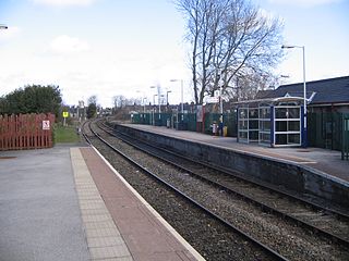
Whalley railway station serves the village of Whalley in Lancashire, England. The station lies on the Ribble Valley Line 7+1⁄4 miles (11.7 km) north of Blackburn. The station has two platforms, slightly offset from each other. It is unstaffed, with shelters on each platform. Immediately beyond its eastern end, the line crosses the River Calder on a 678-yard (620 m) long, brick viaduct of 48 arches.
Buckton Castle was a medieval enclosure castle near Carrbrook in Stalybridge, Greater Manchester, England. It was surrounded by a 2.8-metre-wide (9 ft) stone curtain wall and a ditch 10 metres (33 ft) wide by 6 metres (20 ft) deep. Buckton is one of the earliest stone castles in North West England and only survives as buried remains overgrown with heather and peat. It was most likely built and demolished in the 12th century. The earliest surviving record of the site dates from 1360, by which time it was lying derelict. The few finds retrieved during archaeological investigations indicate that Buckton Castle may not have been completed.

The A671 is a road in the North West of England, that runs between Oldham, Greater Manchester and Worston, near Clitheroe, Lancashire. Major towns on the route include Rochdale and Burnley. The road is approximately 35 miles (56 km) long. Between Burnley and the A59, the A671 has primary status.

Clitheroe Castle is a ruined early medieval castle in Clitheroe in Lancashire, England. It was the caput of the Honour of Clitheroe, a vast estate stretching along the western side of the Pennines.

Wigan & Leigh College is a state General Further and Higher Education College based at five locations in the towns of Wigan and Leigh in Greater Manchester, England, United Kingdom. Currently, there are 500 staff members employed, and more than 8,000 students enrolled in full-time or part-time courses. The college's programmes of study include: General Certificate of Education (GCSEs), BTEC First Diplomas, A-Levels, National Diplomas, Higher National Diplomas, Apprenticeships, Foundation Degree and Degree courses.

The Weavers' Triangle is an area of Burnley in Lancashire, England consisting mostly of 19th-century industrial buildings at the western side of town centre clustered around the Leeds and Liverpool Canal. The area has significant historic interest as the cotton mills and associated buildings encapsulate the social and economic development of the town and its weaving industry. From the 1980s, the area has been the focus of major redevelopment efforts.

Clitheroe Castle Museum is located in Clitheroe, Lancashire, England, in the former Steward's House, a Grade II listed building that was built in the 18th century to house the steward of Clitheroe Castle. It is a museum showing the history of the local area.

The Lancashire Witches Walk is a 51-mile (82 km) long-distance footpath opened in 2012, between Barrowford and Lancaster, all in Lancashire, England. It starts at Pendle Heritage Centre in Barrowford before passing through the Forest of Pendle, the town of Clitheroe and the Forest of Bowland to finish at Lancaster Castle.

Mearley Brook is a minor river in Lancashire, England. It is approximately 4.5 miles (7.2 km) long and has a catchment area of 8.79 square miles (22.77 km2).
References
- 1 2 "North West Sound Archive set to close due to 'financial circumstances'". Lancashire Telegraph. 22 December 2014. Retrieved 26 September 2015.
- ↑ Ashworth, Susan (2010). Clitheroe Castle Museum. Castle Keep, Museum and Park. Lancashire County Council. ISBN 9781857596489.
- ↑ "North West Sound Archive" . Retrieved 26 September 2015.