Ludlow is a New England town in Hampden County, Massachusetts, United States. The population was 21,002 as of the 2020 census, and it is considered part of the Springfield Metropolitan Statistical Area. Located just northeast of Springfield across the Chicopee River, it is one of the city's suburbs. It has a sizable and visible Portuguese and Polish community.

Palmer is a city in Hampden County, Massachusetts, United States. The population was 12,448 at the 2020 census. It is part of the Springfield, Massachusetts Metropolitan Statistical Area. Palmer adopted a home rule charter in 2004 with a council-manager form of government. Palmer is one of thirteen Massachusetts municipalities that have city forms of government but retain "The town of" in their official names.

Wilbraham is a town in Hampden County, Massachusetts, United States. It is a suburb of the City of Springfield, and part of the Springfield Metropolitan Statistical Area. The population was 14,613 at the 2020 census.

The New York, New Haven and Hartford Railroad, commonly known as The Consolidated, or simply as the New Haven, was a railroad that operated in the New England region of the United States from 1872 to December 31, 1968. Founded by the merger of the New York and New Haven and Hartford and New Haven railroads, the company had near-total dominance of railroad traffic in Southern New England for the first half of the 20th century.

Brewster station is a commuter rail stop on the Metro-North Railroad's Harlem Line, located in Brewster, New York. It is the southernmost station in Putnam County. Trains leave for New York City every hour, and about every 25 minutes during rush hour. It is 52 miles from Grand Central Terminal and travel time there is approximately one hour, 22 minutes.

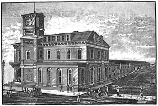
South Station, officially The Governor Michael S. Dukakis Transportation Center at South Station, is the largest railroad station and intercity bus terminal in Greater Boston and New England's second-largest transportation center after Logan International Airport. Located at the intersection of Atlantic Avenue and Summer Street in Dewey Square, Boston, Massachusetts, the historic station building was constructed in 1899 to replace the downtown terminals of several railroads. Today, it serves as a major intermodal domestic transportation hub, with service to the Greater Boston region and the Northeastern and Midwestern United States. It is used by thousands of commuter rail and intercity rail passengers daily. Connections to the rapid transit Red Line and bus rapid transit Silver Line are made through the adjacent subway station.

North Station is a commuter rail and intercity rail terminal station in Boston, Massachusetts. It is served by four MBTA Commuter Rail lines – the Fitchburg Line, Haverhill Line, Lowell Line, and Newburyport/Rockport Line – and the Amtrak Downeaster intercity service. The concourse is located under the TD Garden arena, with the platforms extending north towards drawbridges over the Charles River. The eponymous subway station, served by the Green Line and Orange Line, is connected to the concourse with an underground passageway.
The Southwest Corridor or Southwest Expressway was a project designed to bring an eight-lane highway into the City of Boston from a direction southwesterly of downtown. It was supposed to connect with Interstate 95 (I-95) at Route 128. As originally designed, it would have followed the right of way of the former Penn Central/New Haven Railroad mainline running from Readville, north through Roslindale, Forest Hills and Jamaica Plain, where it would have met the also-cancelled I-695. The 50-foot-wide median for the uncompleted "Southwest Expressway" would have carried the southwest stretch of the MBTA Orange Line within it, replacing the Washington Street Elevated railway's 1901/1909-built elevated railbed. Another highway, the four-lane South End Bypass, was proposed to run along the railroad corridor between I-695 in Roxbury and I-90 near Back Bay.

The Maine Central Railroad Company was a U. S. class 1 railroad in central and southern Maine. It was chartered in 1856 and began operations in 1862. By 1884, Maine Central was the longest railroad in New England. Maine Central had expanded to 1,358 miles (2,185 km) when the United States Railroad Administration assumed control in 1917. The main line extended from South Portland, Maine, east to the Canada–United States border with New Brunswick, and a Mountain Division extended west from Portland to St. Johnsbury, Vermont, and north into Quebec. The main line was double track from South Portland to Royal Junction, where it split into a "lower road" through Brunswick and Augusta and a "back road" through Lewiston, which converged at Waterville into single track to Bangor and points east. Branch lines served the industrial center of Rumford, a resort hotel on Moosehead Lake and coastal communities from Bath to Eastport.

The Boston and Albany Railroad was a railroad connecting Boston, Massachusetts to Albany, New York, later becoming part of the New York Central Railroad system, Conrail, and CSX Transportation. The line is currently used by CSX for freight. Passenger service is provided on the line by Amtrak, as part of their Lake Shore Limited service, and by the MBTA Commuter Rail system, which owns the section east of Worcester and operates it as its Framingham/Worcester Line.

The Boston and Providence Railroad was a railroad company in the states of Massachusetts and Rhode Island which connected its namesake cities. It opened in two sections in 1834 and 1835 - one of the first rail lines in the United States - with a more direct route into Providence built in 1847. Branches were built to Dedham in 1834, Stoughton in 1845, and North Attleboro in 1871. It was acquired by the Old Colony Railroad in 1888, which in turn was leased by the New Haven Railroad in 1893. The line became the New Haven's primary mainline to Boston; it was realigned in Boston in 1899 during the construction of South Station, and in Pawtucket and Central Falls in 1916 for grade crossing elimination.

The Fitchburg Railroad is a former railroad company, which built a railroad line across northern Massachusetts, United States, leading to and through the Hoosac Tunnel. The Fitchburg was leased to the Boston and Maine Railroad in 1900. The main line from Boston to Fitchburg is now operated as the MBTA Fitchburg Line; Pan Am Railways runs freight service on some other portions.
The Central Massachusetts Railroad was a railroad in Massachusetts. The eastern terminus of the line was at North Cambridge Junction where it split off from the Middlesex Central Branch of the Boston and Lowell Railroad in North Cambridge and through which it had access to North Station in Boston. From there, the route ran 98.77 miles west through the modern-day towns of Belmont, Waltham, Weston, Wayland, Sudbury, Hudson, Bolton, Berlin, Clinton, West Boylston, Holden, Rutland, Oakham, Barre, New Braintree, Hardwick, Ware, Palmer, Belchertown, Amherst, and Hadley to its western terminal junction at N. O. Tower in Northampton with the Connecticut River Railroad.

The Springfield and Eastern Street Railway, originally the Palmer and Monson Street Railway, was a streetcar company in the towns east of Springfield, Massachusetts.

Providence station is a railroad station in Providence, Rhode Island, served by Amtrak and MBTA Commuter Rail. The station has four tracks and two island platforms for passenger service, with a fifth track passing through for Providence and Worcester Railroad freight trains. It is now the 11th busiest Amtrak station in the country, and the second-busiest on the MBTA Commuter Rail system outside of Boston.

The Joseph Scelsi Intermodal Transportation Center is a transit facility located in downtown Pittsfield, Massachusetts. The $11 million facility is named after Joseph Scelsi, a longtime State Representative who represented Pittsfield. Owned by the Berkshire Regional Transit Authority (BRTA), it is serviced by local BRTA bus services, Amtrak intercity rail service, and Peter Pan intercity bus service. The second floor of the building houses two classrooms used by Berkshire Community College and Massachusetts College of Liberal Arts.
The Lexington and West Cambridge Railroad was a railroad company chartered in 1845 and opened in 1846 that operated in eastern Massachusetts. It and its successors provided passenger service until 1977 and freight service until 1980 or early 1981.
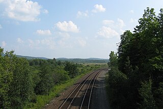
The Boston Subdivision is a railroad line in the U.S. state of Massachusetts. The line runs from Back Bay Station in Boston west to Wilbraham, just east of Springfield. along a former New York Central Railroad line. The line connects with the Northeast Corridor its east end and continues as the Berkshire Subdivision at its west end. Along the way, the line junctions with the Framingham Subdivision and Fitchburg Subdivision at Framingham.

The Berkshire Subdivision is a railroad line owned by CSX Transportation in the U.S. states of Massachusetts and New York. The line runs from near Springfield, Massachusetts west to Schodack, New York, along a former New York Central Railroad line. Its east end is in Wilbraham, east of Springfield, at the west end of the Boston Subdivision. Its west end is just east of the Alfred H. Smith Memorial Bridge, at a junction with the Castleton Subdivision and Schodack Subdivision. Along the way, the line junctions Amtrak's Post Road Branch in Schodack.

The Eastern Railroad was a railroad connecting Boston, Massachusetts to Portland, Maine. Throughout its history, it competed with the Boston and Maine Railroad for service between the two cities, until the Boston & Maine put an end to the competition by leasing the Eastern in December 1884. Much of the railroad's main line in Massachusetts is used by the MBTA's Newburyport/Rockport commuter rail line, and some unused parts of its right-of-way have been converted to rail trails.


