
The Northern line is a London Underground line that runs between North London and South London. It is printed in black on the Tube map. It carries more passengers per year than any other Underground line – around 340 million in 2019 – making it the busiest tube line in London. The Northern line is unique on the Underground network in having two different routes through central London, two southern branches and two northern branches. Despite its name, it does not serve the northernmost stations on the Underground, though it does serve the southernmost station at Morden, the terminus of one of the two southern branches.

Battersea is a large district in southwest London, part of the London Borough of Wandsworth, England. It is centred 3.5 miles (5.6 km) southwest of Charing Cross it also extends along the south bank of the Thames Tideway. It includes the 200-acre (0.81 km2) Battersea Park.
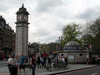
Clapham is a district in south west London, England, lying mostly within the London Borough of Lambeth, but with some areas extending into the neighbouring London Borough of Wandsworth.

King's Road or Kings Road is a major street stretching through Chelsea and Fulham, both in west London, England. It is associated with 1960s style and with fashion figures such as Mary Quant and Vivienne Westwood. Sir Oswald Mosley's Blackshirt movement had a barracks on the street in the 1930s.

The A24 is a major road in England that runs for 53.2 miles (85.6 km) from Clapham in south-west London to Worthing on the English Channel in West Sussex via the suburbs of south-west London, as well as through the counties of Surrey and West Sussex.

Northcote is an inner suburb in Melbourne, Victoria, Australia, 6 km (3.7 mi) north-east of Melbourne's Central Business District, located within the City of Darebin local government area. Northcote recorded a population of 25,276 at the 2021 census.

Upton Park is an area of the East London borough of Newham, centred on Green Street which is the boundary between West Ham and East Ham. West Ham United Football Club formerly played at the Boleyn Ground, commonly known as Upton Park.
Uxbridge Road is the name of the A4020 road in West London. The 12-mile (19 km) route starts at Shepherd's Bush Green and goes west towards Uxbridge. It passes through Acton, Ealing, Hanwell, Southall, Hayes, and Hillingdon.
The A3036 is an A road in London, England, running from Waterloo to Wandsworth.

Camden Passage is a pedestrian street, close to the Angel tube station off Upper Street in the London Borough of Islington. The passage is known for its antique shops, markets and its array of independent shops, cafes, and restaurants.

The A200 is an A road in London running from London Bridge to Greenwich.

Selhurst Road is a main road between South Norwood and Selhurst in the London Borough of Croydon, south London. It forms part of the A213 road which is a major A Road connecting both Sydenham and Croydon.

North End is a pedestrianised road in Central Croydon, which includes entrances to the town's two main shopping centres, Centrale and the Whitgift Centre. The road has high street chains including Next, Zara, French Connection, and a large branch of department store House of Fraser. A large Debenhams store on the west side of the road did not reopen after the 2020 Coronavirus lockdown as the company entered administration. North End was closed off to all forms of motor traffic in 1989, to entice shoppers to choose Croydon over its main south-east London rival Bromley.

The Falconbrook was a stream that rose in Balham and Tooting, draining much of those parishes then the south and west of the larger district of Battersea including Clapham Junction to enter the London reaches of the Thames. Before doing so, it briefly formed the border of Wandsworth Town, reflected in the SW11/SW18 boundary today.

Walworth Road railway station was a railway station in Walworth Road, Southwark, south London, England, on the London Chatham & Dover Railway, which opened on 1 May 1863 on the City Branch to Blackfriars as part of the company's ambitious plan to extend into the City of London. It was originally known as Camberwell Gate before changing its name in 1865.

Regent's Park Estate is a large housing estate in the London Borough of Camden. The estate consists of nearly 2,000 homes across 49 buildings and lies on either side of Robert Street, between Albany Street and Hampstead Road. It is immediately to the east of the Regent's Park estate owned by the Crown Estate. The estate includes the sites of Cumberland Market, Munster Square and Clarence Gardens.

Clapham High Street is the main through road and shopping area in Clapham, South London, England, in the London Borough of Lambeth.
Clapham Common was an administrative division of the London Borough of Lambeth, United Kingdom from 2002 to 2022.

The Shaftesbury Park Estate, commonly known as The Shaftesbury Estate, is a residential estate in Battersea in South London, England. It lies north of Lavender Hill and Clapham Common and east of Clapham Junction railway station.

Northcote Road Antique Market is a large indoor market located at 155a Northcote Road, Battersea in London, England. It houses over thirty dealers selling antiques, vintage, retro, and collectables.
